Efficiency redefined for small planes
Convert your airplane effortlessly into a survey aircraft and open doors to a new revenue stream. With the PAS 150, you can add a mapping camera to your airplane, collecting high-quality imagery while conducting for example flight lessons or whilst you are enjoying a private trip. This addition not only enhances your aircraft’s capabilities but also transforms your leisurely flights into new opportunities for capturing aerial data. Unlike drones, small airplanes face no flight restrictions, completing mapping projects efficiently with reduced costs and fewer missions.
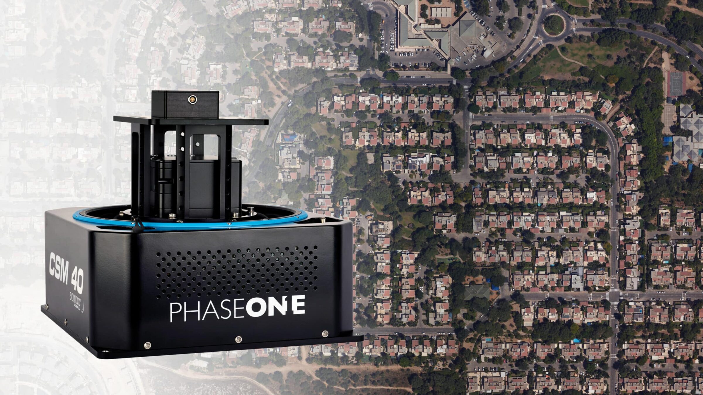
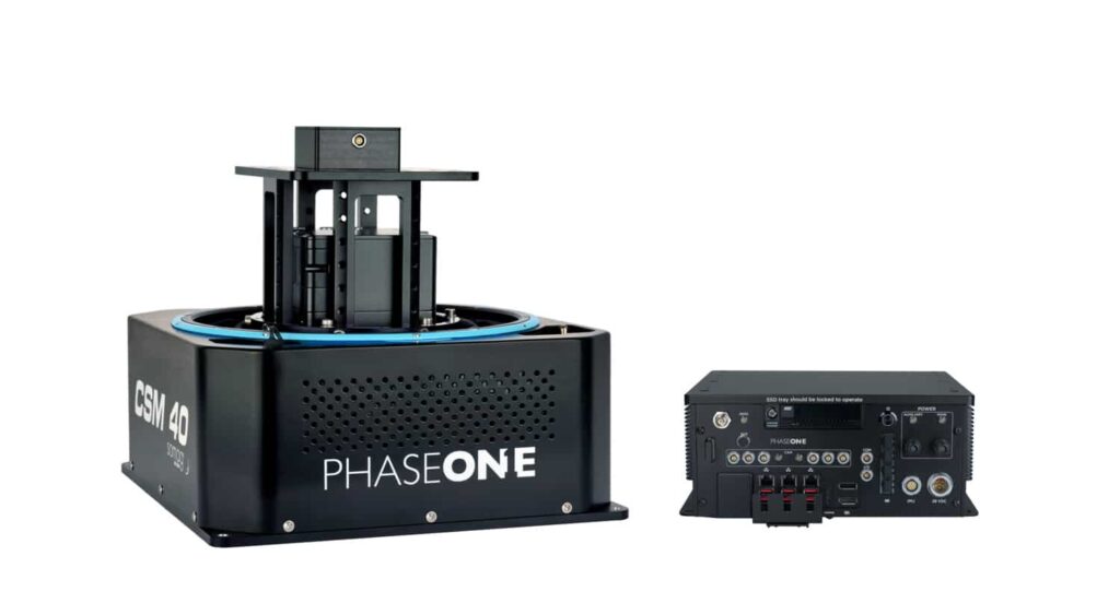
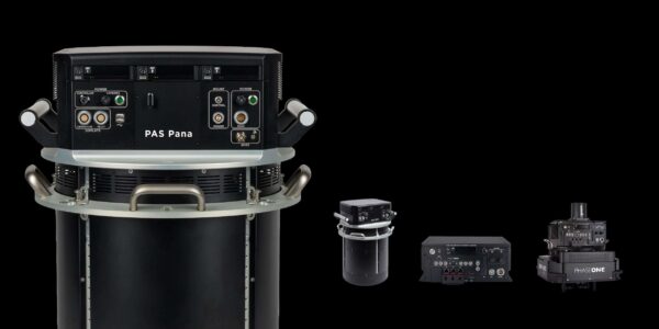
Unlock the full potential of your small airplane with Phase One’s PAS 150—a revolutionary aerial mapping solution ideal for small flying schools, flight academies or private owners. Our smallest system yet, the PAS 150 transforms your aircraft into a mapping airplane, allowing you to seamlessly integrate mapping capabilities into your operations.
Experience the unparalleled efficiency of small airplanes in aerial mapping. Our solution ensures quick task completion with reduced missions, providing valuable insights to your customers. The PAS 150 is the key to achieving your mapping goals—lightweight, efficient, and equipped with advanced sensor technology for top-tier image quality.
Ideal for emergency response and small mapping projects
In critical situations, every second counts. You can be part of helping taking faster actions for emergency response situations. The PAS 150 is ideal for fast emergency response, covering incident sites in high resolution from the air. Equip your aircraft with our solution to provide accurate, real-time data for effective decision-making.
It is the perfect fit for medium-sized LiDAR and mapping projects such as orthophotography, city mapping, and corridor mapping.
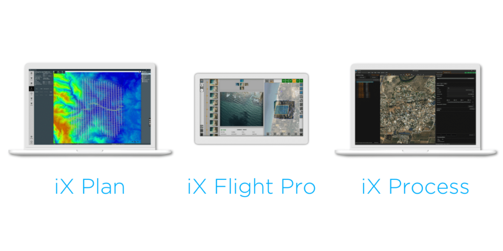
Easy to use software, powerful results
We help you throughout the entire process with our easy-to-use software, ensuring a seamless integration into your existing operations. Experience the power of Phase One technology, revolutionizing aerial mapping for small airplanes.
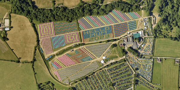
Success stories from our customers
Discover the success stories of our customers who have harnessed the power of Phase One cameras combined with light, fixed-wing aircraft. Explore our case studies for xEye and Glastonbury to witness the real impact of our solution.
The Phase One Aerial System provided us with a complete turnkey aerial imaging solution, compact in size, light in weight, and flexible enough to use with our current fleet of aircraft, to improve productivity, and bid on bigger projects.
Contact a Phase One Expert
If you would like to learn more about how you can best utilize your small airplane with our solutions, our experts are eager to help! Contact us.