What you need to know when choosing a high-end imaging solution
When selecting a premium imaging solution, various factors need to be taken into consideration. Image quality comes down to both ultra-high resolution and high-quality pixels.
Ultra-high resolution to see the smallest details
The term ‘high resolution’ is often used for two very different things: The size of the pixels and the number of pixels.
The size of the pixels defines the smallest details that can be seen. This aspect focuses on the scale of individual pixels in relation to the ground or object being imaged. Terms such as Ground Sampling Distance (GSD), ground resolution, or pixel size can be used interchangeably to describe how well small details can be discerned within the image.
The term ‘image size’ defines how many pixels are in each image. For example, 921,600 pixels in a standard 720p video frame or 151,301,008 pixels in an image from a Phase One 150MP iXM camera.
As the pixel size decreases, more details become visible in the image
It is crucial to consider the necessary level of detail in image capture. For instance, when assessing the condition of a wind turbine blade, the ability to clearly identify minute cracks or other indications of wear and tear is paramount.
Understanding the influence of pixel size is essential when selecting the optimal camera and lens for any application, to ensure they will meet the specific requirements of the task at hand.
When the required pixel size is known, it is important to consider how big an area can be covered by each image at that ground resolution.
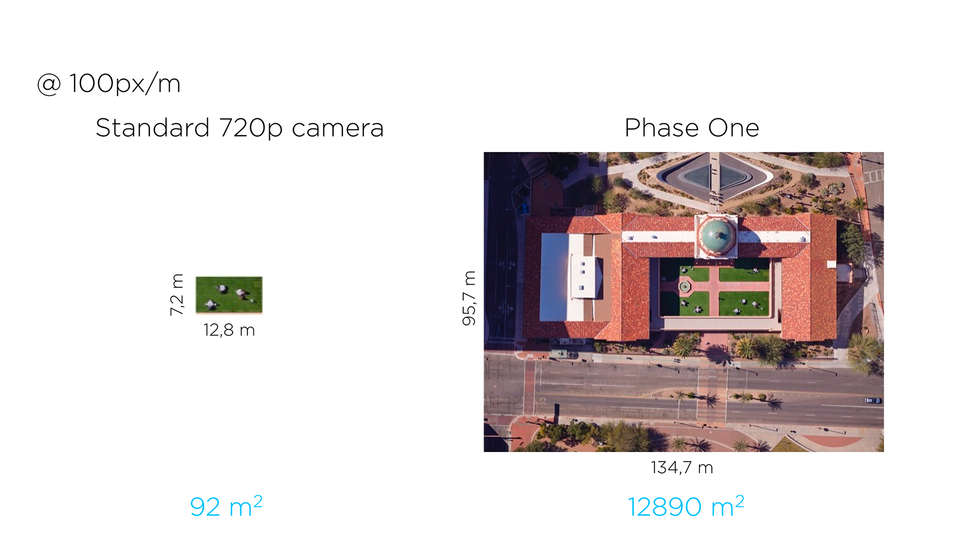
Two images with the same GSD or pixel size of 1 cm. While a standard surveillance camera in 720p format covers 92 m2, a Phase One iXM-120GS with 120 MP covers an area of nearly 13,000 m2.
Why is this important?
By using a camera with a larger image size, it is possible to cover a large area with the required pixel size, using fewer images. This not only reduces the total number of images required but directly translates to a higher number of assets inspected or a bigger area mapped per day, significantly boosting productivity and resource utilization.
High-quality pixels
We want high ground resolution to get the right level of detail and we need a large image size to get high productivity.
Additionally, pixel quality is important for the overall image quality. There are again many aspects to this. Some of the key parameters of pixel quality are:
- Low noise
- High dynamic range
- Raw data format with no loss of data from processing or compression
- High quality optics
Inspections are often done in bright sunlight, which can make it challenging to see all the details in both the brightest and darkest areas. Phase One cameras feature low noise and a high dynamic range to deliver usable images regardless of light levels.
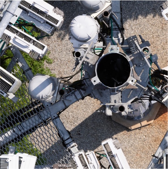
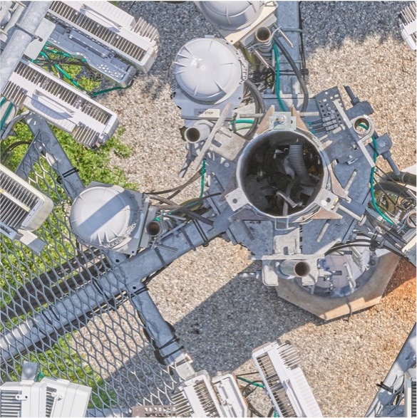
The first image has a very dark area with no visible details due to the high contrast between the bright sunlight and the deep shadow inside the pipe. The second image shows how the detail inside the dark area can be recovered thanks to the Phase One camera’s low noise and high dynamic range.
Additionally, Phase One’s RAWimage format – Intelligent Image Quality (IIQ) – is unique. Essentially, we refrain from doing any processing of the data during the initial capture. Unlike many other cameras that process the data immediately upon capture, our approach preserves all the information captured by the image sensor. This is particularly crucial as the processing and compression applied by other cameras results in irreversible data loss.
Our data processing only occurs later, for example, when transforming the images into maps or 3D models, or applying Artificial Intelligence (AI) to detect cracks and defects. At this stage, we possess a better understanding of the full context, so the individual images can be processed in the optimal way, ensuring the best possible utilization of all the information contained in the files.
Quality: Why it makes a difference
When considering the use of Phase One cameras for mapping missions, the ability to capture very large images in an ultra-high quality means getting more done in less time. It’s a direct gateway to productivity savings. This is one of the major reasons why customers choose us.
In the context of aerial inspections, ensuring accurate data acquisition with high productivity, even in challenging light conditions, is imperative. It is also crucial that the captured image data is not processed or compressed in the camera, allowing AI-driven analysis to perform to its full potential.
For any further inquiries please feel free to contact us: https://geospatial.phaseone.com/contact/
Share this on social media:
