PAS Pana Aerial Camera System
The most productive wide–area camera solution for photogrammetric aerial mapping
Wide-area camera solution for geospatial mapping
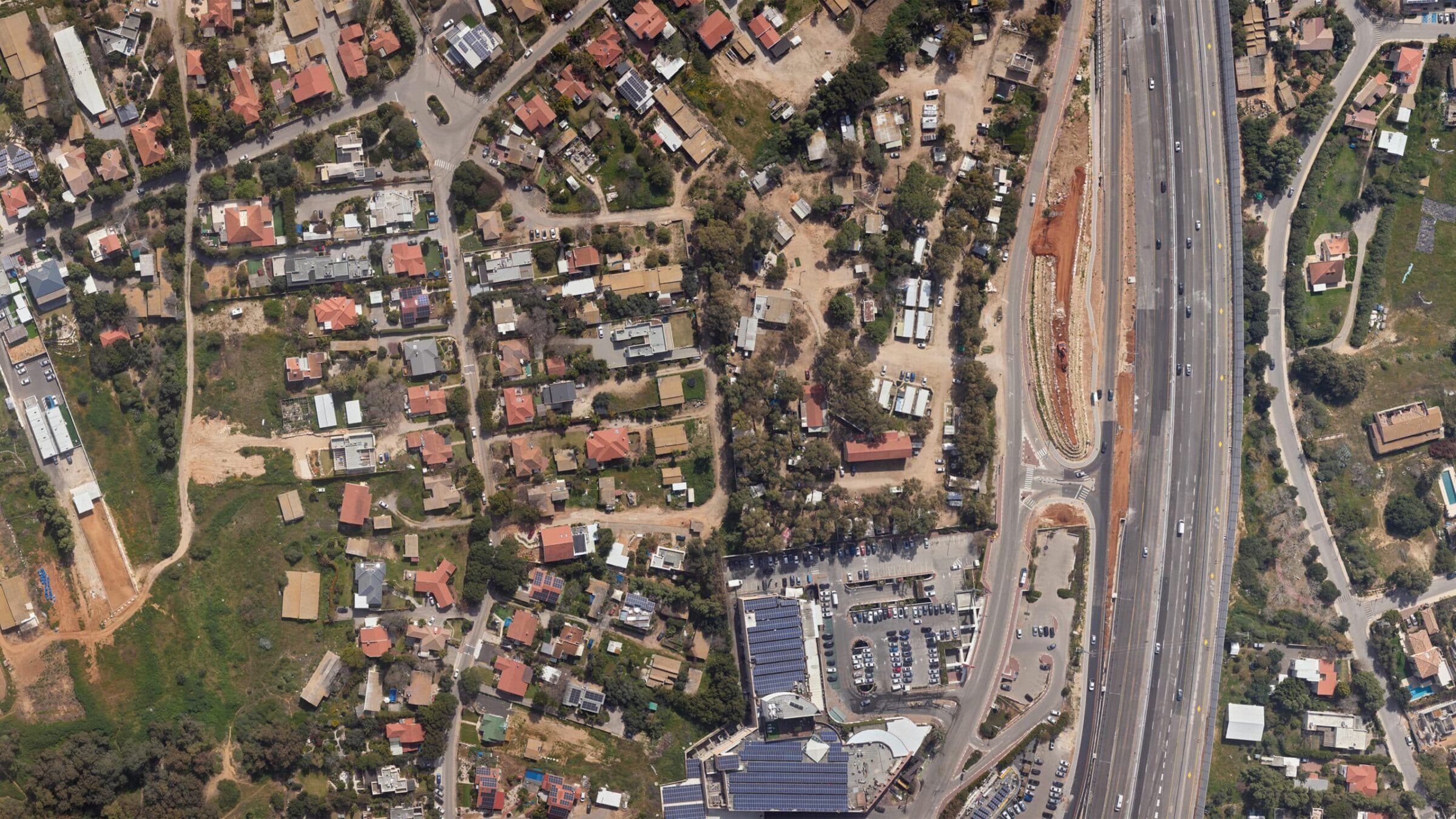
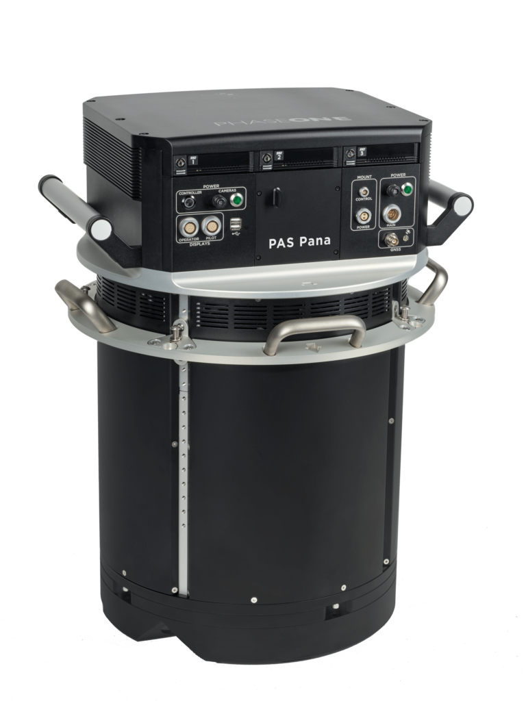
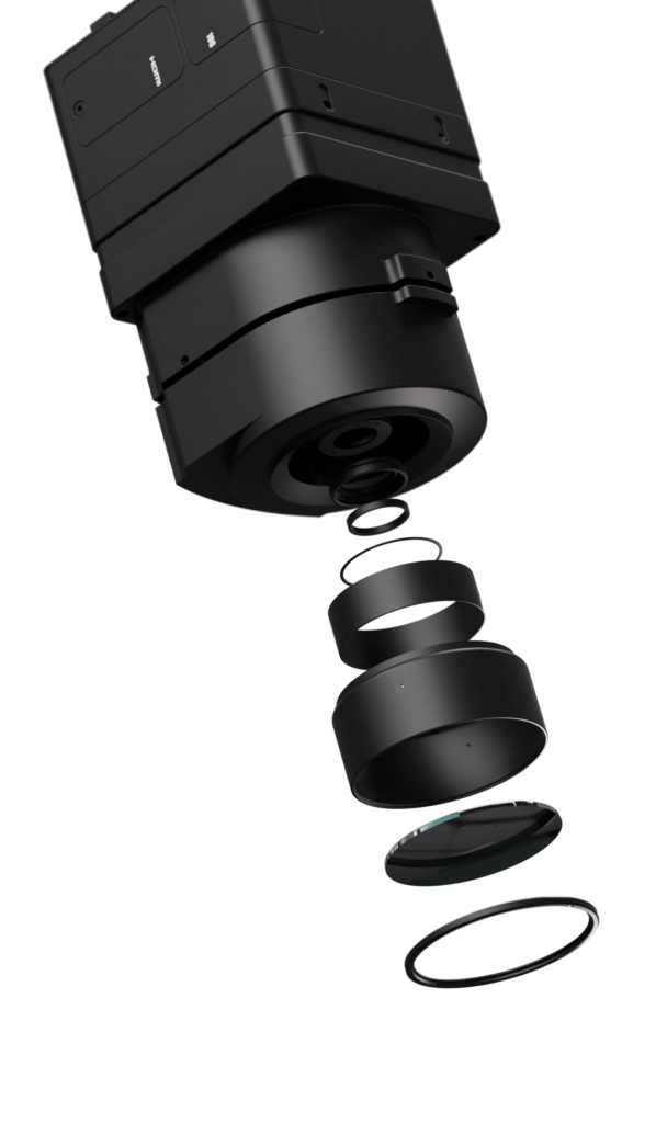
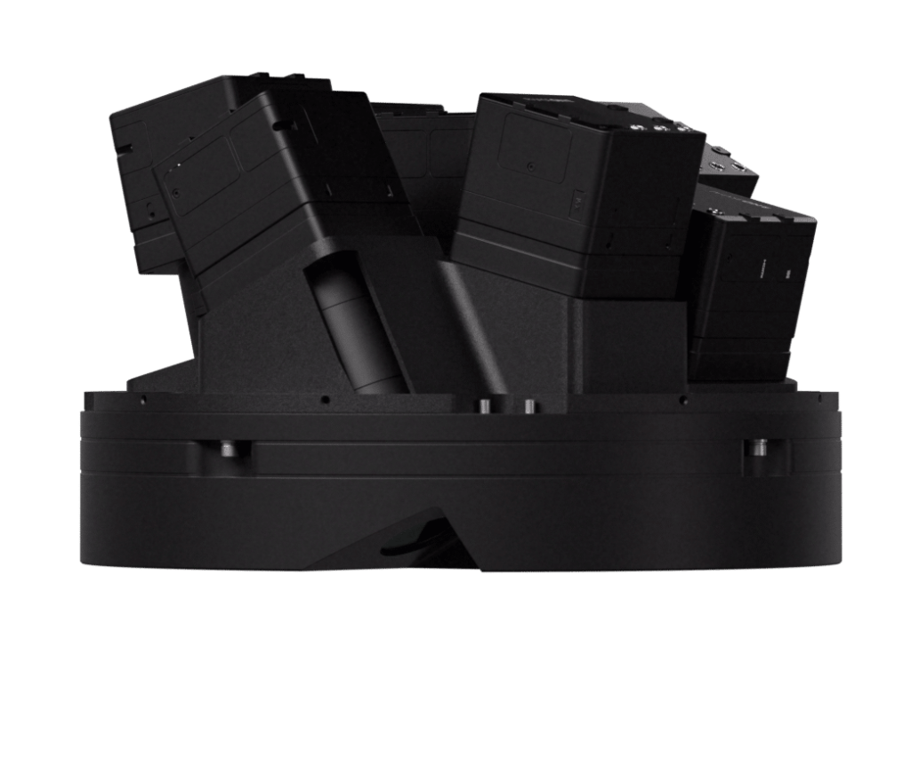
PAS Pana is a 7-camera wide-field camera system consisting of 5 RGB cameras with 150 mm lenses, and 2 NIR cameras with 70 mm lenses. It is a mapping system designed to provide effective performance in country-wide area mapping. Its large swath of 48,800 pixels allows to capture country-wide areas while keeping flying lines, hence flying time at the minimum.
PAS Pana offers various resolution options to suit diverse needs. It delivers exceptional high resolution at 2.5 cm Ground Sample Distance (GSD) for intricate details and up to 30 cm GSD for rapid wide-area coverage. This flexibility allows you to customize it to meet specific mission requirements, whether focusing on fine details or wide coverage.
PAS Pana also grants you full data ownership, freeing you from content program constraints. When paired with the entire iX Suite workflow, it ensures effortless data quality control from the outset. PAS Pana is fully integrated with iX Suite: iX Plan, iX Flight Pro and iX Process. iX Suite offers the most effective workflow and supports mapping projects from planning to execution and processing.
To achieve the schedule and quality requirements of our clients we must collect data rapidly. The high resolution and sensitivity of the PAS Pana system provides the speed and performance to meet our clients ever increasing requirements. Phase One has built a team of industry experts, backed by capable support group, ensuring efficient issue resolution.
Mike Mueller
Senior VP of Operations, Surdex Corporation
Country wide-area mapping solution
Achieve the highest productivity
PAS Pana is a mapping system designed to provide outstanding performance fueled by high-quality data collection. Its large swath of 48,800 pixels enables capturing maximum area in minimal time. In addition, when operated with iX Suite, the level of efficiency reaches a completely new standard. With our proprietary raw image format IIQ, importing has never been smoother, saving you tremendous image conversion time.
Adjust resolution to your needs
By offering a wide range of resolution options, spanning from incredibly high resolution with 2.5 cm GSD to accommodating fast wide area coverage with up to 30 cm GSD, PAS Pana empowers you to achieve optimal results based on your specific geospatial mapping needs, whether it entails fine details or broad coverage.
Zoom in and discover the full resolution
Embrace the freedom to choose
With PAS Pana, you have the freedom to use your aircraft without any restrictions. It seamlessly integrates into any type of aerial photography aircraft, thanks to its plug-and-play design. By simply pairing PAS Pana with our recognized iX Suite software, data quality assurance from the earliest stage has never been so easy. And for delivering your final product, we provide you with the flexibility to choose any preferred post-processing software supporting multi-head systems.
Own your data
PAS Pana breaks free from content program restrictions, offering unparalleled flexibility for any type of larger projects. Its high adaptability caters to your unique requirements, providing the versatility needed to tackle diverse mapping endeavors.
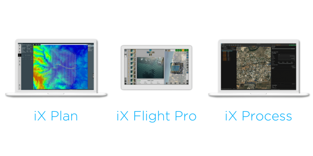
iX Suite
Seamless workflow,
quality assured from the earliest stage
Experience streamlined mission planning with iX Plan—initiate planning by selecting your Phase One system, automatically generating flight lines and controlling project costs. Elevate your mapping project with iX Flight Pro, ensuring precise mission execution and increased efficiency with instant images review and replan while flying. Streamline your workflow with iX Process for immediate image review and adjustments without need of pre-processing.
Technical specifications
Technical specifications
PAS PANA
Cameras
5x 150MP RGB camera with a 150 mm lens
Cameras
5x 150MP RGB camera with a 150 mm lens
2x 150MP NIR camera with a 70 mm lens
2x 150MP NIR camera with a 70 mm lens
Pixel swath
48,800
Pixel swath
48,800
Frame size
5 x 10652 x 14204 pixels (RGB)
Frame size
5 x 10652 x 14204 pixels (RGB)
2 x 14204 x 10652 pixels (NIR)
2 x 14204 x 10652 pixels (NIR)
Coverage
5 cm 1.73 km2
Coverage
5 cm 1.73 km2
10 cm 7.21 km2
10 cm 7.21 km2
20 cm 28.85 km2
20 cm 28.85 km2
Frames per second
1.7
Frames per second
1.7
Dynamic range (dB)
83
Dynamic range (dB)
83
Channels
RGB, NIR
Channels
RGB, NIR
Power consumption
400W
Power consumption
400W
470W max peak power
470W max peak power
System weight (kg/Lb)
47 / 104
System weight (kg/Lb)
47 / 104
Dimensions (mm/in)
408 x 716 x 691 / 16 x 28 x 27.2
Dimensions (mm/in)
408 x 716 x 691 / 16 x 28 x 27.2
Data storage capacity (Controller)
24 TB
Data storage capacity (Controller)
24 TB
128 GB RAM
128 GB RAM
Stabilized mount
Somag gyro-stabilized mount GSM 4000
Stabilized mount
Somag gyro-stabilized mount GSM 4000
Mount weight (kg/Lb)
29 / 63.9
Mount weight (kg/Lb)
29 / 63.9
Field of view
20.2° along track 70.0° across track (RGB)
Field of view
20.2° along track 70.0° across track (RGB)
31.9° along track 70.0° across track (NIR)
31.9° along track 70.0° across track (NIR)
GNSS/IMU
Integrated Applanix GNSS-Inertial
GNSS/IMU
Integrated Applanix GNSS-Inertial
AP610 (IMU – 57)
AP610 (IMU – 57)
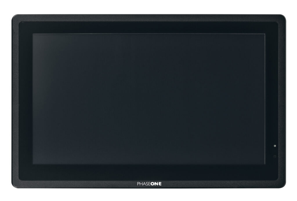
Monitors for PAS Solution
Phase One provides a complete solution for the PAS product line offering two operating monitors, 15’’ and 21’’, and one 7” pilot monitor fitting all PAS systems. The monitors are ruggedized displays tailored for airborne applications. All monitors are Phase One branded and tested on our PAS offerings.
Ready to take the next step?
Whether you have questions about our solutions or need more information, our sales team is ready to guide you along the process and answer any questions you may have.
Book a meeting with our team today.
Need support for an existing product or service?
Please visit our Support Page for faster assistance.