P5 Engineering Survey Payload for Drones and UAVs
The new standard for high accuracy aerial engineering & surveying.
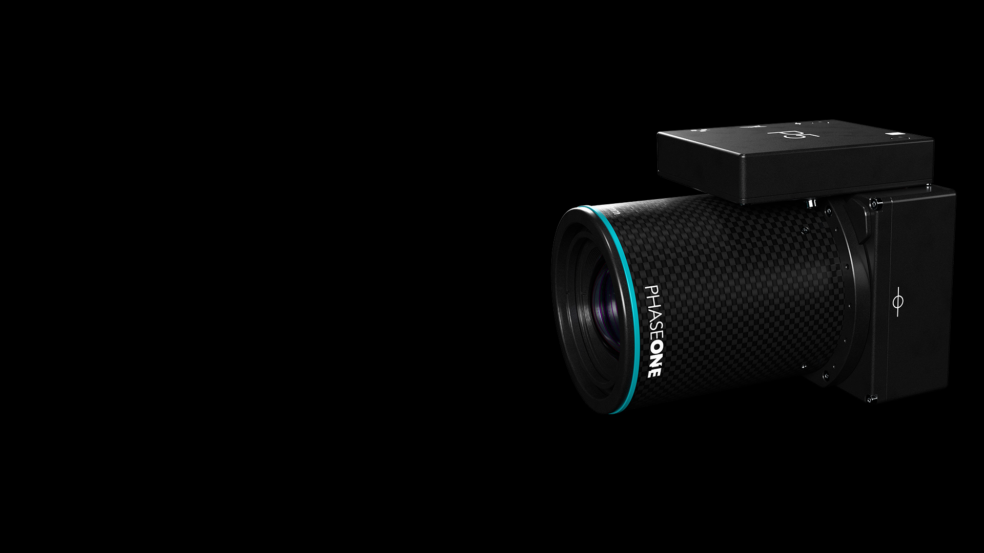
P5 Payload for Aerial Engineering Surveying
Step into the future of engineering surveying with P5, the UAV payload that revolutionizes drone-based aerial surveying. Purpose-built for your UAV, it’s compact, lightweight – less than 700 g, and power-efficient, perfect for portable and user-friendly mini fixed and transitional UAVs.
P5 offers flexible mounting options for land or corridor surveying, with lightning-fast 1 G interface and industry-standard MAVLink/Auterion communication protocols, making it easy for UAV OEMs to deliver top industry-leading payloads.
Eliminating geometric distortion through meticulous calibration and boasting a 100% accurate capture timestamp with mid-exposure triggering, P5 ensures data accuracy without compromising speed. Choose from 35 mm and 80 mm lens options for maximum coverage and minimal noise, achieving an exceptional 0.5 cm accuracy. Its advanced 128 MP image sensor guarantees low Ground Sample Distance (GSD) and blur-free images, while the electronic global shutter ensures high performance in any conditions. Elevate your aerial surveying game with P5.
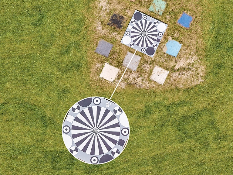
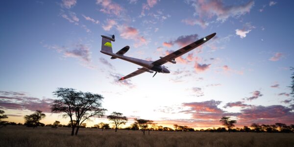
The test team assessed the performance of the P5 payload in a Trinity™Pro drone during 2023, at the UAS Denmark Test Center.
White Paper: Phase One P5 Achieving survey-grade accuracy with a fixed-wing UAV
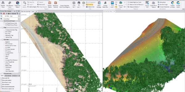
Achieving high precision in geospatial data collection remains a significant challenge in engineering surveying. Traditional methods often struggle to meet the required 0.5 cm accuracy in X, Y, and Z axes, which is essential for producing reliable geospatial products such as orthomosaics, dense point clouds, and digital surface models.
To address this challenge, the Phase One P5 camera system has been developed for integration with fixed-wing VTOL UAVs. This technical white paper examines the ability of the Phase One P5 to deliver 0.5 cm accuracy, using data collected at the UAS Denmark International Test Center.
Discover the P5 payload
With P5 you can experience the power of precision and performance, where every mission counts. Embrace uncompromised accuracy and revolutionize your engineering surveying projects with P5.
Uncompromised absolute accuracy
P5 is the first UAV payload designed to meet the highest engineering surveying standards.
- Exceptional accuracy down to 0.5 cm.
- Metrically calibrated camera free from geometric distortion, providing ultra-sharp images.
- Optimized for maximum coverage and maximum accuracy with 35 and 80 mm lens options.
The right lens for the right application
80mm
- The narrow field of view is optimized for the lower GSD and reduced image distortion.
- Ideal for high precision and NADIR mapping/inspections.
- A narrower swath is optimized for achieving the highest accuracy.
35mm
- The wide field of view is optimized for maximum coverage.
- Ideal for large areas and 3D model processing.
- A wider swath requires fewer flight lines for a given area.
Robust data capturing
P5’s exceptional performance relies on its advanced 128 MP image sensor, ensuring an incredibly low Ground Sample Distance (GSD).
- Faster and more accurate ground point selection.
- Low-geometric-distortion, less than 1 px.
- Electronic global shutter boosting fast frame rate of +4 f/s for high-speed flight with required image overlap.
Purpose built for readily available UAVs
Purpose-built for available UAVs, P5 is compact, lightweight, and power-efficient, ideal for portable mini fixed and transitional UAVs.
- Engineered to provide end-to-end solutions for modern surveyors.
- Small SWaP and low installation height makes it perfect for portable, user-friendly and commercially available mini-fixed and transitional UAVs.
Ready for your mission? Calculate the right GSD (Ground Sample Distance)
Welcome to our GSD Calculator, the essential tool for precision-driven aerial imaging.
Understanding your GSD empowers you to optimize image quality and flight missions of your drone, ensuring optimal results for your surveying project.
P5 fulfils a realm of applications efficiently, like no other UAV payload in the market
Applications
The P5 UAV payload is designed to tackle a wide range of industries and applications with unmatched efficiency and precision. The P5 delivers the accuracy and adaptability needed for high-impact results across industries, all in one powerful tool.
Surveying & Infrastructure
- Land Surveying: From traditional practices to compliance and crack detection
- Roads & Railways: Corridor mapping, condition monitoring, and signal box analysis
Industrial Applications
- Mining & Quarrying: Pit mapping, geology, haul road analysis, and fragmentation studies
- Construction: Precision monitoring and design compliance
Environmental & Agricultural Insights
- Environmental Management: Coastal mapping, erosion analysis, and disaster response
- Agriculture: Plant counting, water management, and large-area mapping
Aerial Mapping & Asset Management
- Supports 3D mapping, insurance-related monitoring, and infrastructure maintenance
Technical specifications
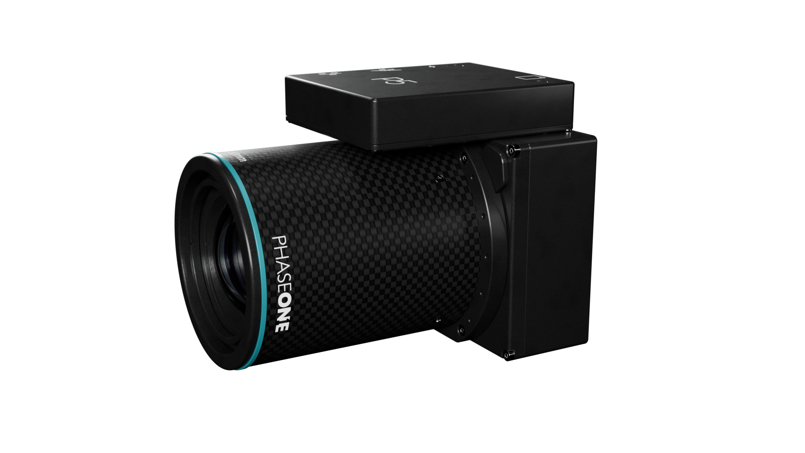
Image Sensor & Camera
Sensor resolution (MP)
128 RGB
Sensor resolution (MP)
128 RGB
Sensor type
CMOS
Sensor type
CMOS
Shutter type
Electronic global shutter
Shutter type
Electronic global shutter
Frame size across track (long side, pix)
13,468
Frame size across track (long side, pix)
13,468
Frame size along track (short side, pix)
9,564
Frame size along track (short side, pix)
9,564
Pixel size (u)
3.45
Pixel size (u)
3.45
Dynamic range (dB)
80
Dynamic range (dB)
80
Light sensitivity (ISO)
200 - 6,400
Light sensitivity (ISO)
200 - 6,400
Max. shutter speed (sec)
1/16,000
Max. shutter speed (sec)
1/16,000
Recommended max. operational shutter speed (sec)
1/10,000
Recommended max. operational shutter speed (sec)
1/10,000
Max. frame rate (fps)
4
Max. frame rate (fps)
4
Weight & Dimensions
35 mm
± 690 g / h: 11.8 w: 9 b: 9 cm
Weight & Dimensions
35 mm
± 690 g / h: 11.8 w: 9 b: 9 cm
80 mm
± 620 g / h: 12.5 w: 9 b: 9 cm
80 mm
± 620 g / h: 12.5 w: 9 b: 9 cm
Lenses
Lens
35 mm
80 mm
Lens
35 mm
80 mm
Lens composition
12 elements in 8 groups
8 elements in 5 groups
Lens composition
12 elements in 8 groups
8 elements in 5 groups
Minimum focusing range
60 m infinity
60 m to 120 m (customized focus available for a fee)
Minimum focusing range
60 m infinity
60 m to 120 m (customized focus available for a fee)
Aperture range
f/5.6 – f/22
f/5.6 – f/22
Aperture range
f/5.6 – f/22
f/5.6 – f/22
Filter diameter (mm)
58
58
Filter diameter (mm)
58
58
Angle of view in long side (°)
66
32
Angle of view in long side (°)
66
32
Angle of view in short side (°)
49
23
Angle of view in short side (°)
49
23
Entrance pupil to image plane (mm)
72
85
Entrance pupil to image plane (mm)
72
85
Metrically Calibrated
Yes - Seven australis adjustment parameters
Yes - Seven australis adjustment parameters
Metrically Calibrated
Yes - Seven australis adjustment parameters
Yes - Seven australis adjustment parameters
Interfaces & storage
Electrical interfaces
1 G Ethernet, JST-ZE 14 pin
Electrical interfaces
1 G Ethernet, JST-ZE 14 pin
Communication interface
MAVLink, Auterion & IQP
Communication interface
MAVLink, Auterion & IQP
Power consumption (W)
16
Power consumption (W)
16
Storage type
CF express
Storage type
CF express
Storage size (TB)
up to 2 TB
Storage size (TB)
up to 2 TB
Operating conditions
Operating temperature (ambient)
35 and 80 mm
- 10°C to + 40°C
Operating temperature (ambient)
35 and 80 mm
- 10°C to + 40°C
Passive or active cooling such as airflow is required when the camera is not in idle mode.
Passive or active cooling such as airflow is required when the camera is not in idle mode.
IP Rating
22
IP Rating
22
Max. ground speed @ 70% overlap
80 mm
60 m: 25 m/s (0.26 cm/px)
Max. ground speed @ 70% overlap
80 mm
60 m: 25 m/s (0.26 cm/px)
80 mm
120 m: 51 m/s (0.51 cm/px)
80 mm
120 m: 51 m/s (0.51 cm/px)
35 mm
60 m: 57 m/s (0.58 cm/px)
35 mm
60 m: 57 m/s (0.58 cm/px)
35 mm
120 m: 115 m/s (1.16 cm/px)
35 mm
120 m: 115 m/s (1.16 cm/px)
Compliance
ITAR Free
Yes
ITAR Free
Yes
NDAA Compliant
Yes
NDAA Compliant
Yes
Contact a Phase One Expert
If you would like to learn more about our P5 Drone Payload Solution, our experts are eager to help! Contact Us.