It is not every day that a new product comes along and changes the way an industry operates. Phase One’s P5 payload aims to do just that: herald a new standard for aerial engineering surveying.
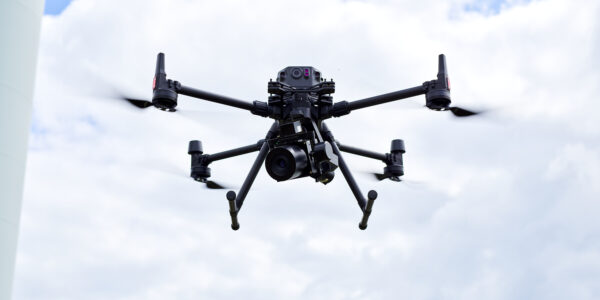
With its extremely high accuracy combined with light weight, this payload can be integrated into small UAVs and transform the productivity of surveying applications for Architecture, Engineering, and Construction (AEC).
But in this application, many surveyors have experienced that UAVs give disappointing data quality. To convince these professionals, we knew we would need to prove the accuracy and efficacy of the P5 beyond all doubt.
The burden of proof is ours
At present, the use of commercial UAVs by surveying and mapping specialists is restricted to less critical tasks due to the limitations of their cameras. The currently available payloads for UAV-based surveying are too slow, too heavy, and too inadequate to capture survey-grade quality.
Naturally, surveyors are skeptical about new technologies in the AEC industries where accuracy and reliability are paramount. Some engineering professionals have direct experience of the limitations of UAVs for engineering surveying, where the data quality has failed to meet the required level. They know too that UAV cameras – being consumer cameras – can lead to an increased risk of liability due to inaccuracies.
With this legacy, we knew it would take a great deal of convincing to reopen surveyors’ eyes to the promise of surveying with small UAVs: vast improvements in reliable productivity without needing specialist UAVs or their operators. With these high standards in mind, we set out to prove the capabilities offered by the P5: true survey-grade accuracy that meets the highest engineering surveying standards.
The accuracy of the P5
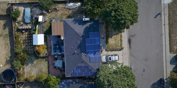
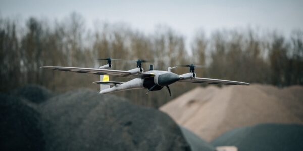
The P5 payload is the world’s first purpose-built engineering survey-grade camera for small UAVs. It enables surveyors to use a small, readily available UAV on even the most challenging jobs, either during the construction phase or the post-completion monitoring phase.
Consequently, when designing the P5, we placed a clear focus on absolute accuracy. The reason small UAVs have not been able to reach the required accuracy until now is their image sensors, which have limited the smallest possible Ground Sampling Distance (GSD) that can be captured. As accuracy is directly connected to GSD, it has not been possible to reach an absolute accuracy of less than 1 cm in the X and Y axes, and 3 cm in the Z axis, which is always more difficult. This is the reason most surveying with fixed-winged or VTOL fixed-winged UAVs are currently focused on applications with less strict requirements for accuracy/GSD, such as mining.
The P5 has a 128MP image sensor which provides the lowest possible GSD on the market from a single sensor payload, giving exceptional accuracy down to 0.5 cm and low-geometric-distortion of less than 1 pixel.
To test this, we set out to evaluate the ability of the P5 to produce these results in real-world conditions, in a Commercial Off-The-Shelf (COTS) drone.
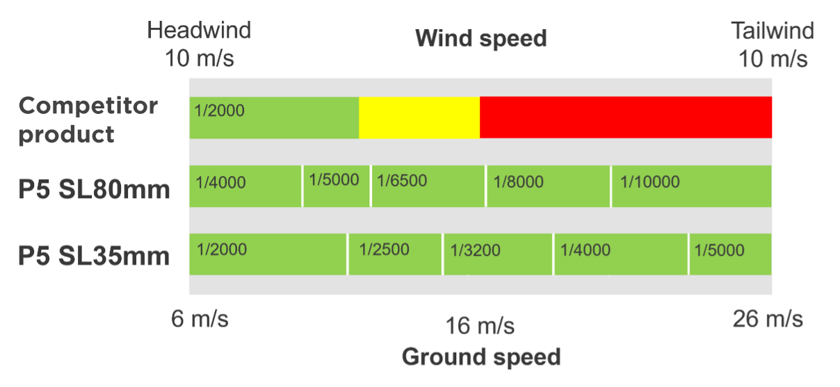
Significantly faster shutter speed
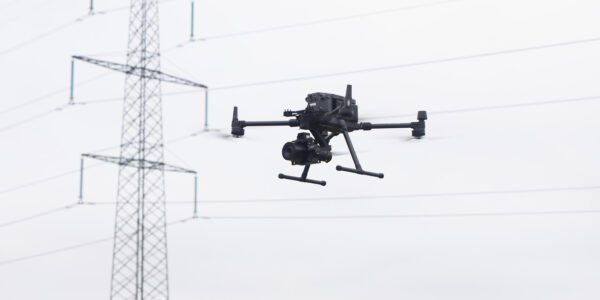
During the testing, we also wanted to show how the P5 overcomes another of the factors that have limited UAVs until now: shutter technology. Off-the-shelf consumer cameras available today are equipped with either a focal plane shutter or a mechanical leaf shutter, both of which are constrained by a maximum shutter speed of approximately 1/2,000 when the camera platform is in motion. This is why most UAV-based surveying today is done with slow-flying, multi-rotor UAVs: the flight speed of fixed-winged UAVs is simply too high to capture sufficiently low GSD at a flight speed of >17 m/s.
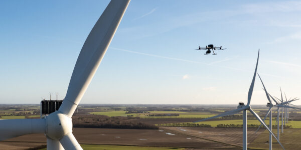
In contrast, the P5 is designed to integrate with fixed-wing COTS drones. Its cutting-edge electronic global shutter enables a faster shutter speed of up to 1/16,000, enabling faster flight speeds at low altitudes without compromising data capture by risking the required image overlap, or blurring.
Testing in real-world conditions
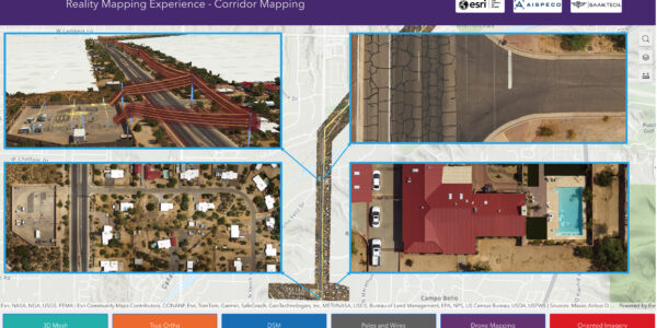
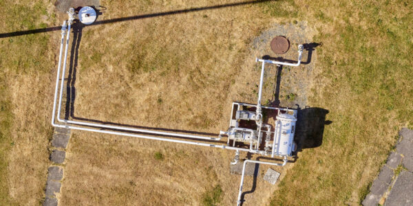
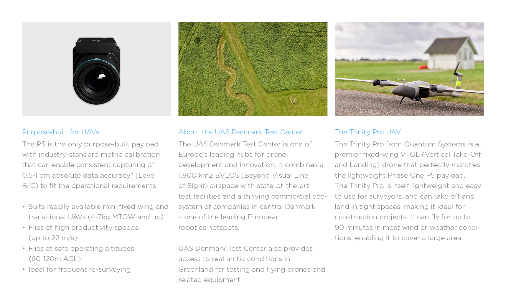
The test team assessed the performance of the P5 payload in a Trinity™Pro drone during 2023, at the UAS Denmark Test Center.
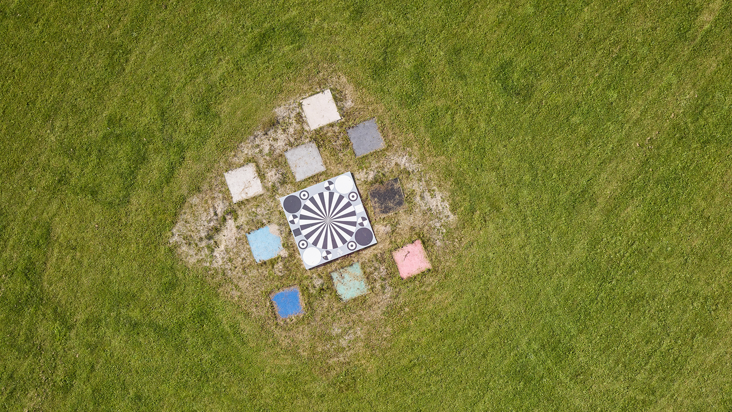
Phase One invested in expanding the test center’s photogrammetric test field, adding 46 ground control points and two national benchmarks within the airfield fence, in cooperation with Denmark’s national mapping agency.
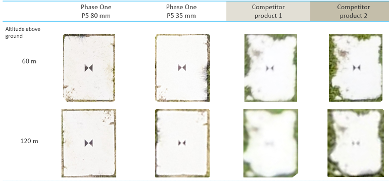
With 1 Siemens star and 25 ground control points (GCP), the test team flew the P5-equipped drone in an overlapping corridor pattern with both 80 mm and 35 mm lenses, to evaluate the effectiveness of each. Two competitor cameras were also assessed to draw a comparison, for which we chose commonly used consumer cameras for drones
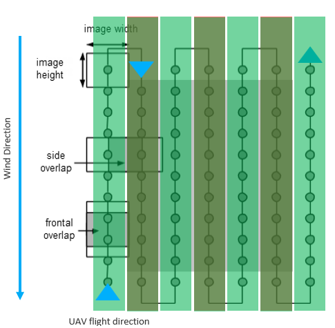
A critical element of the testing was data robustness in relation to the speed of the drone, where wind can affect the amount of overlap between images, which is necessary to ensure the images are precisely aligned.
Absolute accuracy in real-world testing
The P5 allows a wider range of ground speed while ensuring overlap and pixel blur requirements are met. Even at this speed, the Phase One P5 delivered exceptional clarity with pixel blur remaining <1 pixel for both the 35 mm and 80 mm lenses.
Our tests confirmed that the P5 is the only UAV payload that can generate data with 0.5 cm – 1 cm absolute accuracy in the XYZ axes with less than 1 pixel blur under the required operating conditions of +60 m AGL and cruise speed of +17 m/s.
*Data provided in the two tables are based on flight altitude at 60 m.
At a ground speed of 18 m/s the Phase One P5 far surpassed the abilities of two competitor payloads while using both 80 mm and 35 mm lenses.
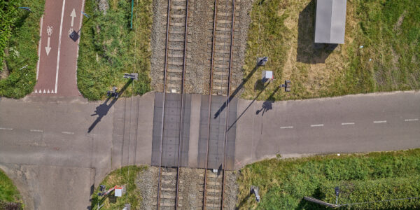
The image below shows the outstanding sharpness of the P5 80 mm lens, which is optimized for more focused absolute accuracy. The P5 35 mm lens shows excellent performance despite being optimized for wider coverage.
A proven new capability for surveyors
With this proven level of accuracy in real-world conditions, the P5 can open up a whole new capability for surveyors. The P5 can be used in smaller, more accessible, and easier to use UAVs, making it a tool for dedicated surveyors rather than specialized UAV operators with a surveying background.
As Quantum Systems’ Robert Leake says, “To be able to get the kind of quality, detail, and accuracy at this scale, with a fixed-wing platform, has never been done before. This is really going to be a game changer; a whole generational leap for what customers can expect out of small, lightweight drones.”
This new capability is the result of Phase One developing products in close cooperation with our customers. It also comes from Phase One’s unique position in the industry: an image capturing technology company that combines excellence in cameras with deep experience of UAVs. Discover our P5 datasets.
Share this on social media: