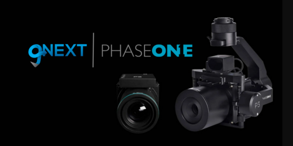
Phase One, Quantum Systems and Trimble unveil groundbreaking survey grade UAV solution with the launch of Phase One P5 camera
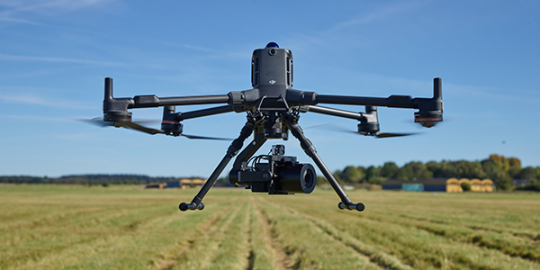
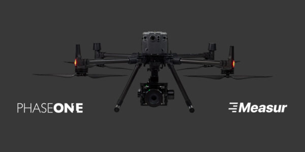
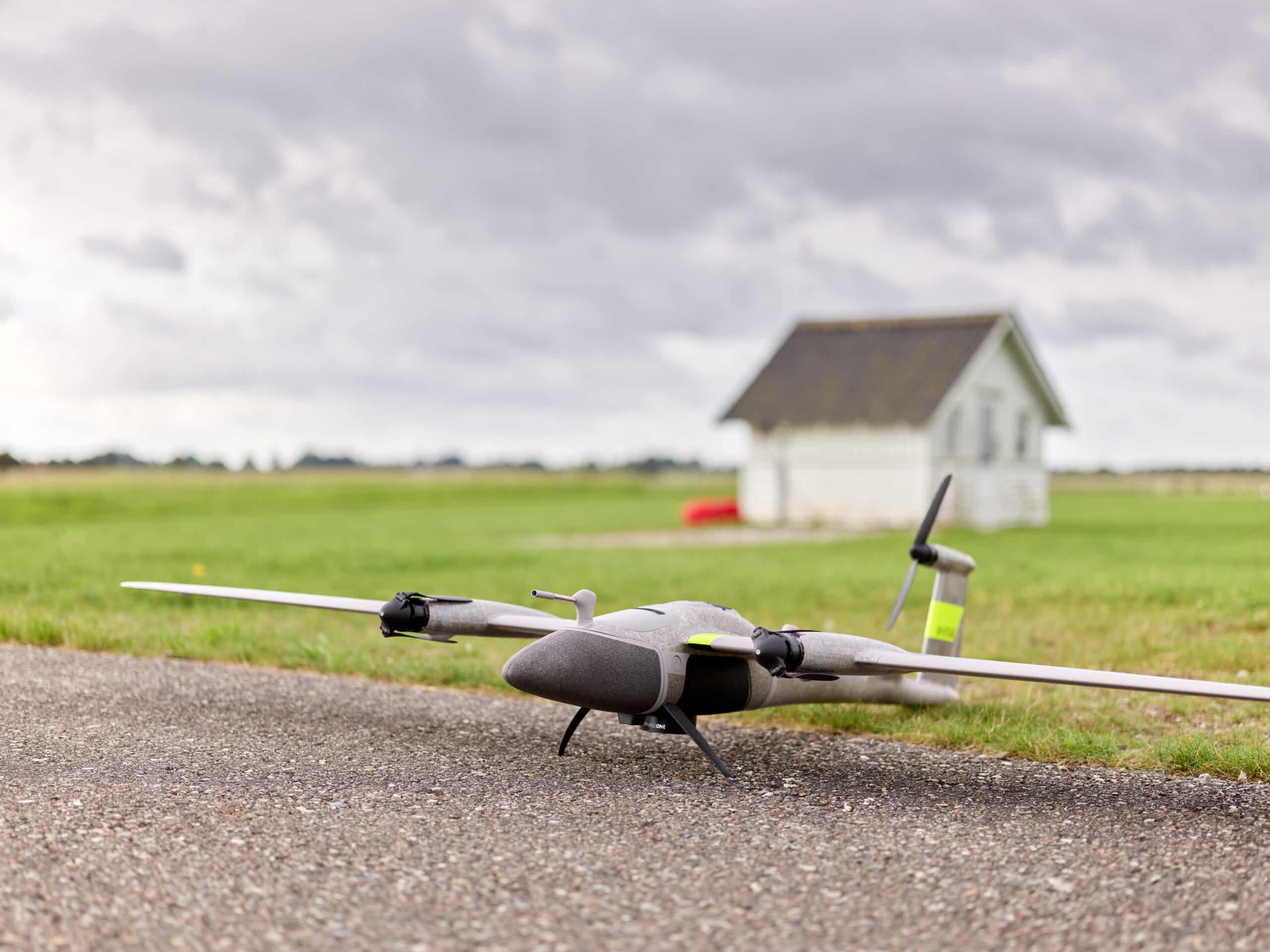
Trimble Dimensions, Las Vegas, NV, USA, Nov. 6th, 2023 – Phase One, pioneer in medium- and large-format digital cameras and imaging systems proudly announces the next-generation instrument for the modern surveyor in collaboration with Quantum Systems and Trimble; seamlessly integrating the new state-of-the-art Phase One P5 128-megapixel camera, purpose-built for survey grade applications, into Quantum Systems flagship Trinity Pro mapping drone and the leader surveying workflow Trimble Business Center (TBC).
Challenges in the fields of architecture, construction, and engineering
The surveying and construction industry confronts a wide range of challenges, including the critical aspects of time constraints, resource limitations, project requirements, and the potential for costly fines due to project delays. Traditional surveying methods have proven to be time-consuming to reach the statistical confidence needed in data quality, which further intensifies the challenge of monitoring construction progress in a timely manner. Delayed delivery of critical projects not only results in substantial financial penalties but also hampers overall industry progress.
Accurate surveys play a critical role in construction projects and architectural design, whether it’s during the construction phase or in the post-completion monitoring stage. However, current UAV-based surveying solutions have often fallen short in capturing survey-grade quality data, leaving a critical gap in meeting industry demands.
Unmatched survey-grade accuracy with the world’s first true end-to-end UAV solution
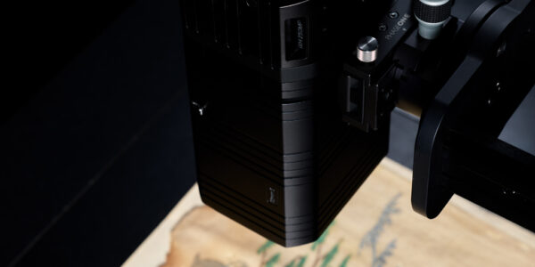
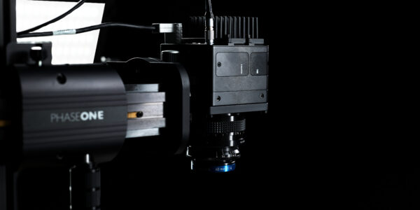
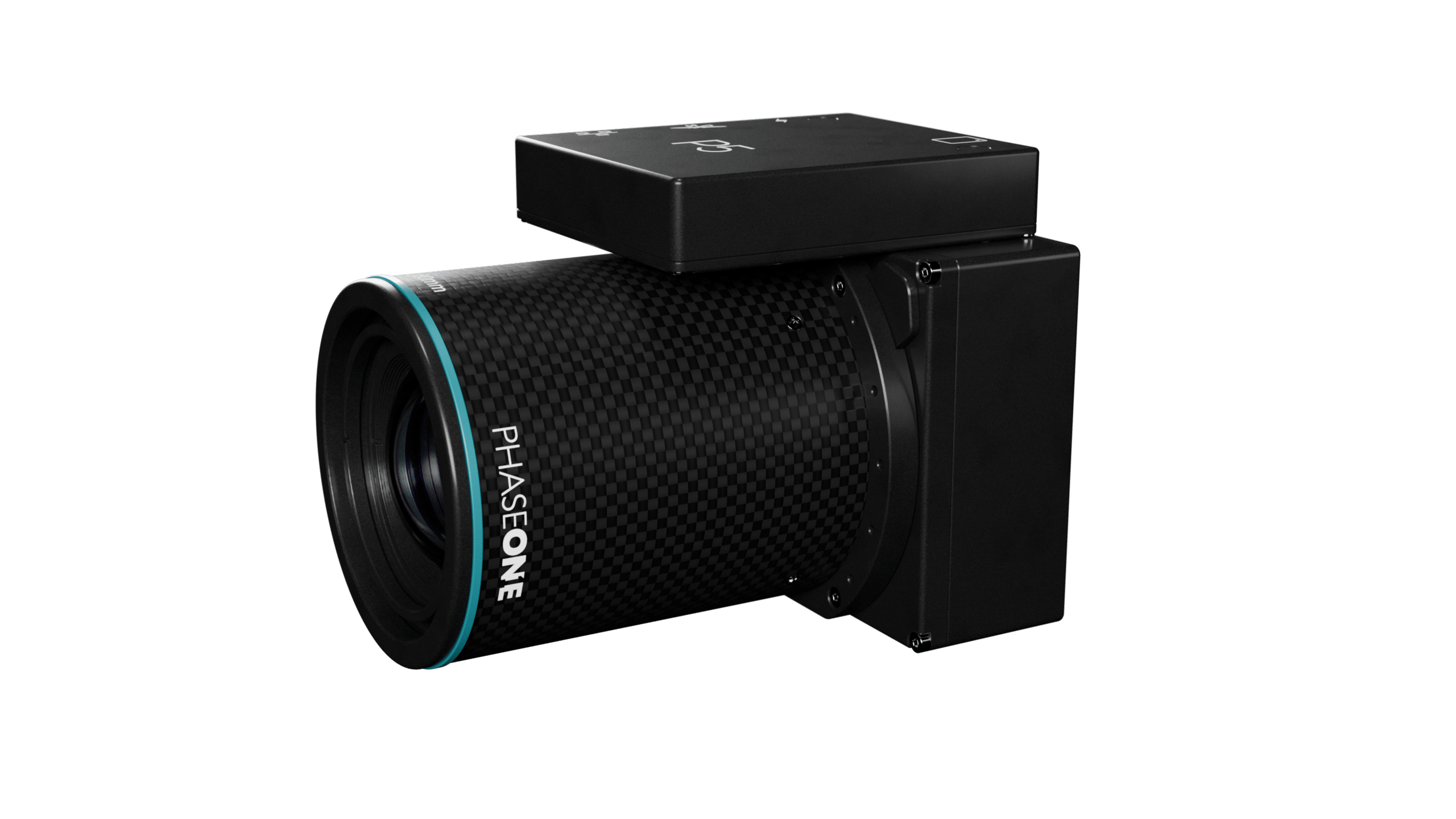
In the realm of specialized camera systems, the Phase One P5 has been meticulously crafted to address the shortcomings of conventional cameras for UAVs in terms of speed, weight, and data quality. Purpose-built for aerial surveying via drone, the camera stands as the world’s pioneering solution, consistently delivering the highest resolution and accuracy, along with industry-standard metrical calibration.
Phase One P5 enhances productivity and addresses the industry’s surveyor shortage by being deployed in conjunction with Quantum Systems Trinity Pro. With a proven track record of over 75,000 flight hours, The Trinity Pro ensures reliability and reduces maintenance requirements, allowing surveyors to focus on their core tasks. Quantum System’s Trinity Pro UAV facilitates high productivity missions with a ground speed of up to 22 m/s while maintaining safe operational altitudes ranging from 60 to 120 meters AGL, enabling the rapid surveying of large-scale areas with just a single flight.
Designed as an end-to-end surveying instrument, the Trinity Pro and Phase One P5 solution seamlessly integrates into the Trimble Business Center (TBC) workflow, setting a new standard for engineering surveying. The modern surveyor will benefit from state-of-the-art technology to improve productivity and increase profitability.
The integration of the Phase One P5 camera into Quantum Systems’ Trinity Pro UAV presents an extensive range of benefits for construction engineering customers. The Phase One P5 camera integration guarantees precision, securing survey-grade data accuracy. This exceptional level of detail and accuracy is paramount for construction projects, fostering confident decision-making while simultaneously minimizing post-processing efforts. Consequently, these features establish the joint solution as an indispensable tool for construction engineering professionals, streamlining large-scale data collection, and delivering unparalleled efficiency.
“We are proud to introduce a pioneering solution that not only addresses the profound challenges faced by the surveying and construction industry but also sets new benchmarks for efficiency and precision. Our collaboration with Phase One and Trimble has yielded a game-changing survey-grade UAV solution. Achieving this level of quality, detail, and accuracy within a fixed-wing platform is a first in the industry. We’re opening new horizons for engineering surveying professionals, and we’re excited to be at the forefront of this revolutionary leap forward.”, said Robert Leake, Head of Commercial Sales at Quantum Systems.
The new standard in UAV-based engineering surveying
At the heart of this transformative solution for mapping and surveying professionals, the Phase One P5 camera stands as a symbol of the highest accuracy. It boasts an impressive 128-megapixel resolution, ensuring an extraordinary level of precision and data reliability.
“Each Phase One P5 camera undergoes factory metric calibration and is supplied with a calibration certificate. When integrated with the Trinity Pro system, the Phase One P5 swiftly and accurately covers large survey areas, resulting in significant time and cost savings compared to traditional mapping and surveying methods.”, states Michael Messerschmidt, Director Product Management Unmanned at Phase One.
The utilization of an electronic global shutter, combined with precisely calibrated lenses and sensor, minimizes the need for extensive post-processing and software corrections typically required to address pixel distortion, thereby ensuring the preservation of high-quality data.
With the launch of the Phase One P5 camera and the complete survey-grade UAV solution, Quantum Systems, Phase One, and Trimble are opening new horizons for professionals in the field of aerial engineering surveying. This groundbreaking solution empowers surveyors to work with unmatched precision, providing data of exceptional accuracy for a wide range of applications.
Join us at Trimble Dimensions in Titian 2202 & 2203 at 4:30 pm PST and discover the new standard for UAV-based aerial engineering surveying.
For additional information on Phase One P5 please visit
https://www.phaseone.com/solutions/geospatial-solutions/uav-payloads/p5/
About Phase One
Phase One is a global leader in digital imaging technology. The company provides unrivalled imaging quality for a wide range of applications, from professional photography to heritage digitization, industrial inspections, aerial mapping, security and space.
For more than three decades, Phase One has developed core imaging technologies and a range of digital cameras and imaging modules, setting new standards for image quality in terms of resolution, dynamic range, color fidelity and geometric accuracy.
Based in Copenhagen, Denmark, and with regional offices strategically located in Denver, Cologne, Tel Aviv, Saku, Tokyo, Beijing, Shanghai, and Hong Kong, Phase One nurtures long-term relationships with customers, technology partners and its global network of distributors, often playing the role of digital imaging partner to customers with unique requirements. It is with this passion for service that Phase One continually exceeds expectations and drives the imaging industry forward.
We deliver Imaging Beyond Imagination.
For more information, contact:
Name: Anna Mössner
Email: amo@phaseone.com
About Quantum Systems
Quantum Systems specializes in the development, design, and production of small Unmanned Aerial Systems (sUAS). The company’s range of electric vertical take-off and landing (eVTOL) sUAS are built to maximize range and versatility and provide operators with a seamless user experience. By integrating cutting-edge software capabilities like edge computing and real-time AI-powered data processing, Quantum Systems is building next-generation UAS for clients in defense, security, and the public sector.
Quantum-Systems is a global company, founded in 2015 and headquartered at Special Airport Oberpfaffenhofen, 20 km west of Munich, with business locations in the United States, Australia and Ukraine.
For more information about Quantum-Systems visit www.quantum-systems.com.
About Trimble
Dedicated to the world’s tomorrow, Trimble is a technology company delivering solutions that enable our customers to work in new ways to measure, build, grow and move goods for a better quality of life. Core technologies in positioning, modeling, connectivity and data analytics connect the digital and physical worlds to improve productivity, quality, safety, transparency and sustainability. From purpose-built products and enterprise lifecycle solutions to industry cloud services, Trimble is transforming critical industries such as construction, geospatial, agriculture and transportation to power an interconnected world of work. For more information about Trimble (NASDAQ: TRMB), visit
Share this on social media: