Carbonix, RIEGL, Phase One announce first fixed-wing VTOL integration of long-range dual sensor system
The collaboration marks a significant milestone for aerial surveying and data acquisition of critical linear assets
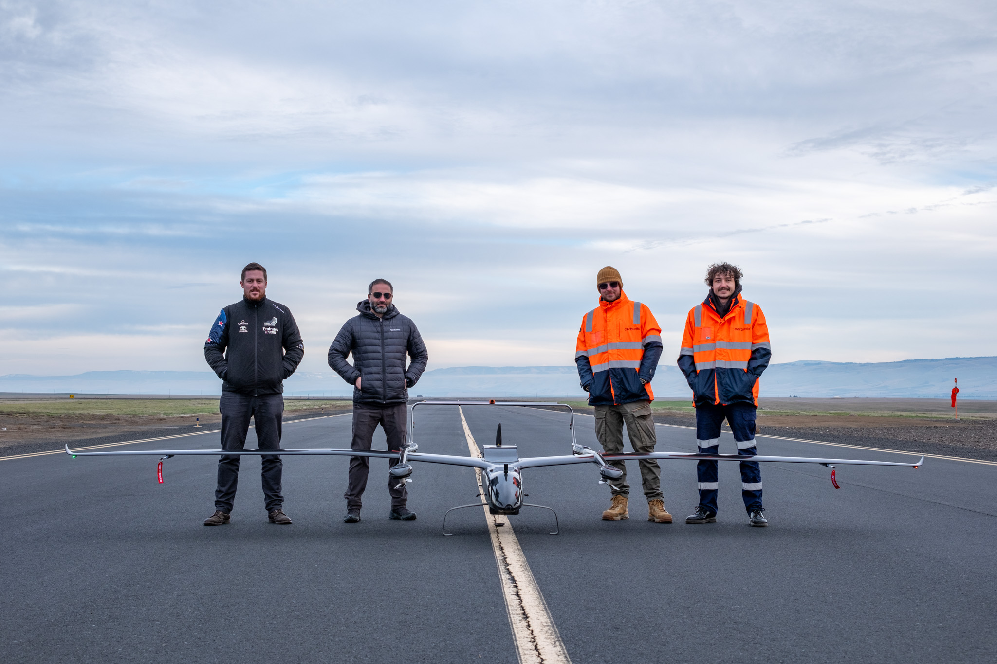
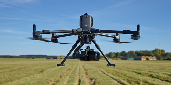
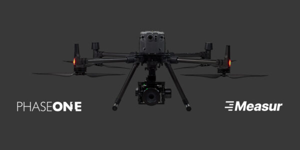
The Carbonix Ottano X
Sydney, 5th March 2024: Innovative drone technology company Carbonix, leading LiDAR sensors and systems provider RIEGL and the world’s most innovative manufacturer of high-quality image capture software and hardware solutions Phase One today announce a significant milestone for aerial surveying and data acquisition.
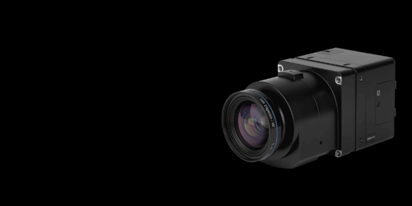
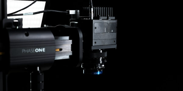
The three companies have successfully joined forces and flown the RIEGL VUX-120 and Phase One iXM 100 medium format camera on Carbonix’s pioneering fixed-wing VTOL platform. The combination of these highly sophisticated pieces of equipment is used in the field of remote sensing and geospatial data collection, serving critical use cases across the linear infrastructure and mining sectors.
Carbonix has proven the capability of the combined sensing platform in Australia and the US covering more than 12,000 hectares in a single mission. Being able to capture large scale detailed colourised 3D models of the infrastructure and terrain, proves the game-changing impact of this combined technology in commercial operations.
The integration underscores Carbonix’s unparalleled long-range platform capability, setting it apart as the first in the industry to accommodate and operate multiple survey-grade, high-resolution sensors concurrently.
Harnessing the calibrated Phase One/RIEGL pair’s cutting-edge sensing capability will enable Carbonix customers to access a multitude of benefits including:
- High-Density Data: The platform offers superior resolution and colourisation, enabling the capture of high-density data crucial for precise analysis and insights.
- Operational Efficiency: With the ability to deploy multiple sensors in a single flight, Carbonix maximises operational velocity and efficiency by streamlining data collection processes.
- Extended Endurance: Carbonix drones have extended flight durations, resulting in substantial cost reductions of up to 80% compared to both multi-rotor and manned aviation alternatives.
- Vast Coverage: With a scanning capacity of more than 12,000 hectares or a linear distance coverage of up to 400 km per single mission, Carbonix drones enable comprehensive area mapping at an unprecedented scale.
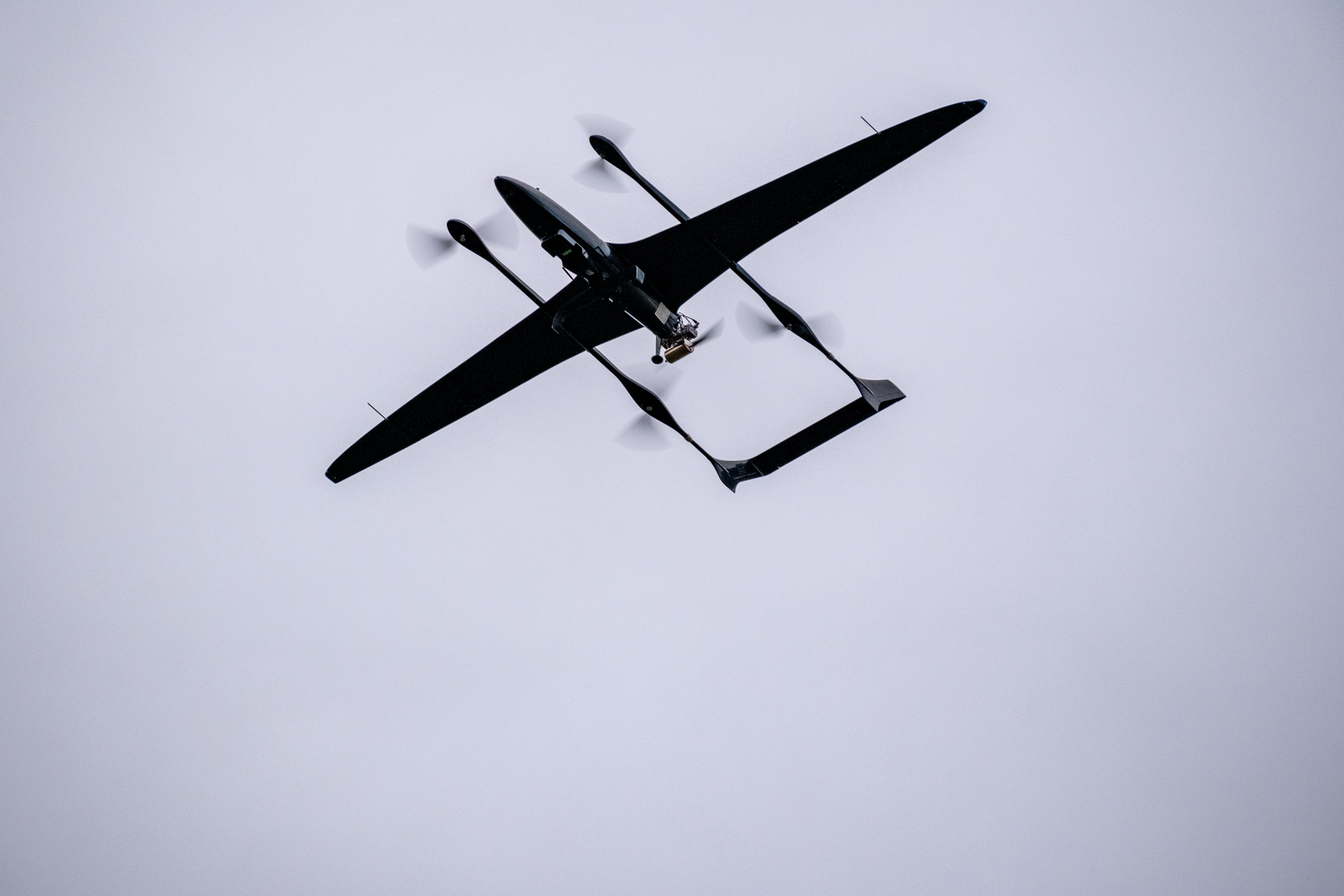
The Carbonix Ottano X flying with RIEGL VUX-120 and PhaseOne IXM-100
Carbonix CEO Philip van der Burg said Carbonix’s commitment to pushing the boundaries of innovation is accelerated by collaboration.
“The partnership with RIEGL and Phase One puts Carbonix at the forefront of remote sensing technology, empowering critical sectors with multi-modal information crucial for decision-making, planning, and monitoring,” he said.
“By harnessing the synergy between LiDAR’s precise 3D data, and photographic imaging’s detailed surface, colour, and texture information, we can provide a holistic solution that enables users to see enhanced details about their asset, assess environmental conditions, and create digital twins with unprecedented accuracy.”
“This collaboration underscores our commitment to innovation and customer satisfaction, as we continue to push boundaries and shape the future of geospatial data collection and analysis.”
RIEGL Australia Managing Director Glenne Blyth said the partnership was pushing the boundaries of aerial imaging and mapping.
“This collaboration is a big step forward for how we gather data from the sky, bringing us closer to a future where aerial surveys can be done with less risk to operational personnel, greater mobility and increased frequency,” he said.
Director of Product Management, Unmanned at Phase One, Michael Messerschmidt, underscored the significance of scalability in the integration of drone-collected images and LiDAR data.
“This project and collaboration between technology leaders proves that there is a path forward for how the collection of images and LiDAR data using drones can be scaled to even the largest areas,” he said.
“In an accelerated and dynamic world, scalability is the key to keeping the digital world up to speed with the rapid changes in the real world.”
<ends>
Further imagery and assets:
https://drive.google.com/drive/folders/1C6Yg7KdR346zxCh8YVH2y9EyjUJkXmyD?usp=sharing
About Carbonix:
Carbonix is Australia’s leading manufacturer and solutions provider of sophisticated commercial Uncrewed Aerial Systems.
We create innovative long-range aerial data capture systems that provide valuable insights, enabling safe and sustainable management of critical assets and operations, at scale.
Our state-of-the-art aerial systems integrate LiDAR, visual, and thermal sensor technology to generate accurate models, clear visuals, and frequent analytical data for specific assets and environments. Carbonix offers full operational and lifecycle support for UAS implementation, enabling frictionless adoption.
Media contact:
Melissa Hamilton
Media & Capital Partners
0417 750 274
melissa.hamilton@mcpartners.com.au
About RIEGL:
RIEGL is an international leading provider of cutting-edge technology in airborne, mobile, terrestrial, industrial and unmanned laser scanning solutions for applications in surveying.
RIEGL has been producing LiDAR systems commercially for over 40 years and focuses on pulsed time-of-flight laser radar technology in multiple wavelengths.
RIEGL’s core Smart-Waveform technologies provide pure digital LiDAR signal processing, unique methodologies for resolving range ambiguities, multiple targets per laser shots, optimum distribution of measurements, calibrated amplitudes and reflectance estimates, as well as the seamless integration and calibration of systems.
RIEGL’s Ultimate LiDARTM 3D scanners offer a wide array of performance characteristics and serve as a platform for continuing Innovation in 3D for the LiDAR industry.
From the first inquiry, to purchase and integration of the system, as well as training and support, RIEGL maintains an outstanding history of reliability and support to their customers.
Worldwide sales, training, support and services are delivered from RIEGL’s headquarters in Austria and in the USA; main offices in, Australia, Japan, China, Canada and the UK; and a worldwide network of representatives.
About Phase One:
Phase One is a global leader in digital imaging technology. The company provides unrivalled imaging quality for a wide range of applications, from professional photography to heritage digitization, industrial inspections, aerial mapping, security and space. For more than three decades, Phase One has developed core imaging technologies and a range of digital cameras and imaging modules, setting new standards for image quality in terms of resolution, dynamic range, color fidelity and geometric accuracy.
Based in Copenhagen, Denmark, and with regional offices strategically located in Denver, Cologne, Tel Aviv, Saku, Tokyo, Beijing, Shanghai, and Hong Kong, Phase One nurtures long-term relationships with customers, technology partners and its global network of distributors, often playing the role of digital imaging partner to customers with unique requirements. It is with this passion for service that Phase One continually exceeds expectations and drives the imaging industry forward.
Share this on social media: