
raw image format
Intelligent Image Quality (IIQ)
Uncompromised image quality. Compact file size. Full data integrity.
IIQ format: Phase One’s smart RAW image format
At Phase One, we are setting new standards in high-resolution imaging with our proprietary IIQ format—a smart RAW image format designed specifically to meet the demanding needs of aerial and geospatial professionals. IIQ delivers smaller files, faster workflows, and instant RAW review, ensuring speed and efficiency from capture to delivery.
Capture maximum image quality with full 83 dB dynamic range
Get the highest image quality, every time. IIQ preserves the full dynamic range (83 dB) of your sensor, ensuring every detail and tonal variation is retained for precise analysis and stunning visuals. By keeping all RAW sensor data intact, IIQ provides maximum flexibility for post-mission adjustments to exposure, white balance, and radiometry, safeguarding integrity and guaranteeing superior results.
Accelerate imaging workflows with IIQ: smaller files, faster delivery
Work faster with no compromise on quality. Benefit from up to 8×–10× smaller files compared to traditional 16-bit TIFFs, accelerating workflows, reducing storage needs, and simplifying data transfer. The highly efficient IIQ format enables high capture rates in high-resolution missions, supporting dense overlaps and fast-paced flying. Instant RAW review in the field minimizes costly re-flights, ensuring mission success with speed and confidence.
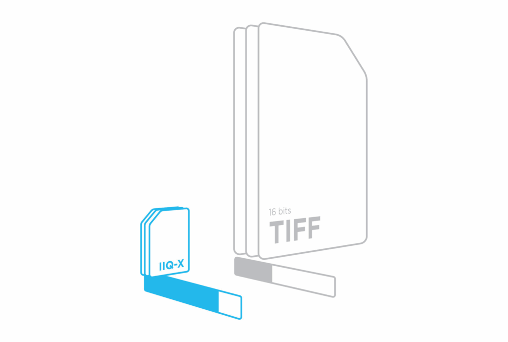
Introducing IIQ-X: Smarter compression for geospatial imaging
Exclusively available for the iXM-RS250 camera and iXM-FS130 camera.
The next evolution of our Intelligent Image Quality format, IIQ-X is engineered to handle the massive data volumes and complex patterns of ultra-high-resolution aerial and geospatial imagery.
IIQ-X delivers up to 10× smaller files than 16-bit TIFFs, while preserving full geometric accuracy and image integrity. This makes the transition to higher-resolution sensors hassle-free and workflow-friendly.
Key benefits of IIQ-X:
![]() Higher compression ratio without compromising quality
Higher compression ratio without compromising quality
![]() Reduced storage needs and lower infrastructure costs
Reduced storage needs and lower infrastructure costs
![]() Faster data transfer and smoother collaboration
Faster data transfer and smoother collaboration
![]() Optimized for hard-to-compress geospatial images
Optimized for hard-to-compress geospatial images
![]() Preserves all details for accurate mapping, surveying, and analysis
Preserves all details for accurate mapping, surveying, and analysis
By building on Phase One’s core IIQ technology, IIQ-X ensures that scaling to ultra-high-resolution missions does not create bottlenecks, enabling operators to work faster, smarter, and more efficiently.
IIQ format: All critical imaging data in one compact, process-ready file
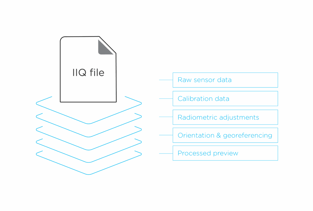
Keep all the critical data in one file. Each IIQ file includes RAW sensor data, calibration information, radiometric adjustments, orientation, and georeferencing—all in one compact format. This eliminates the need for external sidecar files. Additionally, each file contains a small, processed preview that enables real-time production quality control and super-fast post-processing workflows.
Instant quality control on RAW data with IIQ
With IIQ, there is no need for preprocessing before review. Operators can instantly verify sharpness, exposure, and coverage directly on RAW data in the field, saving time while ensuring full data integrity.
Key benefits in action
Precision imaging for mapping & surveying
Capture unmatched color and detail with IIQ files, engineered for seamless integration into professional mapping and surveying workflows.
Smarter 3D model generation with gNext
By utilizing IIQ natively in gNext, users enjoy a seamless experience with no preprocessing needed, while maintaining full data integrity throughout the pipeline. Learn more about the Phase One & gNext collaboration.
Get in touch
Have questions or want to learn more about our digital imaging solutions? Contact us to speak with a Phase One expert.