High-speed, centimeter aerial imaging without compromise
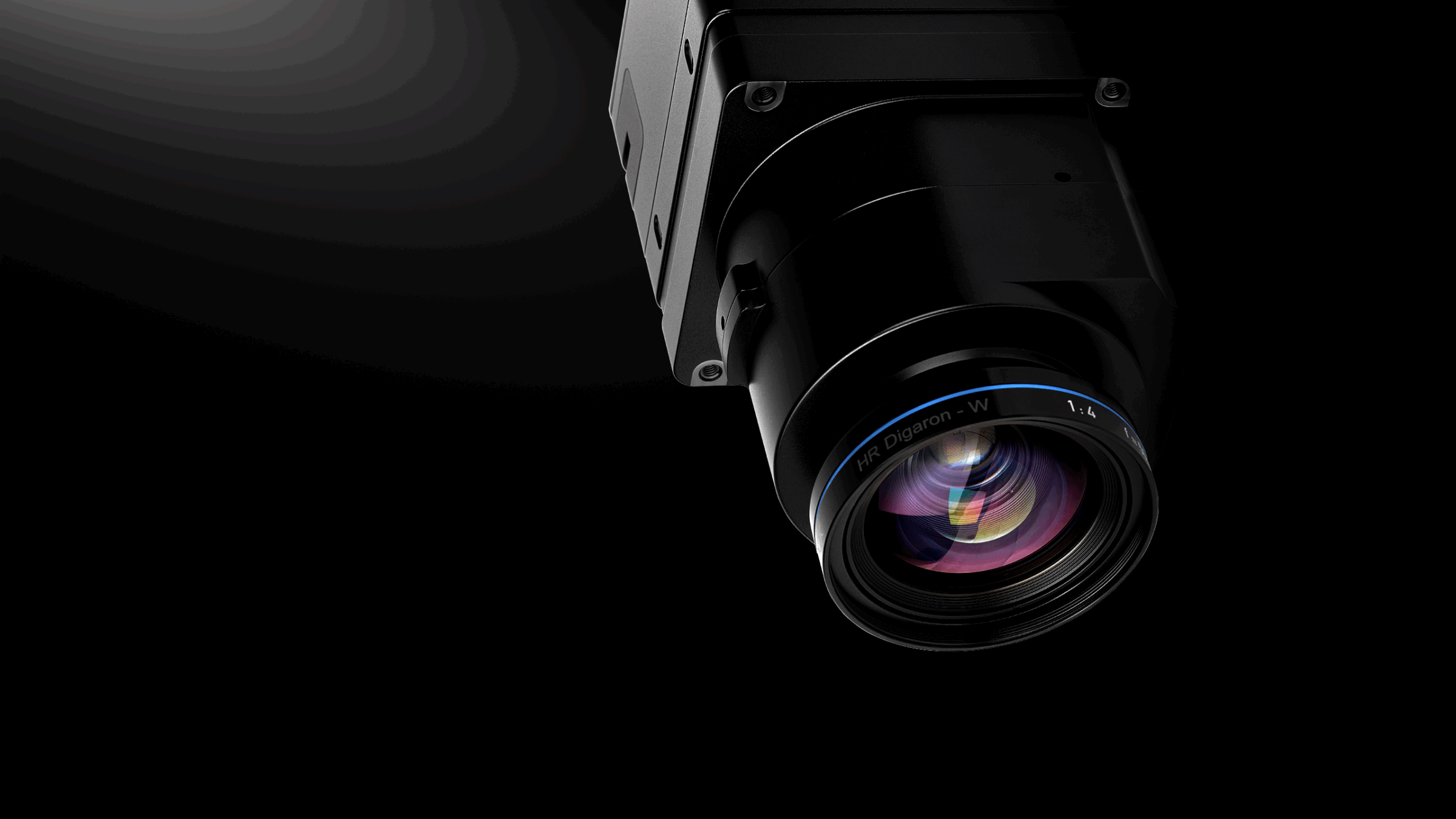
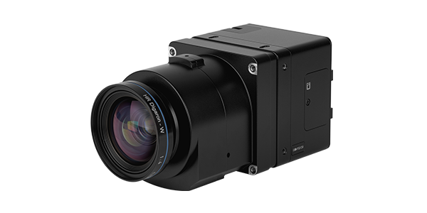
iXM-FS130
The Phase One iXM-FS130 aerial camera is built for fixed-wing aircraft mapping and imagery, enabling true 1 cm GSD (Ground Sample Distance) while maintaining speed, altitude, overlap, and workflow efficiency. Powered by Fusion Shutter™ and IIQ-X compression, it delivers sharp, high-resolution data for demanding mapping missions.
iX Process — now available for our camera components
iX Process is an integrated software solution for mapping professionals. It delivers instant project visualization, advanced radiometric adjustments, and seamless photogrammetry integration, fully leveraging the IIQ format to maximize hardware value.
True 1 cm GSD aerial mapping from fixed-wing, at speed
The Phase One iXM-FS130 aerial camera is purpose-built to enable true 1 cm GSD aerial imaging from a fixed-wing aircraft — without sacrificing speed, altitude, overlap, or workflow efficiency. Powered by Fusion Shutter™ technology and IIQ-X compression, it delivers unmatched resolution and productivity for demanding aerial mapping missions.
Why iXM-FS130 aerial mapping camera
- True 1 cm GSD from a fixed-wing aircraft
- Motion-free capture at high speed and altitude
- Efficient workflows with up to 90% smaller files
- Flexible integration across hybrid, compact, and oblique systems
Achieving sub-centimeter GSD without operational trade-offs
Sub-centimeter GSD missions have traditionally forced aerial operators to compromise — flying slower, flying lower, or accepting inefficient workflows. These constraints limit productivity and increase operational cost.
The iXM-FS130 removes these trade-offs. It enables true 1 cm GSD capture while maintaining efficient flight parameters, allowing operators to complete demanding missions faster and more consistently.
With iXM-FS130, we are removing long-standing tradeoffs between speed, resolution, and image integrity. By introducing Fusion Shutter™ technology and enabling sub-centimeter GSD at high aircraft speeds, we are opening the door to new aerial imaging capabilities while ensuring our customers can build on the investments they have already made.
Thomas Allin
Chief Technical Officer, Phase One
Ground sample distance (GSD) mission planning calculator
Visualize sub-centimeter GSD missions using our interactive mission planning calculator. See how high-speed, high-altitude flights can still deliver motion-free 1 cm GSD capture with efficient coverage and data handling.
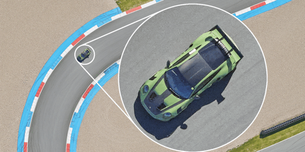
What does 1 cm GSD mean in aerial mapping?
Ground sample distance (GSD) defines the real-world size represented by a single pixel in an aerial image. A GSD of 1 cm means that each pixel corresponds to one centimeter on the ground, enabling extremely fine spatial detail and highly accurate measurements directly from the imagery.
What 1 cm GSD enables
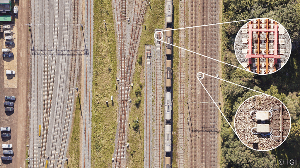
At 1 cm GSD, aerial imagery reaches inspection-grade detail, making it possible to clearly identify small features, edges, and surface conditions. This level of resolution is especially critical for dense urban environments, corridor mapping, and infrastructure aerial inspection, where precision and clarity directly impact analysis quality and decision-making.
Why achieving 1 cm GSD is challenging
Achieving 1 cm GSD from an aircraft is technically demanding. High aircraft speeds increase the risk of motion blur, fine GSD dramatically increases data volumes, and traditional systems often require slower speeds or lower altitudes to compensate. Overcoming these constraints requires advanced shutter technology, stable imaging performance, and efficient data handling to keep missions operationally viable.
Technical specifications
iXM-FS130
Specifications
Resolution (Mpix)
128
Resolution (Mpix)
128
Sensor resolution (pix)
13,468 x 9,564
Sensor resolution (pix)
13,468 x 9,564
Color options
RGB & Achromatic
Color options
RGB & Achromatic
Dynamic range (dB)
80
Dynamic range (dB)
80
Light sensitivity RGB (ISO)
200
Light sensitivity RGB (ISO)
200
Light sensitivity ACH (ISO)
800
Light sensitivity ACH (ISO)
800
Pixel size [um]
3.45
Pixel size [um]
3.45
Sensor size [mm x mm]
46 x 33
Sensor size [mm x mm]
46 x 33
Aspect ratio
7:5
Aspect ratio
7:5
Max shutter speed [s]
1/16000
Max shutter speed [s]
1/16000
Shutter type
Fusion shutter (Electronic AND Mechanical)
Shutter type
Fusion shutter (Electronic AND Mechanical)
Continuous frame rate w. previews (fps)
up to 4 fps
Continuous frame rate w. previews (fps)
up to 4 fps
RAW file compression (approx.) (IIQ)
RAW file compression (approx.) (IIQ)
Lens mount
Phase One RSM and RS
Lens mount
Phase One RSM and RS
Interface
Image data
USB 3.0, Ethernet 10G (fiber/copper)
Image data
USB 3.0, Ethernet 10G (fiber/copper)
API
Phase One SDK
API
Phase One SDK
H/W signals (inputs)
Trigger, Black reference
H/W signals (inputs)
Trigger, Black reference
H/W signals (output)
Camera ready, MEP
H/W signals (output)
Camera ready, MEP
Internal data storage
CF Express card
Internal data storage
CF Express card
HDMI
1,920 x 1,080
HDMI
1,920 x 1,080
Synchronization speed in multiple camera configuration (μsec)
50
Synchronization speed in multiple camera configuration (μsec)
50
Mechanical
Weight - excl. lens (g)
647
Weight - excl. lens (g)
647
Dimensions - excl. lens (mm)
90 x 90 x 67
Dimensions - excl. lens (mm)
90 x 90 x 67
Interface (for mounting)
4 x M4 threads
Interface (for mounting)
4 x M4 threads
Operating conditions
Operating temperature (°C)
-10 to 40
Operating temperature (°C)
-10 to 40
Relative humidity (%)
15 to 80 (non-condensing)
Relative humidity (%)
15 to 80 (non-condensing)
Approvals
FCC Class A, CE, RoHS
Approvals
FCC Class A, CE, RoHS
Weather protection
IP53
Weather protection
IP53
4-Band Configuration (optional)
Number of lenses
2
Number of lenses
2
Number of sensors
2
Number of sensors
2
RGB/NIR ratio
1:1
RGB/NIR ratio
1:1
NIR Range (nm)
720 - 1000
NIR Range (nm)
720 - 1000
Output formats
NIR, CIR, RGBI, NDVI
Output formats
NIR, CIR, RGBI, NDVI
Lenses and opening angles
Camera specifications
-
Pixel size: 3.45 µm
-
Resolution: 13,468 × 9,564 pixels
-
Shutter life: 500,000 actuations
These specifications apply to the iXM-FS130 camera and remain constant across all supported RS and RSM lenses.
RSM-35 mm *
RSM-35 mm
Angle of view - long side (°)
64.4
Angle of view - long side (°)
64.4
Angle of view - Short side (°)
50.5
Angle of view - Short side (°)
50.5
*Resolution limited to 120 MP
*Resolution limited to 120 MP
RS-50 mm
RS-50 mm
Angle of view - long side (°)
49.8
Angle of view - long side (°)
49.8
Angle of view - Short side (°)
36.5
Angle of view - Short side (°)
36.5
RS-70 mm
RS-70 mm
Angle of view - long side (°)
36.7
Angle of view - long side (°)
36.7
Angle of view - Short side (°)
26.5
Angle of view - Short side (°)
26.5
RSM-80 mm
RSM-80 mm
Angle of view - long side (°)
32.4
Angle of view - long side (°)
32.4
Angle of view - Short side (°)
23.3
Angle of view - Short side (°)
23.3
RS-90 mm
RS-90 mm
Angle of view - long side (°)
28.9
Angle of view - long side (°)
28.9
Angle of view - Short side (°)
20.8
Angle of view - Short side (°)
20.8
RS-110 mm
RS-110 mm
Angle of view - long side (°)
23.9
Angle of view - long side (°)
23.9
Angle of view - Short side (°)
17.1
Angle of view - Short side (°)
17.1
RS-150 mm / RSM-150 mm
RS-150 mm / RSM-150 mm
Angle of view - long side (°)
17.6
Angle of view - long side (°)
17.6
Angle of view - Short side (°)
12.6
Angle of view - Short side (°)
12.6
RS-180 mm
RS-180 mm
Angle of view - long side (°)
14.7
Angle of view - long side (°)
14.7
Angle of view - Short side (°)
10.5
Angle of view - Short side (°)
10.5
RSM-300 mm
RSM-300 mm
Angle of view - long side (°)
8.9
Angle of view - long side (°)
8.9
Angle of view - Short side (°)
6.3
Angle of view - Short side (°)
6.3
Built for demanding aerial mapping missions
Large-scale high-resolution mapping
Large-scale mapping projects such as cities, agricultural regions, and national parks benefit from 1 cm GSD by combining wide-area coverage with exceptional detail. This enables accurate feature extraction, change detection, and asset analysis without sacrificing productivity across large geographic areas.
Corridor mapping and infrastructure inspection
For corridors such as railways, roads, pipelines, and powerlines, sub-centimeter GSD ensures critical infrastructure details are captured clearly and consistently. High-resolution imagery reduces the risk of missed defects, supports automated analysis, and enables efficient inspection workflows over long, linear assets.
Dense urban modeling
Dense urban environments demand high-resolution data to accurately model buildings, facades, rooftops, and street-level features. At 1 cm GSD, aerial imagery supports detailed 3D city models, improves reconstruction of complex geometries, and reduces issues caused by occlusions and narrow urban canyons.
High-value geospatial applications
Other high-value geospatial missions require precise, repeatable, and time-sensitive data capture. Sub-centimeter GSD enables detailed situational awareness, consistent monitoring, and accurate comparison over time, supporting mission-critical analysis where reliability and accuracy are essential.
With CM-1, we have a fully operational system that proves what iXM-FS130 enables in practice. The combination of Fusion Shutter™ technology, high-speed image capture, and tight system integration allows operators to fly fast, maintain image integrity, and execute complex missions with confidence. This is not a concept — it is a production-ready solution.
Philip Grimm
Managing Director, IGI