Experience the highest image quality and performance
As the image quality leader, Phase One empowers professionals across industries with precision imaging technology and medium format camera performance. Our high-resolution imaging solutions deliver professional camera quality, sharper data, smarter insights, and unmatched precision — helping you go from capture to clarity, faster.
Smarter data. Sharper insights. Faster results with medium format image quality.
At Phase One, we empower industries with unrivaled image quality and enhanced productivity. By continuously pushing boundaries, we develop reliable imaging solutions, simply integrated in streamline workflows, maximizing performance in data production.
Discover how our commitment to exceptional pixel quality and optimized data delivery accelerates actionable decisions towards reliable perception and analytics. Our approach to imaging solutions, drives clarity, precision, and accuracy, helping you preserve the past, capture the present, and shape the future.

Advanced image quality technology for smarter imaging
Our imaging solutions are designed to maximize efficiency at every stage, helping industries optimize workflows, reduce operational costs, and enhance data delivery speed.
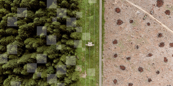
Faster and more efficient data acquisition
- Larger image footprint
- Smaller number of image capture
- Faster data acquisition
- Less data storage
Explore our best-in-class imaging innovations
- Intelligent Image Quality (IIQ) format: While keeping the high quality, IIQ, speeds up data capture, reduces data transfer and handling time, minimizes data storage
- Seamless workflow integration: Direct compatibility with industry leading photogrammetry and remote sensing software ensures seamless transition from image capture to high quality outputs for more reliable AI-driven geospatial analytics
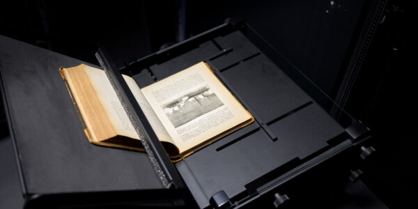
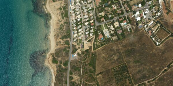
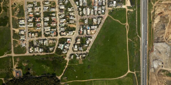
High-speed, large-scale imaging
- Digitization of collections: High-speed, precision imaging enables rapid digitization while minimizing handling time for delicate items
- Automated quality control: Reduces the need for manual intervention, ensuring efficient, high-volume image capture at scale without compromising accuracy.
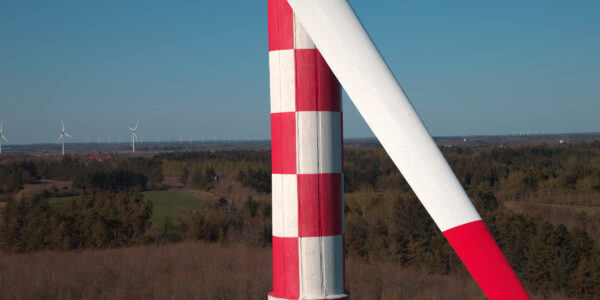
Whether it’s geospatial analysis, industrial inspection, environmental monitoring, or heritage digitization, our imaging solutions ensure smooth and efficient operations from capture to informed decisions.


Phase One has been able to make a huge leap in innovation when it comes to drone mapping capabilities. What used to take weeks of work and 1000's of images now takes a matter of days with very few, yet high-quality imagery that revolutionized how we look at data today.
Phase One's transferring speed and the number of details and wide dynamic range the camera can capture are impeccable. All of this has improved our production rate, workflow, and routines significantly - not least the quality of what we digitize and share with the public.
The detail and sharpness of a Phase One image file bring a level of sophistication that truly makes it a pleasure to edit with. I can honestly say that it's taking my work and attention to detail to another level, and that growth is reflected to both clients and collectors.
Why Phase One is the image quality leader?
With more than 30 years of experience, Phase One has been a leader in the imaging market, starting with medium format cameras for professional Photography and expanding into the Geospatial and Space market – all at a premium level.
Phase One is committed to delivering the highest image quality and enhancing productivity—helping professionals achieve more with every capture.
Get in touch
Have questions or want to learn more about our imaging solutions? Contact us to speak with a Phase One expert.