• Sign in
  • Contact us

Home Aerial imagery

Choose your language

  • English

Tag: Aerial imagery

Webinar-Consortiq-Using the right sensor for the right job
Webinar

Using the right sensor for the right job

Webinar-FLYING-CAM-unmanned-data-acquisition
Webinar

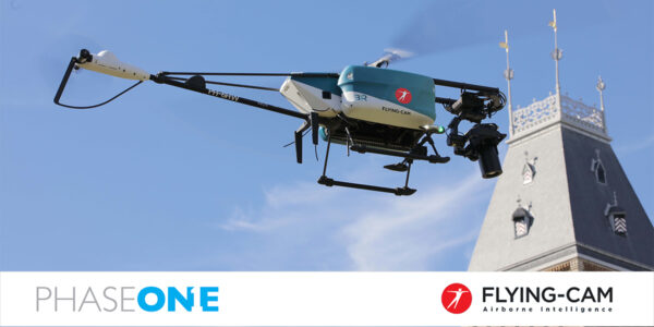
Unmanned Airborne Intelligence with a Soul Inside by Flying-Cam

Webinar

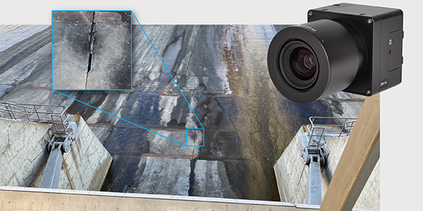
How Digital-Twins of Hydro-power Dams support Plant Operations

Webinar_SimActive
Webinar

How to use metric cameras for accurate mapping

GGS Webinar
Webinar

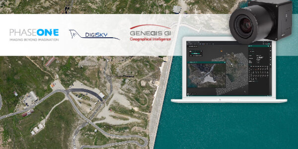
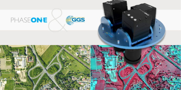
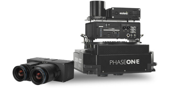
An overview of 20 years of Phase One aerial surveying sensor integration by GGS

Webinar

Achieve precision asset management using Trendspek Software and Phase One Industrial cameras to create high-accuracy true-to-life digital twins

Webinar

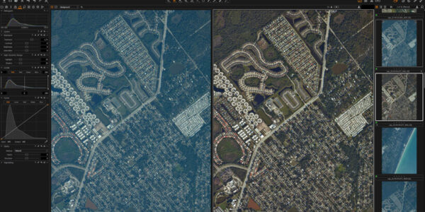
Optimizing Your Aerial Images With Capture One

Webinar

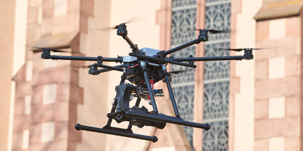
Why the Phase One iXM 100 is the ultimate UAV camera

Webinar

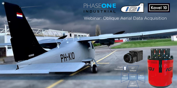
Oblique Aerial Data Acquisition using Phase One Cameras integrated by IGI (Germany) and operated by Kavel10 (Netherlands)

Webinar

Following the announcement of the 280MP Large format Aerial Solution

  • Applications
  • Geospatial Imagery
  • Space
  • Heritage
  • Bespoke Photography
  • Solutions
  • Geospatial Solutions
  • Space solutions
  • Heritage Solutions
  • Photographic Cameras
  • Knowledge Hub
  • Case Studies
  • Upcoming Events, Webinars and Workshops
  • Inspiration
  • Press Releases
  • On-demand webinars and videos
  • Developer
  • Phase One Blogs
  • About
  • What Do We Stand For?
  • Life at Phase One
  • Find a Local Partner
  • Find a Rental Studio
  • Phase One Certified Professional
  • Contact us
Newsletter sign up
  • Legal
  • Privacy Policy
  • Cookie Policy
  • Terms and Conditions
© Phase One 2025
  • Legal
  • Privacy Policy
  • Cookie Policy
  • Terms and Conditions