• Sign in
  • |
  • Contact us

Home Multi-sensor

Choose your language

  • Deutsch
  • English

Tag: Multi-sensor

Inspection camera for powerline corridor mapping
Geospatial

NV5 Geospatial – Capturing Precise Details, with Four Phase One Cameras Integrated into Helicopter-based CLASS

GGS Webinar
Webinar

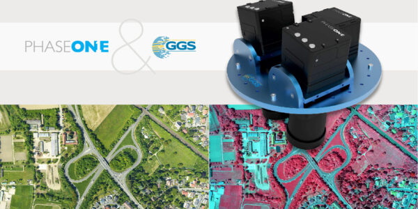
An overview of 20 years of Phase One aerial surveying sensor integration by GGS

multi-sensor power line inspection
Geospatial

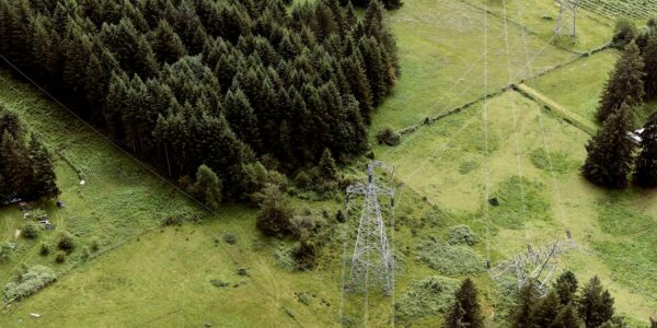
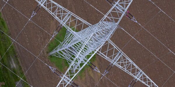
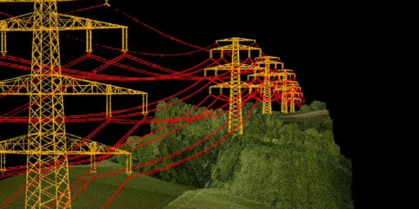
Siemens and GGS – Revolutionizing Powerline Inspection with Multi-Sensor Systems and Artificial Intelligence

Aerial view captured by Phase One for NASA's thermal imaging
Geospatial

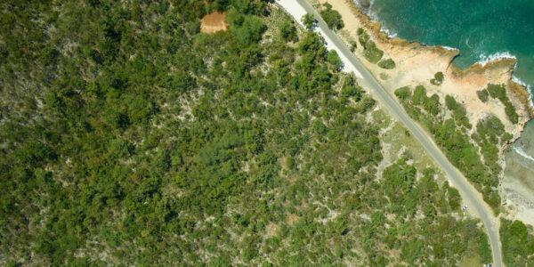
NASA G-LiHT – High-Resolution, Multi-sensor Data to Characterize Puerto Rican Forests

Webinar

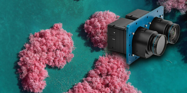
Multi Sensor Integration of Phase One Cameras

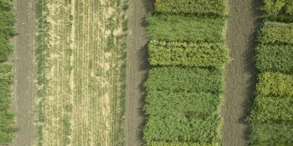
Making Agricultural Management Decisions with the Phase One 4-Band Aerial System

Geospatial

Draganfly – Advances Aerial Drone Data Collection

Webinar

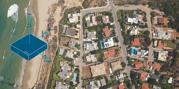
Integration of Phase One Aerial Cameras with Inertial Systems

  • Applications
  • Geospatial Imagery
  • Space
  • Heritage
  • Bespoke Photography
  • Solutions
  • Geospatial Solutions
  • Space solutions
  • Heritage Solutions
  • Photographic Cameras
  • Knowledge Hub
  • Case Studies
  • Upcoming Events, Webinars and Workshops
  • Inspiration
  • Press Releases
  • On-demand webinars and videos
  • Developer
  • Phase One Blogs
  • About
  • What Do We Stand For?
  • Life at Phase One
  • Find a Local Partner
  • Find a Rental Studio
  • Phase One Certified Professional
  • Contact us
Newsletter sign up
  • Legal
  • Privacy Policy
  • Cookie Policy
  • Terms and Conditions
© Phase One 2025
  • Legal
  • Privacy Policy
  • Cookie Policy
  • Terms and Conditions