• Sign in
  • |
  • Contact us

Home 4-band

Choose your language

  • Deutsch
  • English

Tag: 4-band

UAV mapping camera case study Phase One
Geospatial

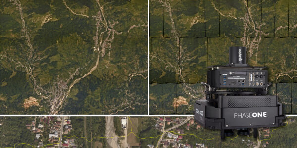
Trimble Inpho – High class photogrammetry with aerial imagery from PAS 280

Multi-sensor LiDAR data aerial imaging and mapping system
Geospatial

MapSoft – Multi-sensor Aerial System Improves Urban Development

Webinar

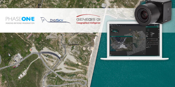
How Digital-Twins of Hydro-power Dams support Plant Operations

Webinar

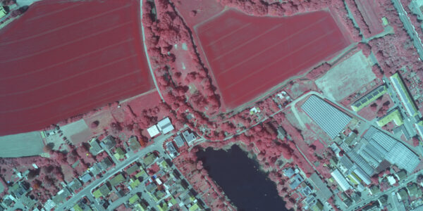
Bridging Processes using Phase One Imagery for Agricultural Analysis

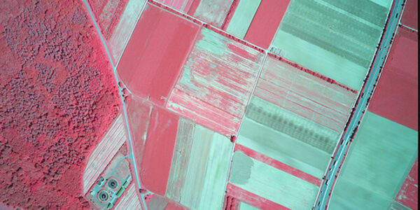
Making Agricultural Management Decisions with the Phase One 4-Band Aerial System

How Phase One Cameras Transform Urban, Agricultural, and Environmental Mapping
Geospatial

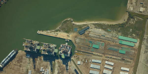
ADS – Ultra-High Resolution Aerial Imagery Improves Oil and Gas Pipeline Planning

aerial 3d model | Multi-sensor aerial imaging system For Geospatial Precision in 3D City Modeling
Geospatial

Aerowest – Creating 3D City Models in a Single Flight

Webinar

Using Phase One Cameras for Environmental Monitoring

GGS GmbH 100MP 4-Band Aerial System
Geospatial

GGS GmbH integration of Phase One 100MP 4-Band System

Geospatial

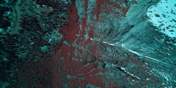
SkyIMD – Monitoring Dead Trees and Preserving the Green in Yosemite Park

  • Applications
  • Geospatial Imagery
  • Space
  • Heritage
  • Bespoke Photography
  • Solutions
  • Geospatial Solutions
  • Space solutions
  • Heritage Solutions
  • Photographic Cameras
  • Knowledge Hub
  • Case Studies
  • Upcoming Events, Webinars and Workshops
  • Inspiration
  • Press Releases
  • On-demand webinars and videos
  • Developer
  • Phase One Blogs
  • About
  • What Do We Stand For?
  • Life at Phase One
  • Find a Local Partner
  • Find a Rental Studio
  • Phase One Certified Professional
  • Contact us
Newsletter sign up
  • Legal
  • Privacy Policy
  • Cookie Policy
  • Terms and Conditions
© Phase One 2025
  • Legal
  • Privacy Policy
  • Cookie Policy
  • Terms and Conditions