
Agricultural & Forestry
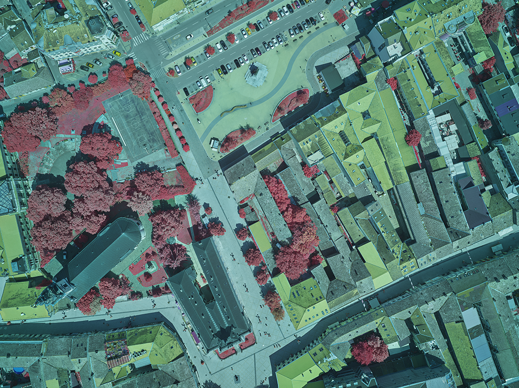
40% faster 4-Band data acquisition when digitally mapping Novi Sad city with a multi-sensor LiDAR data aerial system.
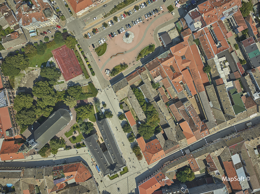
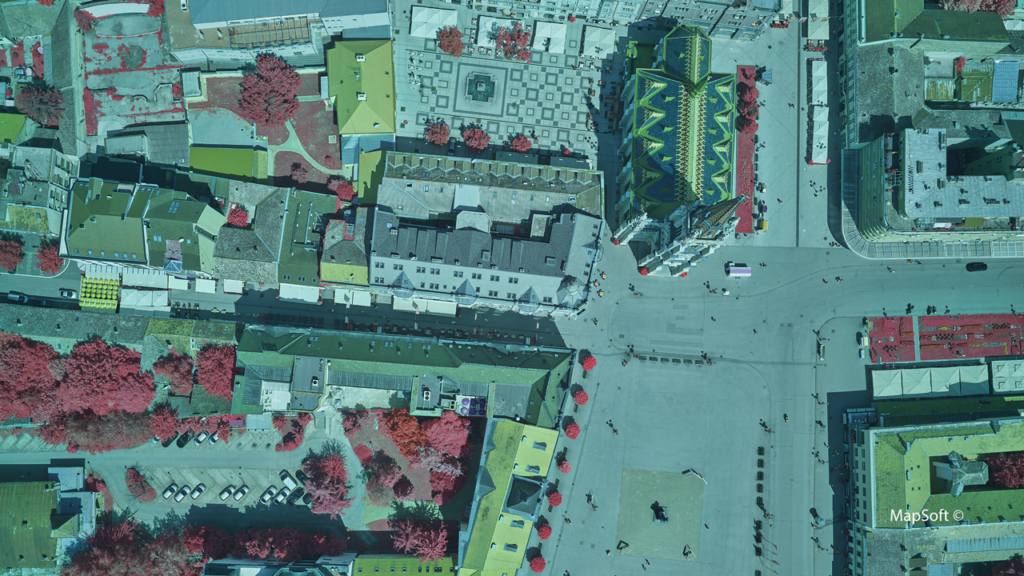
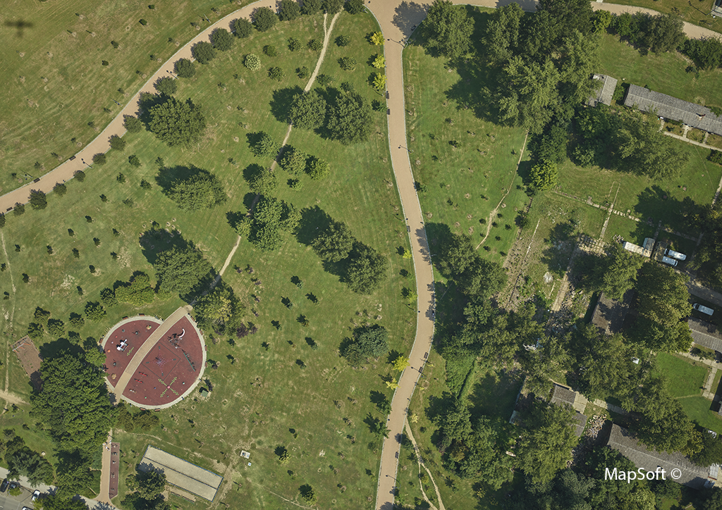
Novi Sad is the second-largest city in Serbia, with about 300,000 inhabitants and rich history. MapSoft uses a hybrid aerial system consisting of two Phase One 100MP cameras and a LiDAR scanner to digitize the city using LiDAR 3D mapping techniques and develop a geographic information system (GIS) solution of urban green areas.
4-Band Data Acquisition at Faster Speeds
A 3D city modeling project was performed over a 160 square kilometers area. The imagery obtained included 4-band images of high spatial resolution (GSD 2.5 cm/pix) and a point cloud density of 30 points/m2.
The project’s biggest challenge was the precise detection of vegetation over the entire area, which was made possible through the efficient implementation of the multi-sensor system. The coverage of the large area required the use of a more efficient and faster aircraft.


An integrated hybrid sensor system, using high-definition Phase One cameras, on an efficient aircraft platform allows the final product to be fully adapted for efficient automation and improved data processing.
Easy integration with LiDAR data multi-sensor system
Phase One cameras integrate easily with other components into a single hybrid sensor system. MapSoft operated the system with a single flight management system and all sensors of the hybrid system used a single GNNS / INS system. As a result, acquired data was easily combined, highly accurate, and of high quality.
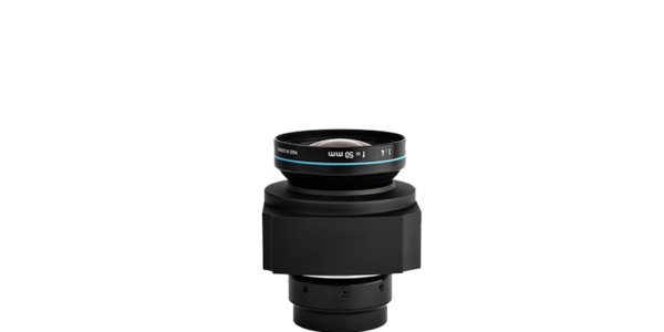
The geometric and radiometric quality of imagery from the Phase One cameras was perfect due to the high quality of the CMOS sensor and short shutter speeds. The shutter synchronization of the two calibrated cameras (RGB + NIR) meant that 4-band images obtained have the matching details with subpixel accuracy. This caused no image blurring regardless of the 2.5 cm/pix GSD, which led to accurate detection of the boundaries on the data used.
Hybrid multi-sensor system improves data collection efficiency
Mapsoft d.o.o. is a geomatics company from Belgrade, Serbia, specializing in data collection via photogrammetric methods and developing GIS solutions in Southeast Europe for almost 20 years.
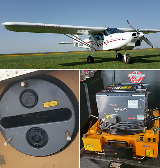
To become more efficient in their data acquisition, the company uses an integrated hybrid multi-sensor system installed on the SOMAG GSM 3000 gyrostabilizer, consisting of a Teledyne Optech Galaxy LiDAR scanner and two Phase One 100MP cameras (RGB and NIR) for precise 3D mapping of the area. MapSoft installs the system into a Serbian AeroEast Europe SILA 750 aircraft (general aviation type), explicitly designed to take aerial systems for photogrammetric projects.
Post-processing with Perfect Results
During point cloud processing from georeferenced images, each point is assigned a NIR value in addition to the RGB attributes. This makes it possible to use the NDVI index in addition to the standard point cloud classification procedure for vegetation classification. The high geometric accuracy of the images and point cloud makes it possible to precisely assign attributes to the point cloud from 4-band images. As a result, vegetation was automatically detected with a much higher degree of reliability and accuracy compared to the classification without the use of NIR channels. The vegetation mapping process produced 6 types of categories: RGB; CIR; NDVI; classified; ground vegetation; and vegetation.
Along with other data (2.5 cm/pix orthophoto, trees, shrubs, flower gardens, etc.) of the established GIS of green areas, vegetation data is an excellent spatial basis for recording, preserving, maintaining, protecting, and planning green areas and city natural spaces in general. That defines, measures, and sets standards for city management and development.

Geospatial
Eight perspectives, one system

Geospatial
Finding tiny cracks with UAVs opens new opportunities

Geospatial
From capture to corridor intelligence: How Kavel 10 scaled 1 cm mapping with the Phase One + IGI CM-1

Geospatial
From sensors to solutions: How AISPECO orchestrates precision in reality surveying

Geospatial
Monitoring pipeline corridor using PAS 280 large format camera

Geospatial
Preventing Wild Bushfires By Mapping Planned Burns

Geospatial
Novice Aerial Photographer Becomes Advanced Mapping Provider

Geospatial
Inspecting Wind Turbine Blades While They Are Rotating

Geospatial
Precision at Altitude: Redefining Aerial Mapping with the PAS 880 Oblique Camera System

Geospatial
Perfecting telescope dish accuracy with UAV photogrammetry

Geospatial
Saving costs while lowering carbon footprint: Innovative aerial surveying service uses small airplanes enabled by compact cameras

Geospatial
Detecting forest tree diseases using a large-format camera on an ultralight aircraft

Geospatial
Mapping lava flows during volcanic eruptions in Iceland

Geospatial
The PAS Pana: a 48,800-pixel camera innovated with our customer Surdex

Geospatial
Rebuilding after Hawaii’s wildfire with engineering-grade surveying