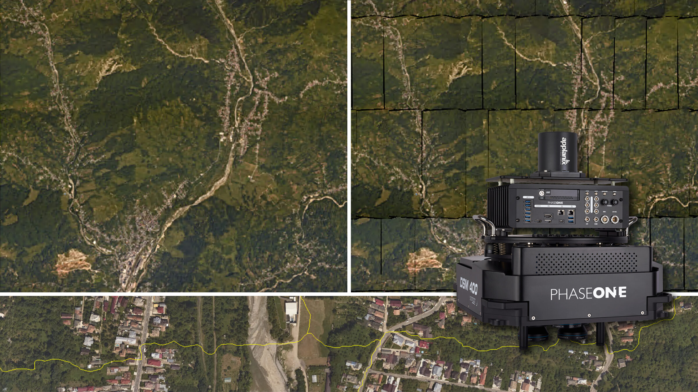
Agricultural & Forestry
High class photogrammetry with aerial imagery from a PAS 280 and Trimble Inpho Software
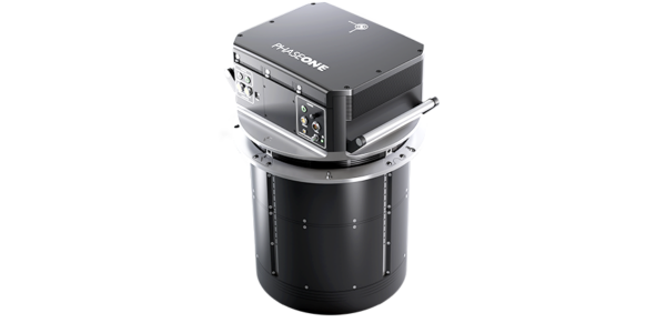
A Phase One Aerial System 280MP (PAS 280), combined with Trimble Inpho software, reached new efficiency levels when processing a classic photogrammetry project for an agricultural customer.
Leveling-up project precision and productivity
Combining a high-quality aerial camera system and complementary software for a complete and seamless workflow is mandatory to level up the precision and productivity of photogrammetric projects.
Improved efficiency was evident in a recent mission of a European customer, exceeding expectations. A Phase One 280MP Aerial System (PAS 280) and Trimble Inpho software achieved project deliverables with the highest productivity.


Generating the DSM and DTM using Inpho toolkits
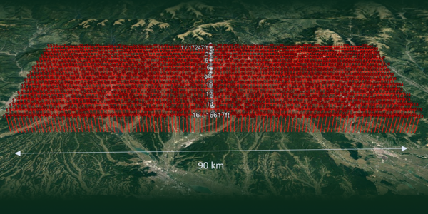
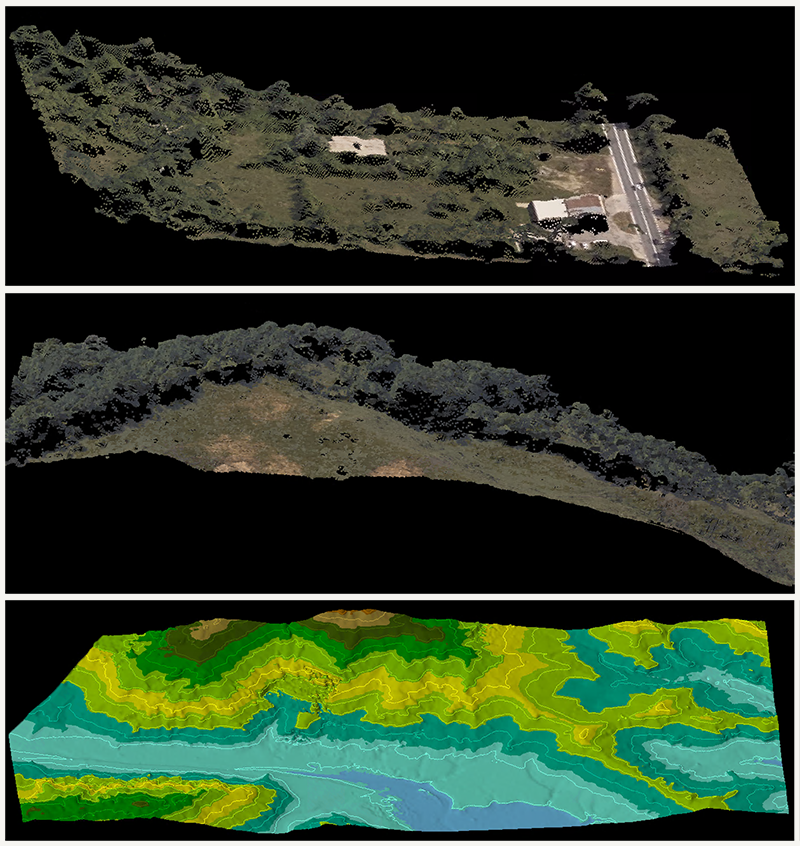
Due to the project’s rural application, the flight was conducted with a 60% overlap and 40% side-lap to rapidly generate a Digital Surface Model (DSM), with sub-pixel accuracy, using the MATCH-T DSM module in Inpho. In city modeling or urban mapping projects, or in areas with high buildings, as well as high-overlapping imagery projects, MATCH-3DX is recommended.
Automatically generated colorized dense point clouds, in sub-pixel accuracy, were filtered to obtain a Digital Terrain Model (DTM) using the DTMToolkit functionality. The standard settings, as default, provided outstanding results, which improved with customized filter settings or interactive modifications.
image: DSM and DTM models created with inpho match-t DSM and DTM toolkit
The combination of high quality Phase One cameras and Trimble Inpho suite increases the level of quality and efficiency in the production lines of any imagery project, from small to large scales.
Orthophoto generation and mosaicking using OrthoMaster and OrthoVista
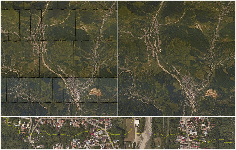
The OrthoMaster module in Inpho offers a high-performance orthorectification tool, which was able to rectify the images in Orthophotos in less than 1sec./image.
OrthoVista was used to process the final radiometric adjustment, seamline calculation, and mosaicking. Although this Inpho module is well-known for its strong and automatic ratiometry enhancement capabilities, the refinements of this project were no challenge due to the well-aligned radiometry from the PAS280 images.
Image: Orthophotos after image rectification (left) and final orthomosaic (right). Zoomed view in the orthomosaic after radiometric adjustment with seamlines (bottom)
Increased productivity in less time
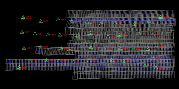
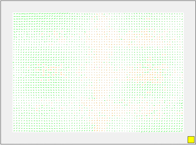
The project provides a fitting example of a solution using Phase One cameras and Trimble Inpho software for leveling up the productivity in high-quality aerial imagery projects. The image matching results represent the power of MATCH-AT in tie point extraction with solid connectivity in the whole block.
The high-quality imagery of a PAS280 and the well-balanced radiometry across the entire project increases productivity by reducing the time for any additional refinement to the automatic steps in orthomosaic generation in OrthoVista.
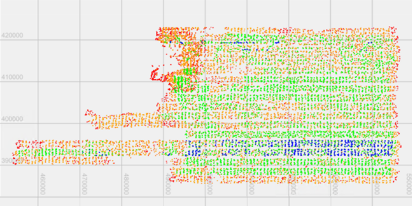
Image: Residuals of the lens showing the high quality of the camera

Geospatial
Eight perspectives, one system

Geospatial
Finding tiny cracks with UAVs opens new opportunities

Geospatial
From capture to corridor intelligence: How Kavel 10 scaled 1 cm mapping with the Phase One + IGI CM-1

Geospatial
From sensors to solutions: How AISPECO orchestrates precision in reality surveying

Geospatial
Monitoring pipeline corridor using PAS 280 large format camera

Geospatial
Preventing Wild Bushfires By Mapping Planned Burns

Geospatial
Novice Aerial Photographer Becomes Advanced Mapping Provider

Geospatial
Inspecting Wind Turbine Blades While They Are Rotating

Geospatial
Precision at Altitude: Redefining Aerial Mapping with the PAS 880 Oblique Camera System

Geospatial
Perfecting telescope dish accuracy with UAV photogrammetry

Geospatial
Saving costs while lowering carbon footprint: Innovative aerial surveying service uses small airplanes enabled by compact cameras

Geospatial
Detecting forest tree diseases using a large-format camera on an ultralight aircraft

Geospatial
Mapping lava flows during volcanic eruptions in Iceland

Geospatial
The PAS Pana: a 48,800-pixel camera innovated with our customer Surdex

Geospatial
Rebuilding after Hawaii’s wildfire with engineering-grade surveying