Revolutionizing aerial engineering surveying: Overcoming industry challenges with P5
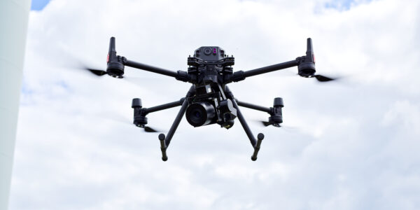
In the ever-changing landscape of technology, drones have become essential catalysts, transforming the fields of aerial imaging and data collection across diverse industries, including architecture, engineering, and construction (AEC). In this dynamic environment, consumer-grade drones take center stage in the AEC industry. However, despite offering a range of features, they fall short in meeting the stringent surveying requirement for sub-centimeter accuracy. This need for precision has highlighted a significant gap in the industry. Until now, traditional surveying methods are still considered the most reliable tools to register survey-grade accuracy in the most precise, efficient and productive way. With the advent of Phase One P5, the market is witnessing a true revolution of engineering surveying where accuracy, efficiency and productivity reach a completely new standard.
Say goodbye to time constraints when surveying an asset
The surveying and construction industry grapples with time constraints, resource limitations, and potential fines due to project delays. Traditional surveying methods, which often involve physically accessing the asset, can be incredibly time-consuming. This not only hinders progress on construction projects but can also exacerbate the industry’s struggle with a shortage of qualified surveyors.
These traditional methods are further hampered by two key limitations. Firstly, they often require shutting down an entire area, such as a road or industrial plant, to ensure the safety of both the surveyor and those around them. This adds significant delays to the surveying process. Secondly, traditional instruments may not be able to reach certain assets due to their location or complexity.
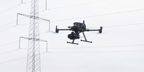
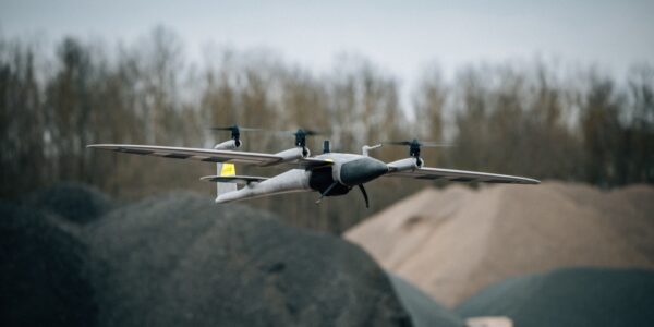
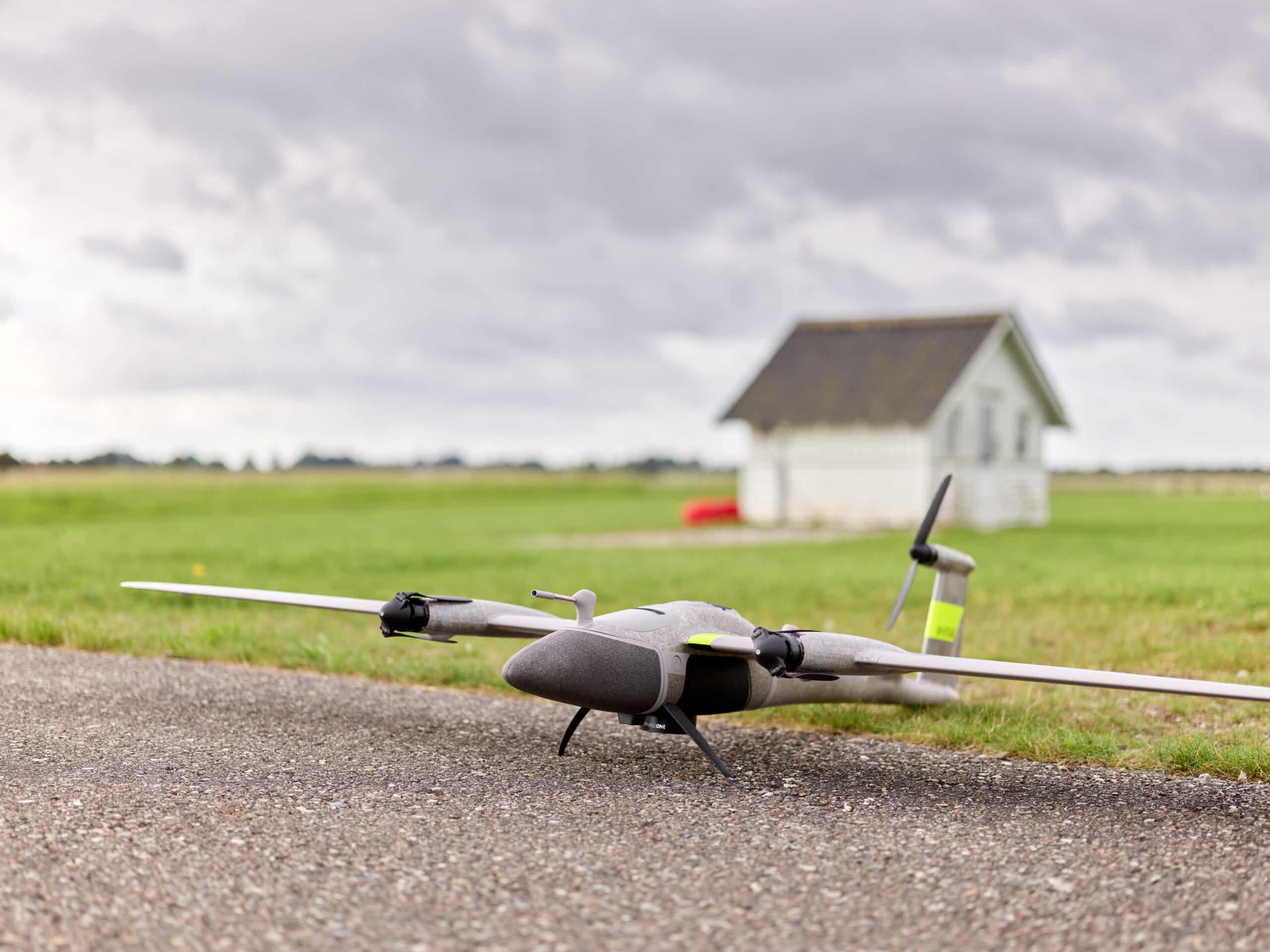
The P5 was designed to overcome these challenges. Mounted on fixed-wing and VTOL platforms, the drone boasts exceptional flight speed, allowing surveyors to cover large areas more efficiently, while still achieving true survey grade accuracy. Its small size also eliminates the need for extensive site closures, minimizing disruption to ongoing operations. With the P5, difficult-to-access assets become readily surveyable, streamlining the entire process and maximizing productivity.
How UAVs are Closing the Data Gap in Surveying
Surveyors, particularly in smaller companies, may be reluctant to embrace technological advancements, preferring familiar methodologies. The main concerns stem from the possibility of integrating new tools into already established workflows and data quality.
Construction and architectural projects require high-precision surveys, and some current UAV-based solutions struggle to capture survey-grade data. This “data gap” can lead to:
- Re-flying missions: Inaccurate data forces surveyors to retake entire missions, significantly increasing costs and consuming valuable human resources.
- Project delays: Re-flights and data processing delays can push back project timelines and impact profitability.
Here is where the P5 steps in. This revolutionary solution is specifically designed to address these challenges faced by modern surveyors.
Built for accuracy: The real P5 advantage
Productivity is key for large-scale engineering surveying companies to remain competitive and deliver critical projects on time. Ground-based measuring methods are often time-consuming, and past attempts to use UAVs have been hindered by data quality issues and increased liability risks. UAVs have struggled to achieve the required accuracy due to limitations in image sensor technology, shutter speed, and the inherent risks associated with consumer-grade cameras – until now, then our P5 is different. It has been purpose-built for this industry to tackle the challenges that surveyors face.
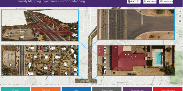
The P5 sets itself apart with a purpose-built design optimized for readily available, portable mini fixed-wing and transitional UAVs. Its compact size, lightweight construction, and efficient power consumption make it perfect for user-friendly integration. Flexible mounting options allow the P5 to adapt to various surveying needs, whether it is land surveying or corridor mapping.
But the true strength of the P5 lies in its data accuracy:
- Sub-centimeter precision: The P5 delivers sub-centimeter data accuracy, meeting the demands of surveying projects.
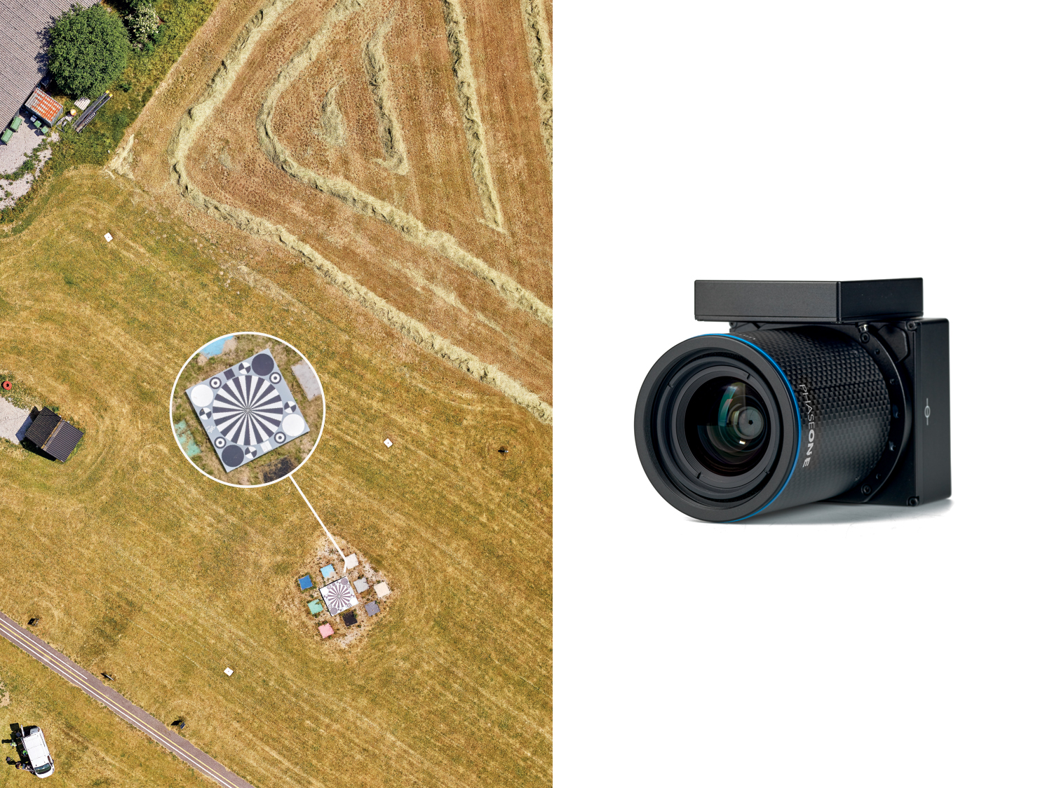
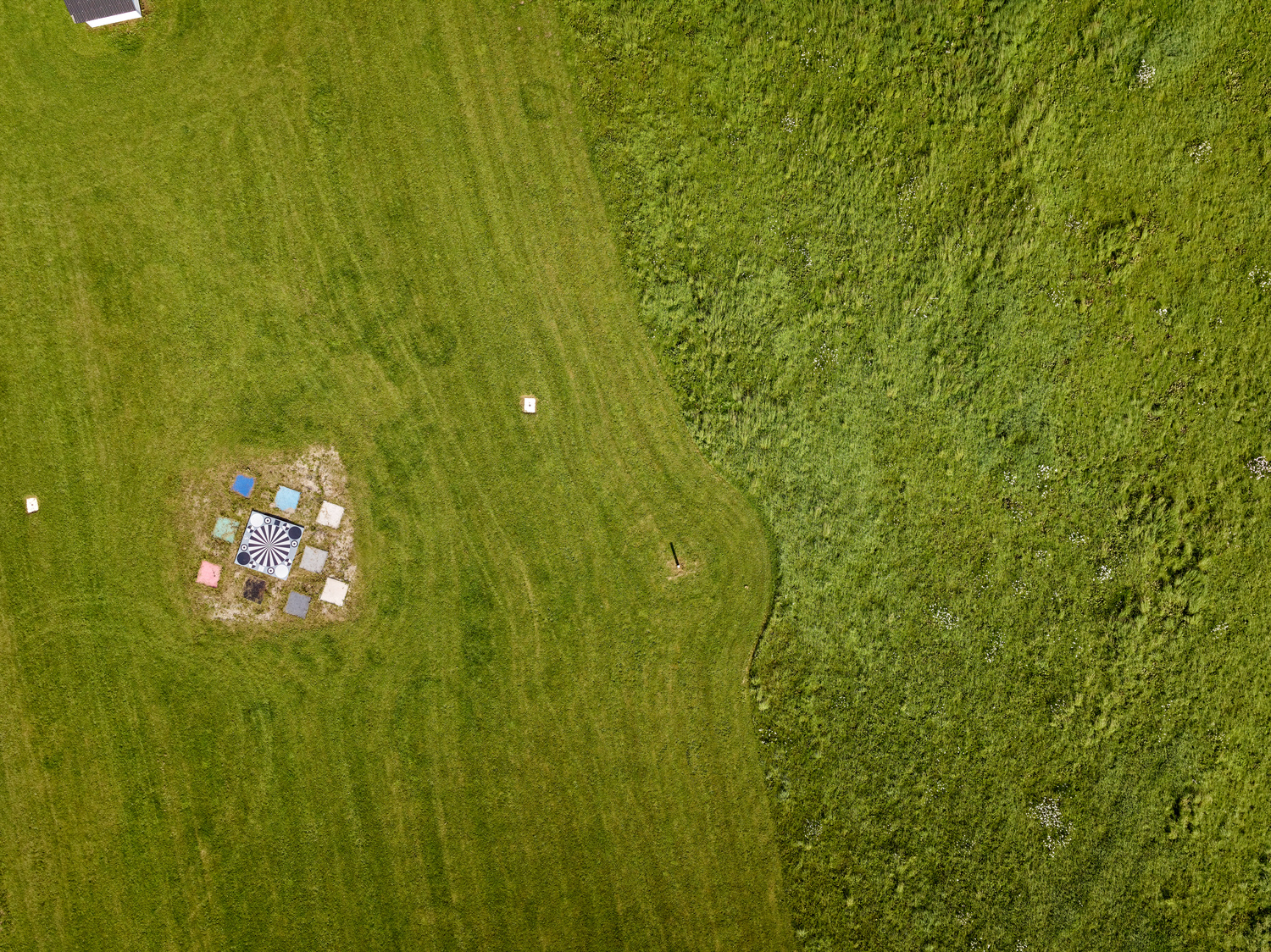
- Field-tested performance: To validate these claims, we conducted extensive real-world testing using an eVTOL fixed-wing mapping drone.
You can view the detailed results in our separate article about survey-grade accuracy
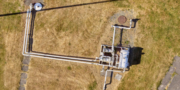
The secret to P5’s accuracy lies in its high-resolution 128MP image sensor. This sensor captures the lowest possible Ground Sampling Distance (GSD) on the market from a single payload, resulting in exceptional accuracy down to 0.5 cm and minimal geometric distortion (less than 1 pixel). This translates to point clouds with unmatched detail and precision, empowering surveyors to confidently rely on UAV-based data for their projects.
Choose the P5 for aerial engineering surveying
The P5 is the ideal choice for mapping and surveying tasks, as well as horizontal inspection. It is the optimal solution for large-scale construction, where high accuracy, great productivity and broad coverage are needed. Additionally, when it comes to infrastructure construction and maintenance, whether it’s for rail, road, oil and gas, the P5’s exceptional performance and swift operation, make it the go-to solution for ensuring the highest level of data quality and project efficiency.
What makes the P5 special?
The P5 UAV payload redefines drone-based surveying with unparalleled results, reliability, and robust data capturing. It sets a new benchmark for data precision, ensuring a seamless and efficient surveying process without compromises.
- Purpose-built for UAVs: Designed for portable and user-friendly small fixed and transitional UAVs.
- Flexible mounting options: Ideal for both land and corridor surveying.
- Seamless integration: Thanks to its fast data transfer and industry-standard MAVLink/Auterion communication protocols. This empowers UAV OEMs to seamlessly integrate P5, making it an industry-leading payload.
- Precise Timestamping: Eliminate errors in image geo-referencing with a 100% accurate and consistent timestamp thanks to mid-exposure triggering. This ensures perfect synchronization between image capture and drone location data.
- Metrically Calibrated Lenses: Choose from 35mm and 80mm metrically calibrated lenses (calibration certificate included) to achieve maximum coverage and unmatched accuracy in your surveys.
- Cutting-edge electronic global shutter: Enables shutter speeds exceeding 1/4000 for ultra-sharp images without motion blur.
- Efficient image compression: IIQ format for data management, storage, and upload efficiency.
- Industry standard metadata: Provides efficient post-processing workflows.
Choosing the right tool for your projecy
The P5 stands as a groundbreaking solution, addressing the challenges in aerial engineering surveying. Its advanced features and capabilities redefine industry standards, making it an indispensable tool for professionals seeking uncompromised accuracy, robust data capturing, and purpose-built efficiency. Choose P5 to elevate your surveying endeavors and transform the way you approach precision and productivity.
Share this on social media: