Monitoring pipeline corridor using PAS 280 large format camera
Over the past two decades, the application of photogrammetry has evolved significantly. In the past, governmental topographic and mapping agencies primarily focused on creating universal datasets designed to serve multiple industries simultaneously. Today, there is an increasing emphasis on acquiring data tailored to the needs of specific clients and smaller spatial areas. This approach allows for more precise aerial mapping, with spatial, spectral, and temporal resolutions often far exceeding what traditional mapping agencies typically provide.
A notable example of industry-specific mapping is the ongoing project monitoring of gas pipelines in Poland commissioned by OGP Gaz-System S.A This initiative ensures that every segment of the gas pipeline is captured in ultra-high resolution at two-year intervals. The data is collected with a ground sampling distance (GSD) of 5 cm in RGB and NIR channels, complemented by simultaneous LIDAR scanning. The observation corridor around the pipeline is defined as a minimum of 750 meters in width, with 375 meters extending on either side of the pipeline axis.
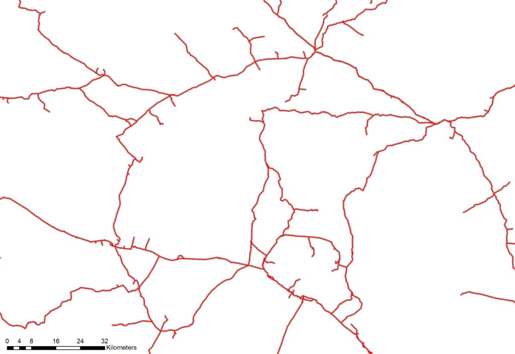
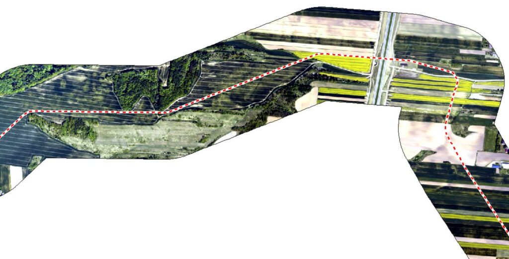
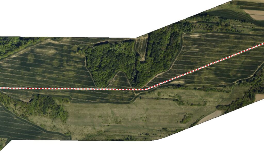
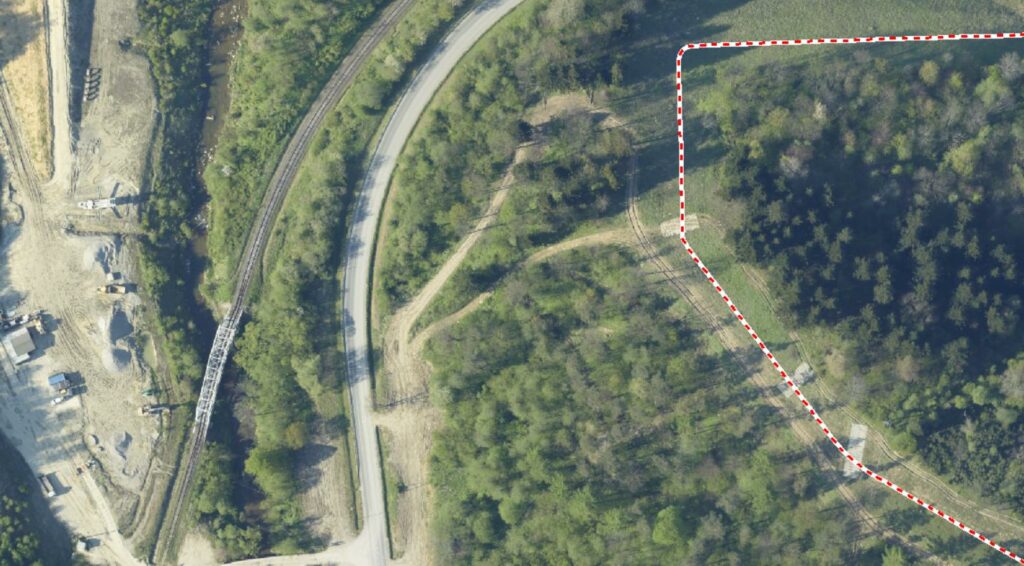
Fig. 1. Typical, very complicated shape of project area during corridor mapping.
During the project implementation, AlterGeo Holding tested the Phase One PAS 280 large-format camera mounted on the ALTER-EYE ultralight aircraft. This setup featured a satellite data link to streamline the data acquisition process and enhance pilot support from the office.
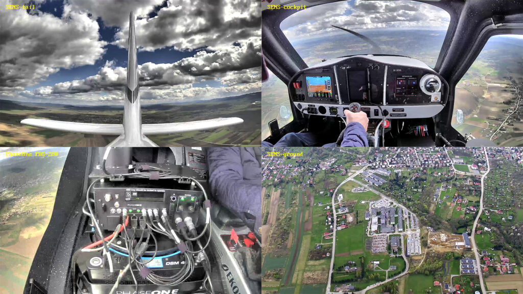
Fig. 2. Satellite data link enhanced control all aspects of test performance.
The PAS 280 large-format aerial solution was chosen for testing due to its seamless compatibility with the ALTER-EYE aircraft’s mounting slot and its ability to capture an observation strip width of 20,150 pixels at a GSD resolution of 5 cm. This setup enables a corridor width of 1,075 meters to be covered in a single flight. Accounting for the observation margin of error along the gas pipeline’s meanders, the camera ensures full corridor coverage in one pass. This approach almost tripled the observation productivity compared to previously used 100-megapixel cameras.
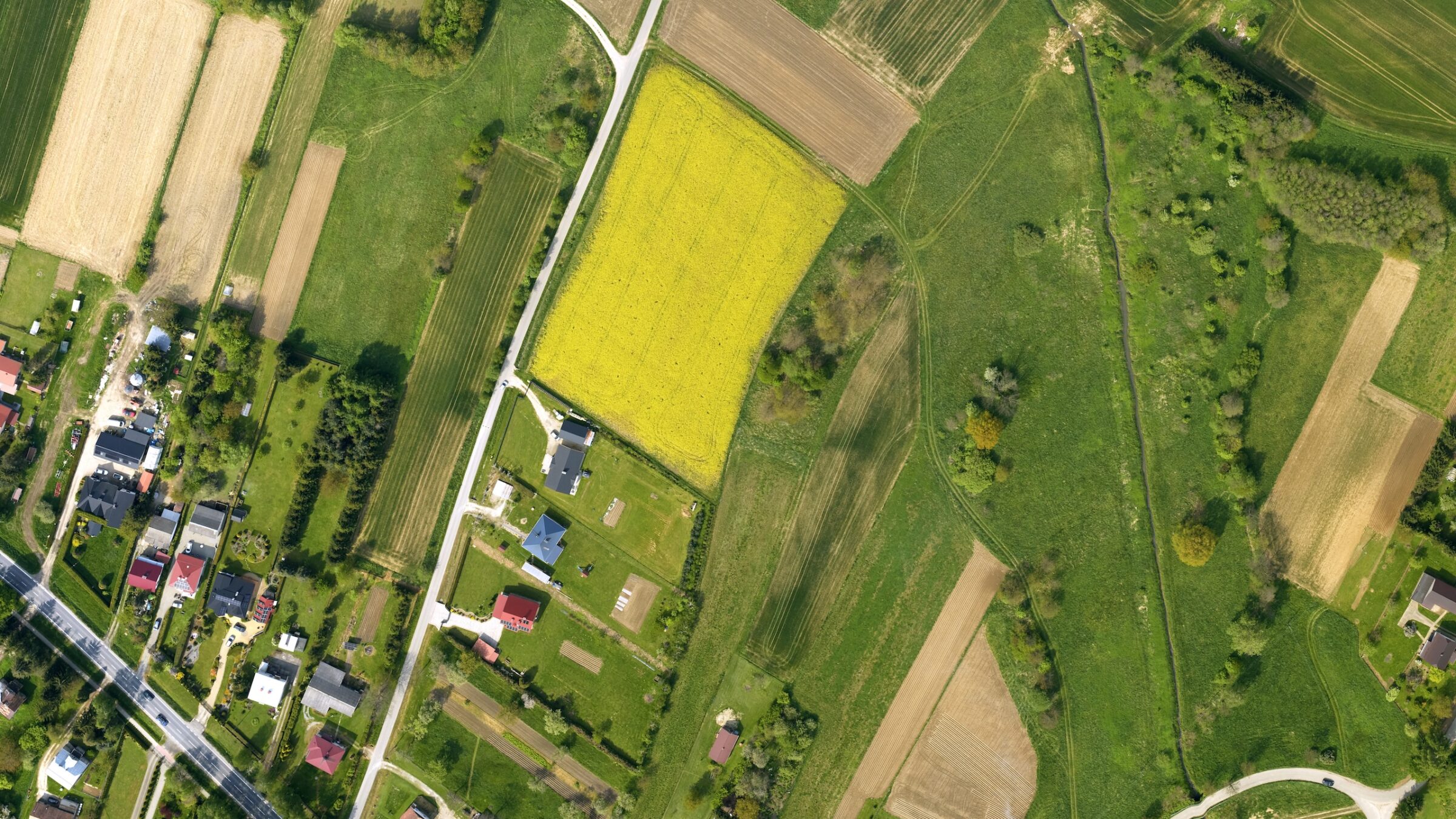
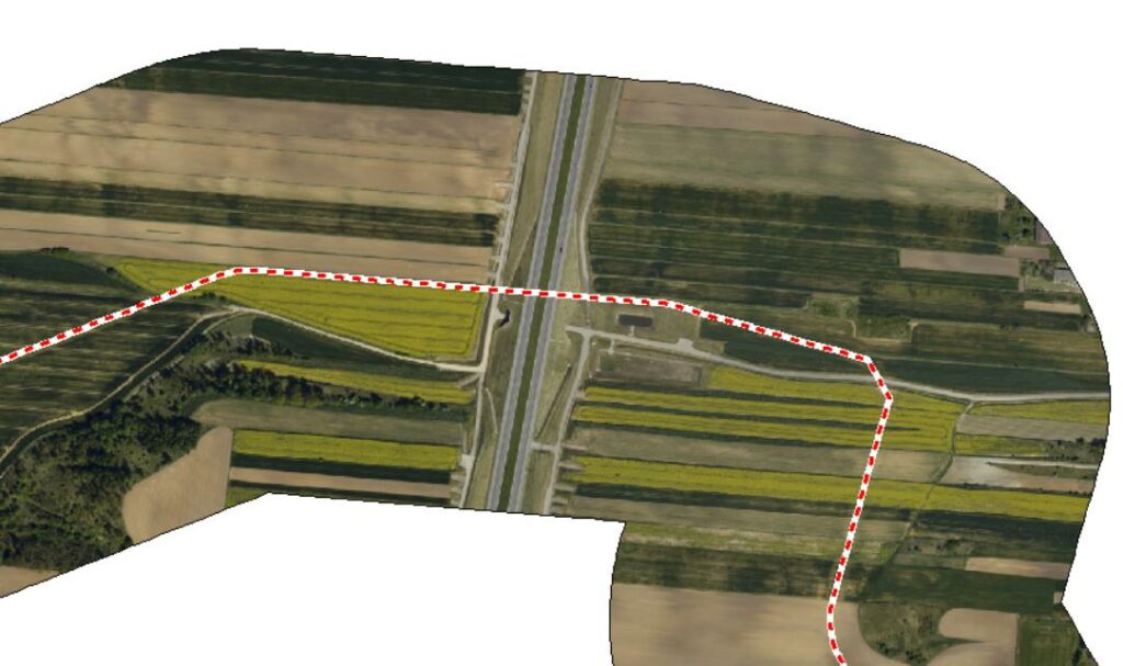
Fig. 3. Sample of final product requested and obtained from corridor mapping.
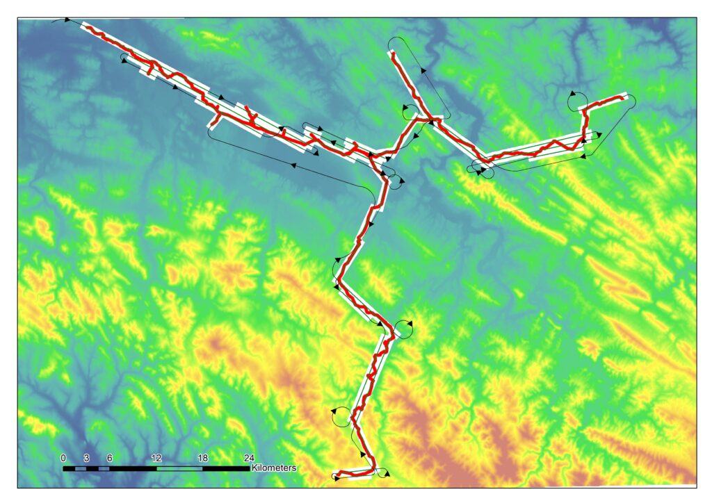
The primary goal of the tests was to determine the optimal approach for planning corridor flights over a highly intricate gas pipeline network. The network’s layout resembles a branched bush, often running through mountainous terrain with significant meandering and elevation changes. This required careful consideration of both the angular shifts in the pipeline’s course and the sudden variations in terrain height, which directly impact the width of the observation strip.
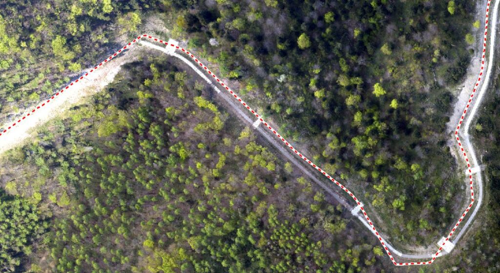
Fig. 4. Sophisticated flight plan created with iX Plan software.
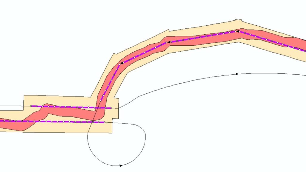
The second aspect of the test focused on evaluating the pilot’s ability to navigate changes in flight angles while maintaining uninterrupted corridor coverage during registration.
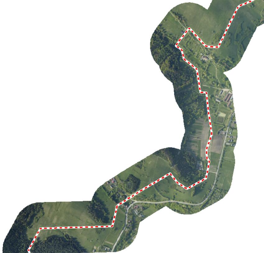
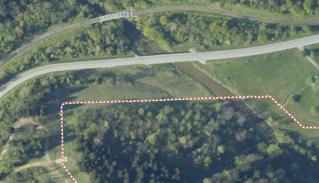
Fig. 5. The flight angle tests in the directly connected block of observation.
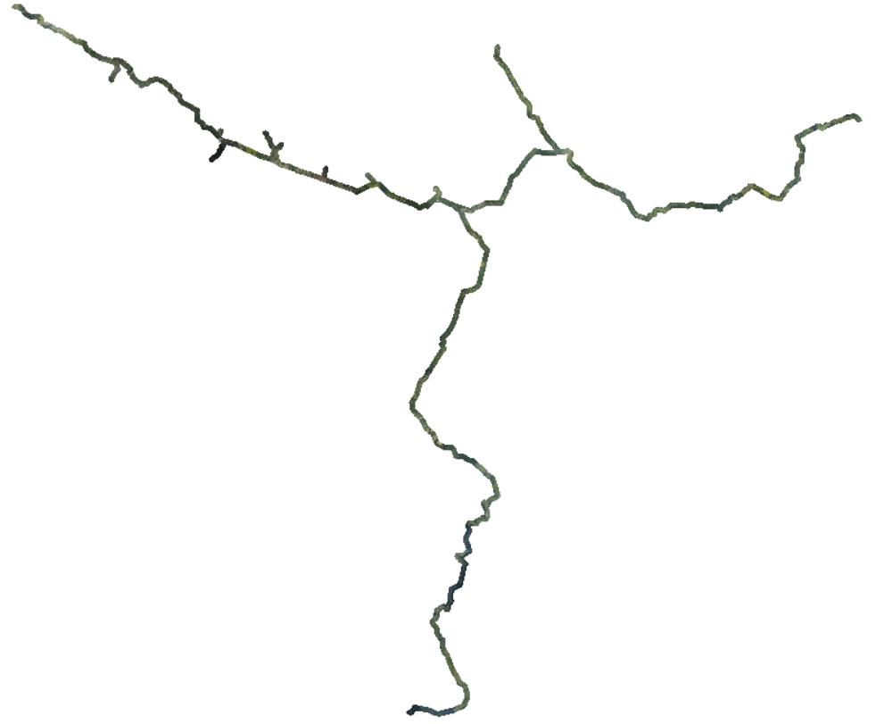
More than 2,000 kilometers of observations were conducted across various topographical conditions of the network. Satellite communication with the aircraft enabled real-time monitoring of the entire flight, with all flight parameters continuously recorded. The operations team closely observed the aircraft’s performance during each turn, allowing for immediate assessment of the planned flight’s effectiveness. On several occasions, the team modified the flight plan via the satellite link without requiring the aircraft to land. These adjustments were made seamlessly during capture pause as the aircraft transitioned to a new observation line.
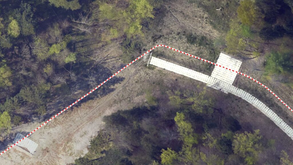
Fig. 6. Final product of observation.
The key findings from the experiment confirm that the PAS 280 camera mounted on the ALTER-EYE ultralight aircraft exceeded expectations.
The PAS 280 camera paired with the ALTER-EYE aircraft has transformed the way we approach corridor mapping. Its unmatched precision, efficiency, and reliability allow us to deliver results that exceed our clients' expectations.
Notably, the ALTER-EYE aircraft proved to be highly maneuverable, capable of flying at relatively low altitudes and slow speeds, making it an ideal platform for corridor flights. Additionally, the integration of the PAS 280 large-format camera with an ultralight aircraft represents a groundbreaking achievement, as it is currently the first and only known solution of its kind globally.
Fig. 7. Image Quality sample obtained with PAS280 in corridor mapping

Geospatial
Eight perspectives, one system

Geospatial
Finding tiny cracks with UAVs opens new opportunities

Geospatial
From capture to corridor intelligence: How Kavel 10 scaled 1 cm mapping with the Phase One + IGI CM-1

Geospatial
From sensors to solutions: How AISPECO orchestrates precision in reality surveying

Geospatial
Preventing Wild Bushfires By Mapping Planned Burns

Geospatial
Novice Aerial Photographer Becomes Advanced Mapping Provider

Geospatial
Inspecting Wind Turbine Blades While They Are Rotating

Geospatial
Precision at Altitude: Redefining Aerial Mapping with the PAS 880 Oblique Camera System

Geospatial
Perfecting telescope dish accuracy with UAV photogrammetry

Geospatial
Saving costs while lowering carbon footprint: Innovative aerial surveying service uses small airplanes enabled by compact cameras

Geospatial
Detecting forest tree diseases using a large-format camera on an ultralight aircraft

Geospatial
Mapping lava flows during volcanic eruptions in Iceland

Geospatial
The PAS Pana: a 48,800-pixel camera innovated with our customer Surdex

Geospatial
Rebuilding after Hawaii’s wildfire with engineering-grade surveying

Geospatial
Revolutionizing Slovenian urban planning: Phase One’s PAS 880i redefines reality mapping