The project
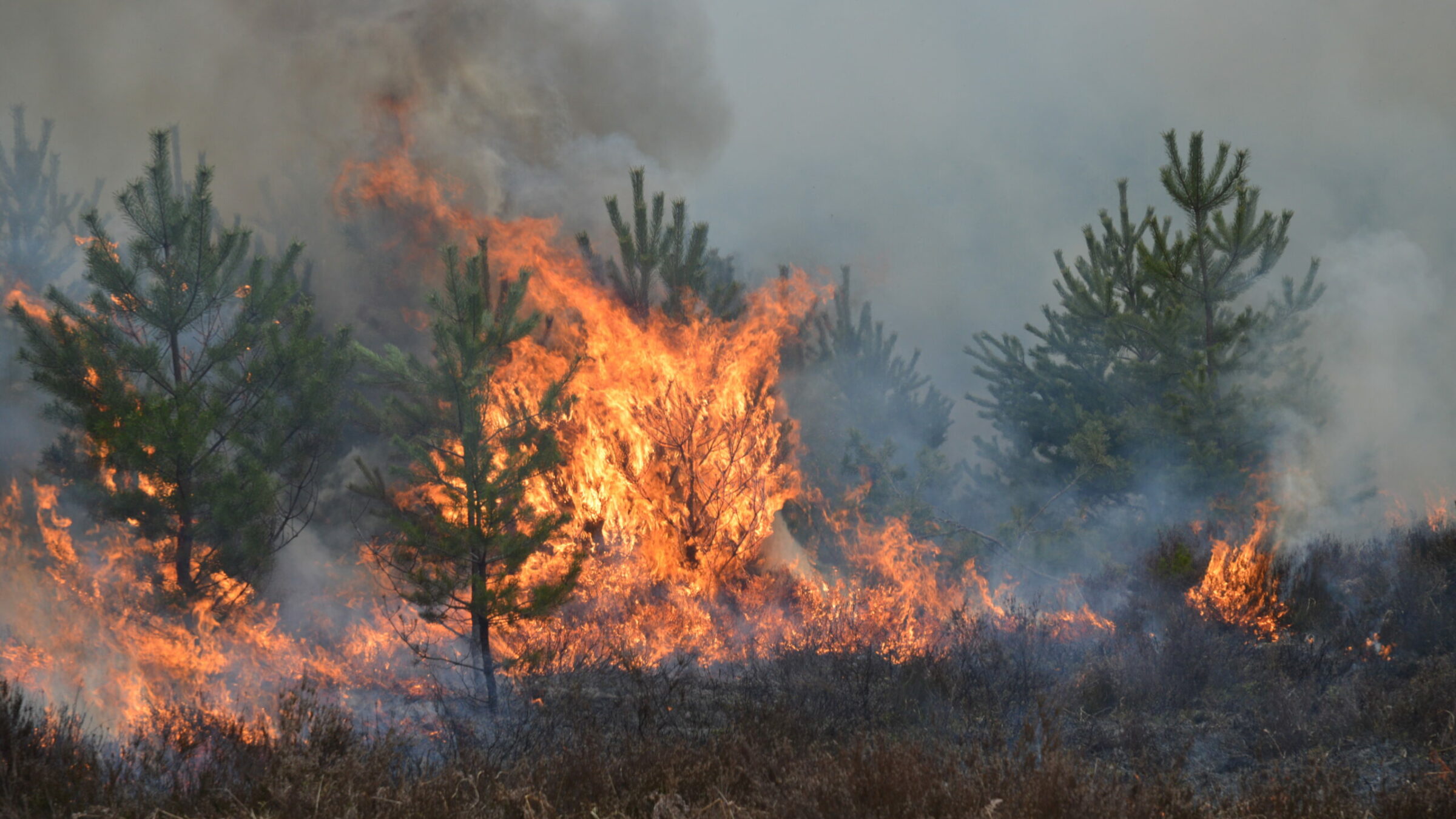
The number of wildfires increased dramatically in recent years due to diminishing forest health caused by the drastically changing climate across the world. Longer dry weather periods and infections by a variety of diseases, e.g., bark beetles affect the large forest areas in Northern Europe. These changes result in lower carbon accumulation, vast ecological changes in addition to financial losses.
In 2022 in Germany 2397 wildfires were registered with a size of more than 3058 Hectares of totally destroyed forests. Most of them in Brandenburg and Saxonia
Monitoring forest areas with aircraft or UAVs can help to detect potential issues in time. In addition, observation towers equipped with the latest camera and sensor technology – and combined with Artificial Intelligence (AI) to detect smoke columns as an indication of a wildfire – can be a perfect solution to assist in the fight against the destruction of vast amounts of wildlife habitats.
A research project – initiated by Landkreis Goerlitz in Saxonia and the BMDV (Ministry for Digital Matters and Mobility), Germany in cooperation with GGS – focused on monitoring an overall forest area of 170 sqkm in the Northeast of Germany.
The project delivery was based on a multitude of approaches: Due to the large area covered, a surveying aircraft and UAVs were used for monitoring by air, while on the ground observation towers with the latest sensor technology and ground sensor were used.
Camera setup for aerial survey
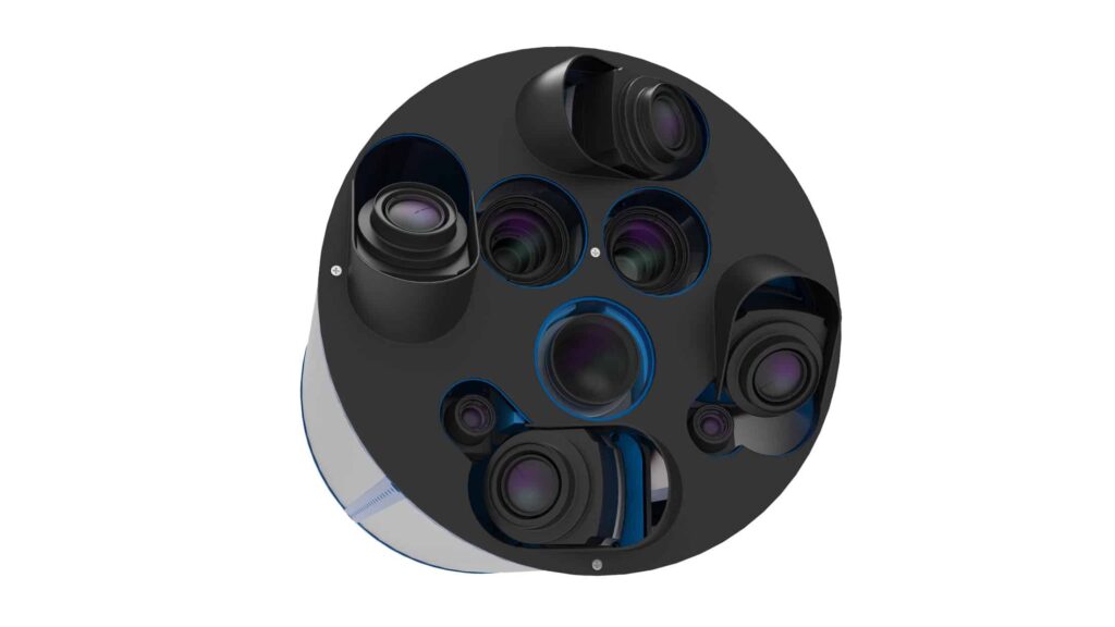
The camera setup for the aerial survey was based on GGS’s OIS-Technology with an addition of NIR and thermal cameras.
GGS chose a Phase One iXM-RS 150 with a 90 mm lens for Nadir imaging. Two additional Phase One Achromatic iXM-100 cameras with NIR filter (band 700-850 nm and 750-850 nm) and two 70 mm lenses were added.
For generating a 3D surface Model, four Phase One iXM-100 oblique cameras each equipped with an 80 mm lens were also integrated into the camera pod. Alongside the Nadir cameras, two further thermal cameras capture the entire footprint with lower resolution to indicate the influence of micro-climate changes on the forest health.
Figure 1: OIS camera pod
Data processing
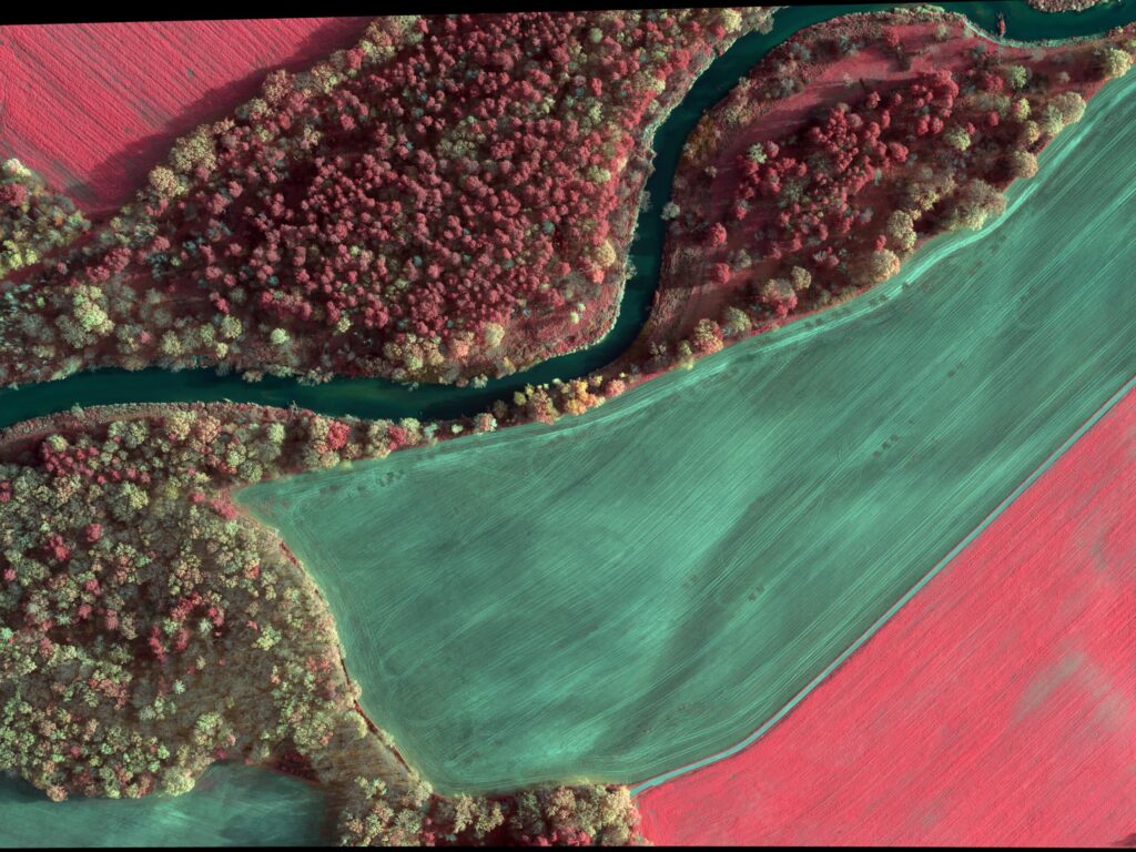
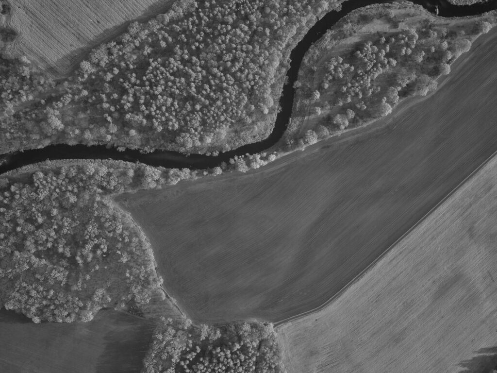
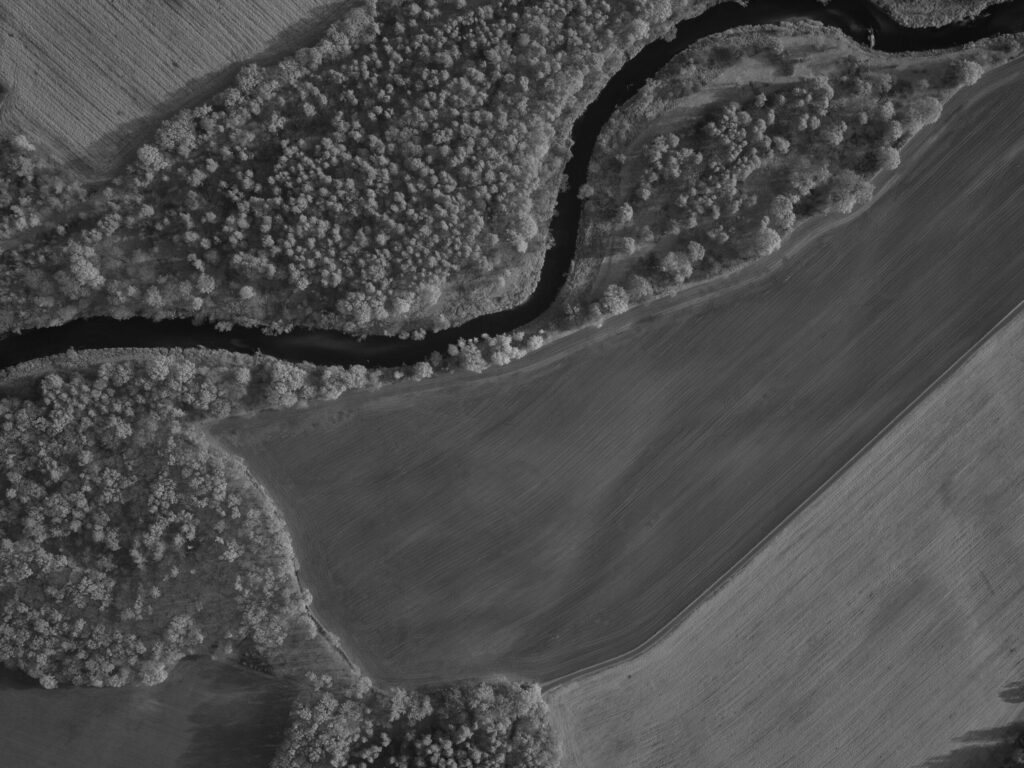
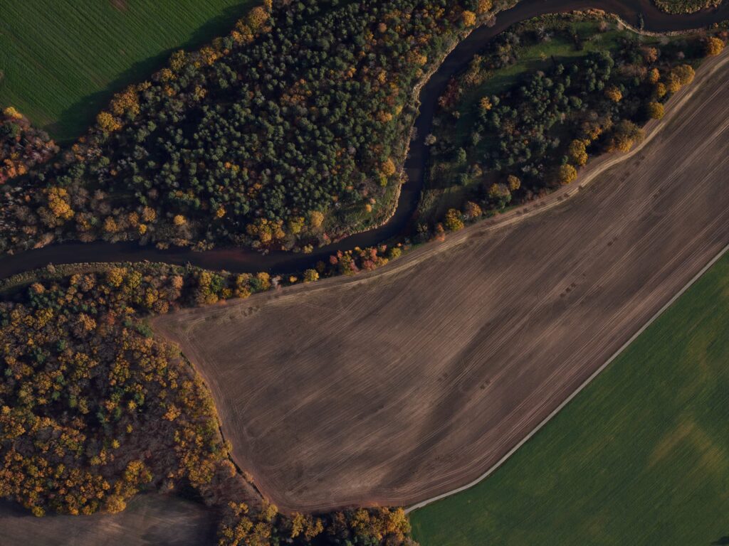
The gathered data – RGB, CIR and NDVI – was processed with Phase One’s iX Capture software first, before further processing with specialized photogrammetric software to generate true orthophotos.
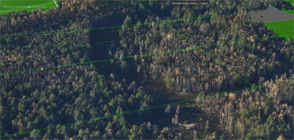
The red Edge data was generated after producing the orthophotos of both NIR bands and refined by Raster conversation between the 2 NIR orthophotos. The RGB data of the oblique system (Nadir and oblique) was processed with Skyline’s software package Photomesh to generate a 3D model.
Figure 2: CIR
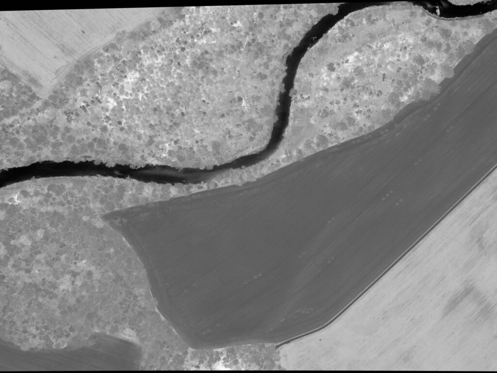
Figure 3: NDVI
Examples RGB/CIR/NDVI/NIR1/NIR2 of same area
Observation towers
There are already three observation towers available with the 170 sqkm, however only one of these is yet equipped with an older camera system. As a next step, an innovative camera array capturing RGB, NIR, AC and Thermal data – which are mounted on a gimbal – will be installed on two towers. The gimbal is scanning the area at 270 degrees while the cameras are taking images with a 60% sidelap.
This data will be streamed via 5G to a server (central crisis management server) and analyzed using AI algorithms to detect wildfires. In combination with the observations from the other towers, the location can be easily calculated and verified. If a wildfire is detected, an alarm will be generated, and a UAV deployed for further assessment.
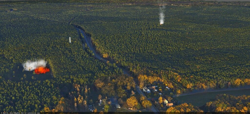
Figure 4: 3D model of the forest area during data processing using the Skyline software
UAV Inspection
Smaller areas can be monitored with UAVs equipped with RGB, NIR and Red Edge cameras. To ensure a long flight time, these drones only carry small format compact cameras. After an alarm was raised, initially a single UAV will be deployed, whereas in certain situations, a UAV swarm may be sent out to observe the larger for additional fire nests. The data gathered – in combination with visual inspection of wind speed and direction – is crucial to determine the speed and direction of fires. Streamed via the 5G network, the combination of all data gathered informs the strategy and deployment of the emergency services, while mitigating the risk to firefighters, settlements and infrastructure.
Figure 5: Fire Simulations to train AI-modules
Contact a Phase One Expert
If you would like to learn more about our solutions, our experts are eager to help! Contact us.
Geospatial
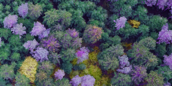
Detecting forest tree diseases using a large-format camera on an ultralight aircraft
Geospatial
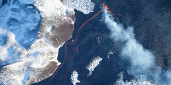
Mapping lava flows during volcanic eruptions in Iceland
Geospatial
The PAS Pana: a 48,800-pixel camera innovated with our customer Surdex
Geospatial
Rebuilding after Hawaii’s wildfire with engineering-grade surveying
Geospatial
Revolutionizing Slovenian urban planning: Phase One’s PAS 880i redefines reality mapping
Geospatial
Imaging solutions combined with AI and 5G – A new approach and promising to assess forest health and detect and monitor wildfires
Geospatial
Phase One Cameras combined with light, fixed-wing aircraft deliver highly efficient LiDAR and mapping missions
Geospatial
Capturing Glastonbury Festival
Geospatial
Breaking barriers to offshore wind energy development
Geospatial
Using aerial oblique images combined with close range UAV (uncrewed aerial vehicles) based data
Geospatial
A change in the future of high-risk, critical asset inspections: fast, effective and safe aerial powerline inspection in a fraction of time and with real cost savings
Geospatial
Using drone technology for Flare Stack Inspection: Getting the smallest details from a safe distance
Geospatial
The Experiences of EyeFly with Phase One iXM
Geospatial
Dam Fine Data: Sub-millimeter-resolution UAV Dam Surveys by Orthodrone
Geospatial
Trimble Inpho – High class photogrammetry with aerial imagery from PAS 280
