Listen to the Full Article:
The Challenge
The University of Tasmania conducts research in Positioning, Navigation and Timing (PNT) where scientists analyze observations made with radio telescopes. These use signals from far distant galaxies to measure parameters including the shape of the Earth, its rotation, plate tectonics, and Earth time.
Such measurements are used for GPS data and many Earth-bound applications such as banking, communication or navigation.
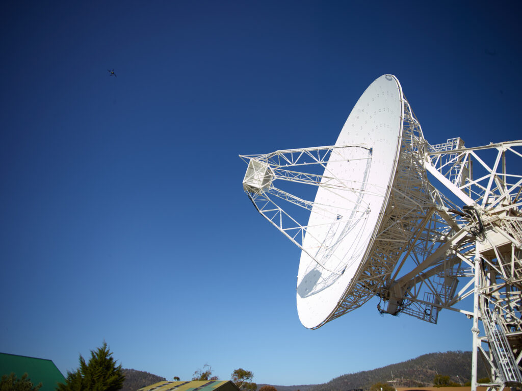
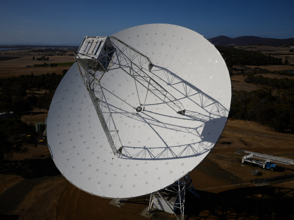
Precise timing information requires measurements to high levels of accuracy. For this, scientists in Hobart sought to calibrate the 26-metre radio telescope dish at their Mount Pleasant Radio Telescope Observatory. They needed to determine its deformation due to gravity and any other influences, so these can be factored into their measurements.
The Hobart radio telescope is part of the International Service for Geodesy and Astrometry (IVS – https://vlbi.org/). Radio telescopes around the world are coordinated to observe together and measure the worlds most precise coordinate frame, as well as the Earths position and orientation in space. This in change is essential for precise satellite navigation and timing information used for secure communication or banking.
Super-high accuracy demands
The university initiated a photogrammetry project to create a deformation model for their radio telescope. This would enable them to add additional delays to the measurements at each telescope position, compensating for the dish’s own effects on the data.
Such measurements require a precision of better than 0.1 mm, which is beyond the accuracy provided by traditional surveying techniques.
A moving structure with difficult access
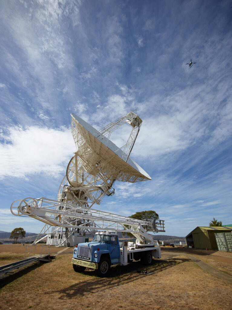
The dish’s deflections vary depending on where the telescope is pointed, as gravity distorts the dish differently depending on its orientation. Creating a deformation model therefore required measurements at many of the dish’s possible positions.
However, at 26 meters in diameter, the radio telescope dish is a large structure whose surface is not always visible from the ground as it moves through its various possible positions. With a cherry picker no longer being sufficient to provide measurement photos from very high positions, the university sought help from surveyors with experience of UAVs.
As Lucia McCallum, Geodesist at the School of Natural Sciences, University of Tasmania says, “Three photogrammetry experts were flown in from Germany. Ansgar Greiwe from the Bochum University of Applied Sciences said that Phase One cameras are simply the gold standard for this type of work.” Michael Lösler and Cornelia Eschelbach from Frankfurt University of Applied Sciences were also involved in analyzing Ansgar’s data on site and determining the amounts of deformation.
Phase One P3 integrated with a UAV
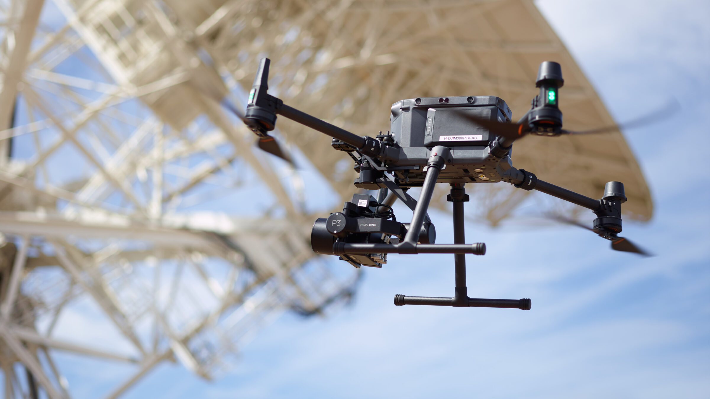
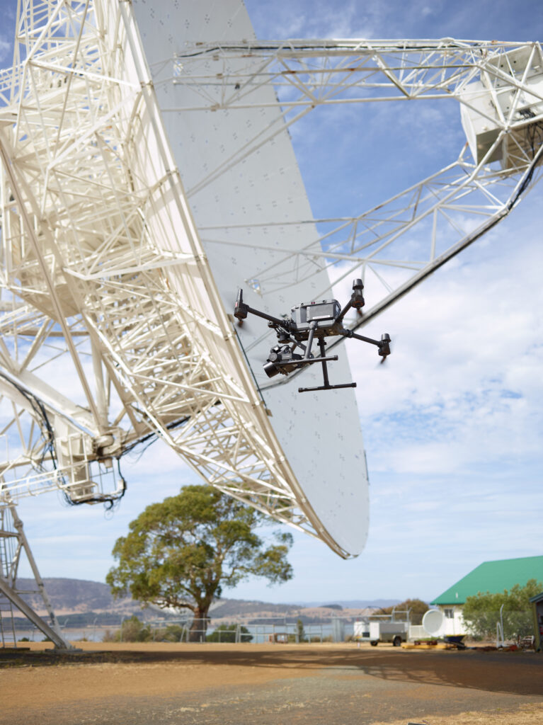
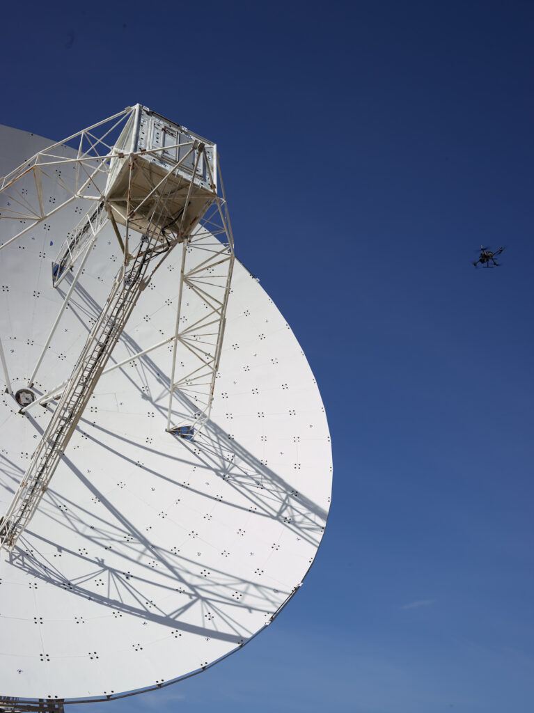
The team of scientists used a Phase One P3 mounted on a DJI M350 UAV to survey the surface of the radio telescope antenna. The design of the P3 is optimized for photogrammetry, which requires high-quality optics and stable integration of the objectives as well as omission of movable stabilizers.
The team tested image sharpness in the lab prior to the flights and confirmed it during the measurements. They found that all images were free from distortions, even towards the edges.
Finding a new methodology
To measure the surface, 1000 target points were stuck onto the dish to reference the photographs.
After about 10 test flights, the team determined an optimal configuration of flight duration and number of pictures. Over the next days, they made 200 flights with more than 300 pictures per flight.
Two lenses were selected for the project. The 35 mm lens enabled a large image section so that all points on the telescope were depicted in each of the measurement photos.
The 80 mm lens was also tested in some flights with the same imaging distance. However, the image section was too small, so the 35 mm version was used for the project.
Infallible data capturing even into the sun
The accuracy achieved with the P3 camera lived up to the scientists’ expectations, ensuring efficient and precise surveying.
Depth of field and image quality were excellent and the image quality was superior compared to other ‘standard’ cameras from the drone manufacturer.
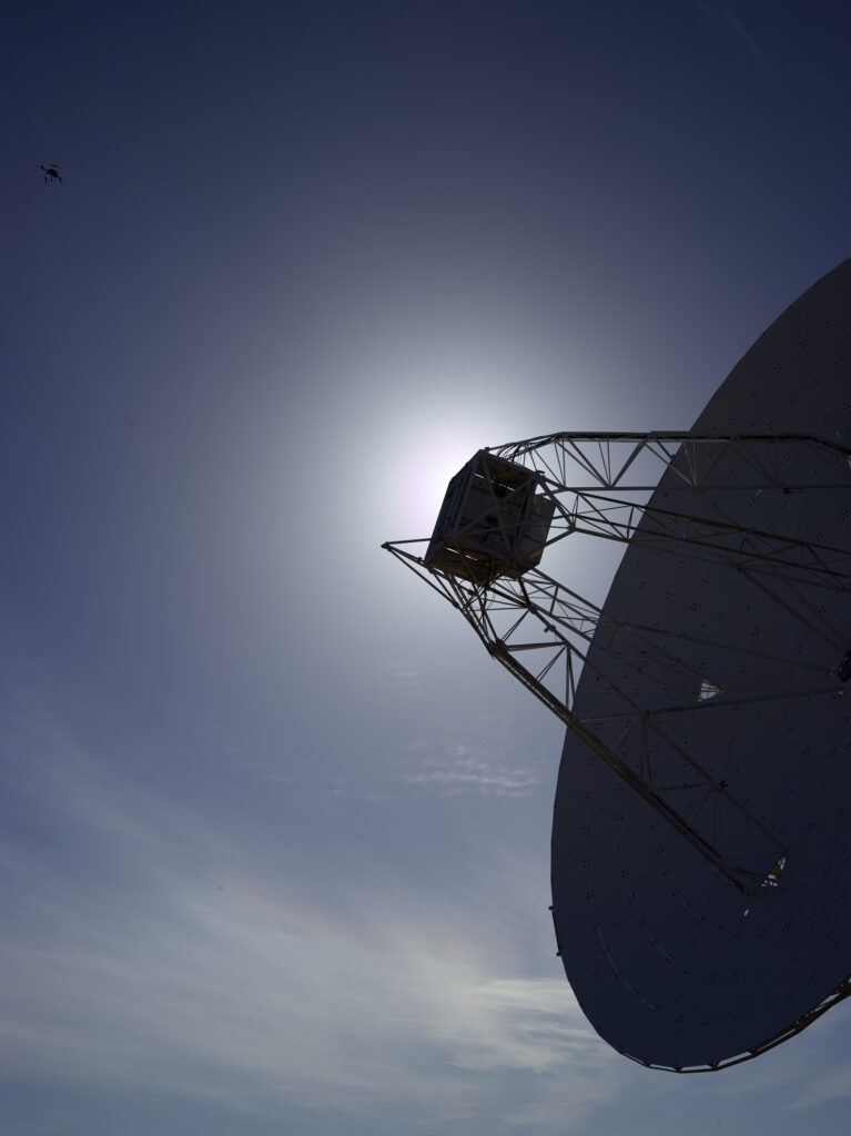
Its high dynamic range ensured excellent image quality, particularly when looking towards the sun. This is because all camera settings could be accessed and varied at all times due to the excellent integration with the UAV. Especially in changing light conditions, the white, very brightly reflecting object surface could always be photographed in very good quality without needing to land the UAV to adjust the recording parameters.
“The camera was infallible,” says Lucia. “All pictures were stored correctly, with no loss of data or other issues.”
“Moreover, the efficient storage system allowed high picture cadence,” she continues. “In one flight, which lasted for approximately six minutes, we were able to take all the 300 images required for later analysis.”
Saving time enabled a larger survey
With the radio telescope in constant demand, the amount of time that the team could use on it was limited – especially since they needed to photograph it in many different positions that did not necessarily align with those needed for observations.
Thanks to the P3’s large sensor and high picture cadence, the team saved a lot of time.
Compared to other available products with smaller sensor areas, it took about half of the time. It was only thanks to this that we could conduct such a large-scale survey. Phase One was super easy to work with. When a great industry partner enables top-end research, I love my job in academia.
Images: Dr. Ansgar Greiwe
Geospatial
Preventing Wild Bushfires By Mapping Planned Burns
Geospatial
Novice Aerial Photographer Becomes Advanced Mapping Provider
Geospatial
Inspecting Wind Turbine Blades While They Are Rotating
Geospatial
Precision at Altitude: Redefining Aerial Mapping with the PAS 880 Oblique Camera System

Geospatial
Saving costs while lowering carbon footprint: Innovative aerial surveying service uses small airplanes enabled by compact cameras
Geospatial
Detecting forest tree diseases using a large-format camera on an ultralight aircraft
Geospatial
Mapping lava flows during volcanic eruptions in Iceland
Geospatial
The PAS Pana: a 48,800-pixel camera innovated with our customer Surdex
Geospatial
Rebuilding after Hawaii’s wildfire with engineering-grade surveying
Geospatial
Revolutionizing Slovenian urban planning: Phase One’s PAS 880i redefines reality mapping
Geospatial
Imaging solutions combined with AI and 5G – A new approach and promising to assess forest health and detect and monitor wildfires
Geospatial
Phase One Cameras combined with light, fixed-wing aircraft deliver highly efficient LiDAR and mapping missions
Geospatial
Capturing Glastonbury Festival
Geospatial
Breaking barriers to offshore wind energy development
Geospatial
Using aerial oblique images combined with close range UAV (uncrewed aerial vehicles) based data
