Phase One cameras combined with light, fixed-wing aircraft deliver highly efficient LiDAR and mapping missions
X-Eye is a swiss company specialized in designing, integrating and delivering turn-key aerial mapping solutions (consisting of multiple Phase One cameras and combined Phase One cameras and LIDAR configurations) into EASA-certified, lightweight, low-emission, fixed-wing airplane. Unlike drones, the plane has no flight restrictions. It completes tasks quickly and with fewer missions.
Aerial surveying and remote sensing solution
X-Eye is an aerial surveying and remote sensing solution for various industries and applications. It uses advanced imaging and laser scanning technologies to collect high-resolution data. Their goal is to improve efficiency and reduce costs for traditional mapping projects. They’ve designed their solution to be more efficient, reduce emissions, lower costs, and provide valuable insights to their customers.
Key to their goal is an aircraft light enough to be efficient and yet still accommodate advanced sensor technology to capture the high-quality aerial imagery mapping demands.
High-quality data capture
For efficiency, they’re using a Pipistrel Explorer Short Wing 121. The Explorer has very low fuel consumption and emissions compared to other single-engine planes, and runs on unleaded automobile fuel. Its EASA-certification makes it suitable for use in European countries. This also provides a foundation for future approval from other civil aviation authorities.
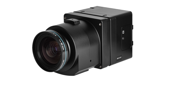
For the high-quality data capture, they have equipped the Explorer with Phase One cameras. As well as collecting quality data, the modular and compact cameras easily fit into the plane which, like many light aircraft, has limited weight and space capacity.
No matter the type of application, the Phase One cameras reliably deliver the data quality.


The efficient solution for surveying, mapping and inspection applications
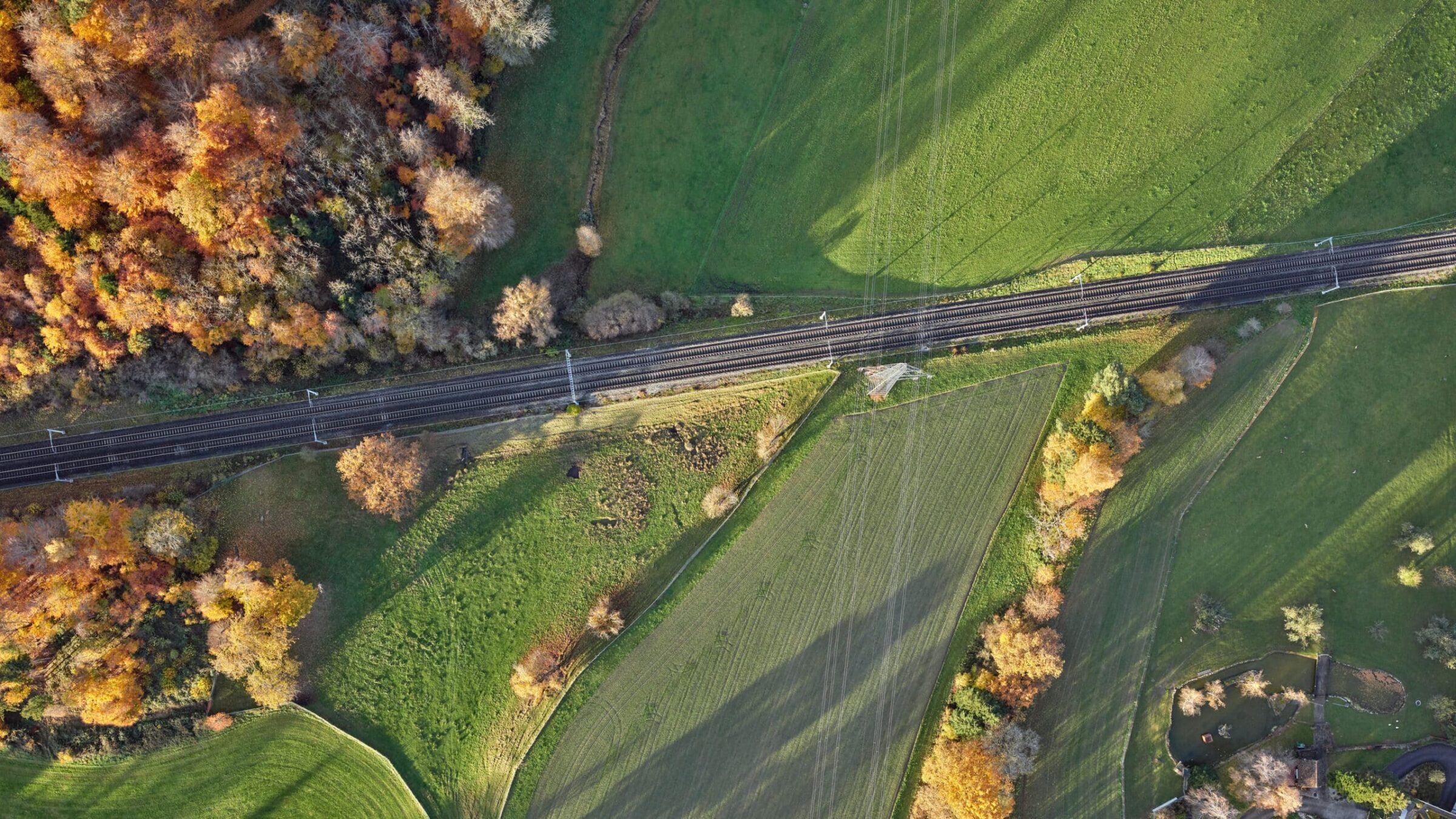
The combination of the fuel-efficient plane and Phase One technology is ideal for customers looking to conduct medium-sized LiDAR and mapping projects such as orthophotography, city mapping, and corridor mapping.
It benefits customers who have previously used drones. The plane is not restricted like drones are, which can only fly within sight range and have low endurance. X-Eye’s altitude range between 300m over ground (limited due to legislations) and 3000m above the sea.
As a result, many smaller drone missions can be combined into a few or even into one only flight. Projects that might take days and weeks with a drone can be accomplished in a few hours with the X-Eye Phase One combination.
Improve your mapping and inspection mission productivity
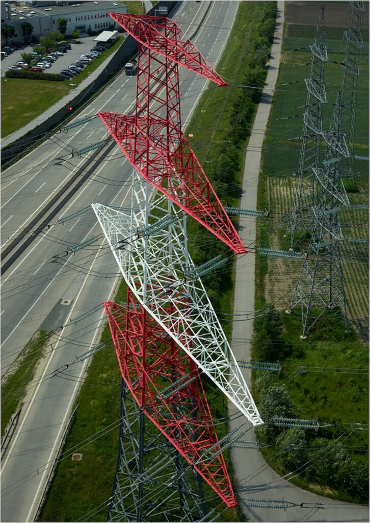
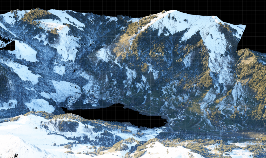
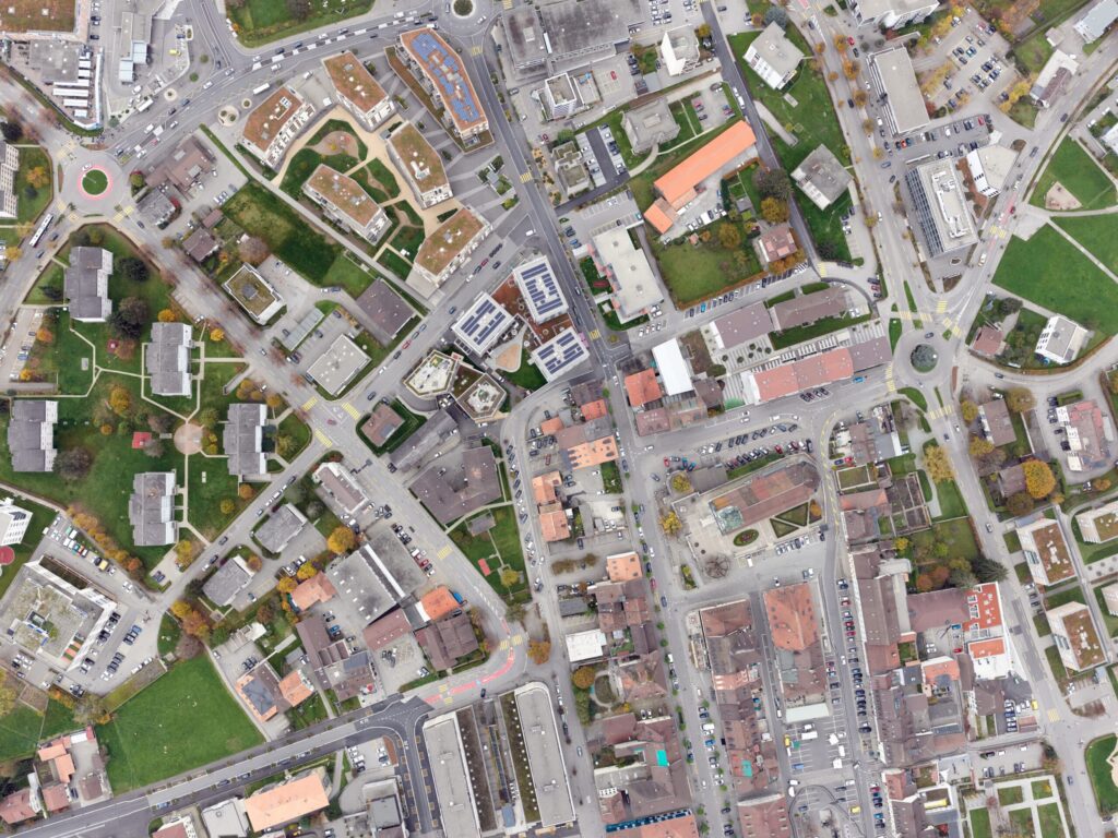
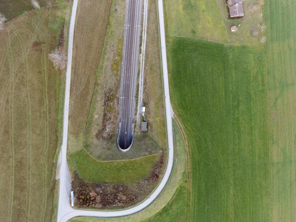
The outstanding productivity allows to cover 800 km in one flight for linear infrastructure projects, eg. railway or powerline, up to 150km2 for smart city mapping, and between 400 to 600km2 for mountains or complex terrain or forestry applications.
The low fuel costs compared to larger aircraft or helicopters (or even drone work over several weeks) leads to an extremely attractive price/performance ratio.
Summarizing, X-Eye’s pod solution is perfect for all fixed-wing surveying and mapping and inspection applications, whether it’s for linear infrastructure inspections from railway tracks to powerline inspection, to smart city and terrain mapping to forestry and agriculture applications.
About X-Eye
X-Eye is a Swiss company that provides an aerial mapping solution for a multitude of applications. The X-Eye platform is a low-emission, EASA certified light fixed-wing aircraft by the manufacturer Pipistrel. X-Eye features a belly pod with a stabilized rig for various versions of sensors, a GNSS antenna mount for accurate positioning, power supply and cockpit equipment to perform simple and seamless mapping missions.
About Phase One
Phase One – a pioneer of digital imaging sensors and airborne systems for the Geo market and the largest provider of aerial cameras based on a long tradition for outstanding image quality and reliable sensors. Founded in 1994, Phase One is a pioneer of digital photography. Phase One has developed core imaging technologies and a range of digital cameras and imaging modules, providing the world’s highest image quality in terms of resolution, dynamic range, color fidelity and geometric accuracy. As such, Phase One has grown to become the leading provider of high-end imaging technology across many demanding business segments, such as space imaging, aerial mapping, industrial inspection, and heritage digitization, as well as serving the world’s most demanding professional photographers.

Geospatial
Eight perspectives, one system

Geospatial
Finding tiny cracks with UAVs opens new opportunities

Geospatial
From capture to corridor intelligence: How Kavel 10 scaled 1 cm mapping with the Phase One + IGI CM-1

Geospatial
From sensors to solutions: How AISPECO orchestrates precision in reality surveying

Geospatial
Monitoring pipeline corridor using PAS 280 large format camera

Geospatial
Preventing Wild Bushfires By Mapping Planned Burns

Geospatial
Novice Aerial Photographer Becomes Advanced Mapping Provider

Geospatial
Inspecting Wind Turbine Blades While They Are Rotating

Geospatial
Precision at Altitude: Redefining Aerial Mapping with the PAS 880 Oblique Camera System

Geospatial
Perfecting telescope dish accuracy with UAV photogrammetry

Geospatial
Saving costs while lowering carbon footprint: Innovative aerial surveying service uses small airplanes enabled by compact cameras

Geospatial
Detecting forest tree diseases using a large-format camera on an ultralight aircraft

Geospatial
Mapping lava flows during volcanic eruptions in Iceland

Geospatial
The PAS Pana: a 48,800-pixel camera innovated with our customer Surdex

Geospatial
Rebuilding after Hawaii’s wildfire with engineering-grade surveying