Green Rebel, Aerial
Breaking barriers to offshore wind energy development
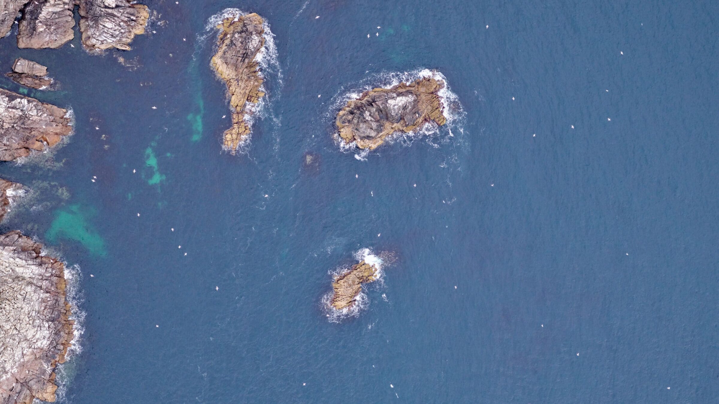
A key element of offshore wind development is the mitigation of environmental impacts. Accurate data regarding the distribution of marine megafauna at a proposed site is critical to safe and sustainable project siting – protecting marine wildlife as well as preventing negative impacts on important feeding or breeding habitats. Moreover, this intelligence can serve as a baseline from which changes can be monitored post-construction to assess any future potential impacts of site development on the distribution of marine wildlife.
Initial proposals for offshore wind in European waters in the late 1990s adapted long-used boat-based survey methodologies, such as European Seabirds At Sea (ESAS), to meet legislative requirements. This approach became an industry standard in the 1990s and early 2000s; however, those methods are rarely used as a result of various shortcomings, including:
- The presence of a vessel influences behavior in many species through attraction or repulsion;
- Boat-based surveys have a high probability of over-estimating abundance as species move around the survey area;
- The method is subject to unquantifiable human error and presents little opportunity for quality assurance;
- Repeating the same transect lines precisely is essential for meaningful inference to be made from post-construction monitoring. However, boat-based surveys may not be able to survey the same lines post-construction due to turbine placement.
“The Phase One iXM RS150F camera provides crisp, clear, high-resolution imagery free of blur, allowing us to identify even small birds on the sea surface from around 1800 ft. altitude at speeds of 110 knots,”
Said Sarah Kandrot, PhD, Head of the Aerial Division at Green Rebel. “The ability to distinguish certain characteristic features is essential to accurate species classification.
“To date we have successfully performed more than one hundred and fifty digital aerial marine ecology surveys in UK and Irish waters. We get consistently high species ID rates due to the high-quality of our imagery. Green Rebel are proud to support the transition to cleaner, greener, more sustainable energy while protecting marine wildlife. Thanks to Phase One aerial technologies, we have the equipment and the support we need to achieve this.”
SOLUTIONS THROUGH AERIAL DIGITAL IMAGING
With advances in technology, digital aerial imaging surveys now provide a compelling alternative to boat-based methods. Larger areas can be surveyed in less time and a permanent record of the survey observations can be preserved – providing an auditable record for the regulator. This aerial approach has been widely adopted as the industry standard, with surveys currently taking place across the globe. In fact, for some regulators, digital aerial methods are now a requirement e.g., the German regulator’s (BSH) StUK4 standards.
Based in Cork, Ireland, Green Rebel is a data company providing offshore site investigation services to the offshore wind sector. Green Rebel’s Aerial division provide developers with critical information about marine wildlife in and around planned development sites to support planning and consenting. The company’s Aerial division conduct digital aerial marine ecology surveys, studying the distribution patterns of birds and mammals at offshore development sites. They employ cutting edge technologies, such as AI, and specialist tools and teams to process and analyze the data. The information gleaned from the survey campaigns ultimately helps to protect the marine environment and biodiversity.
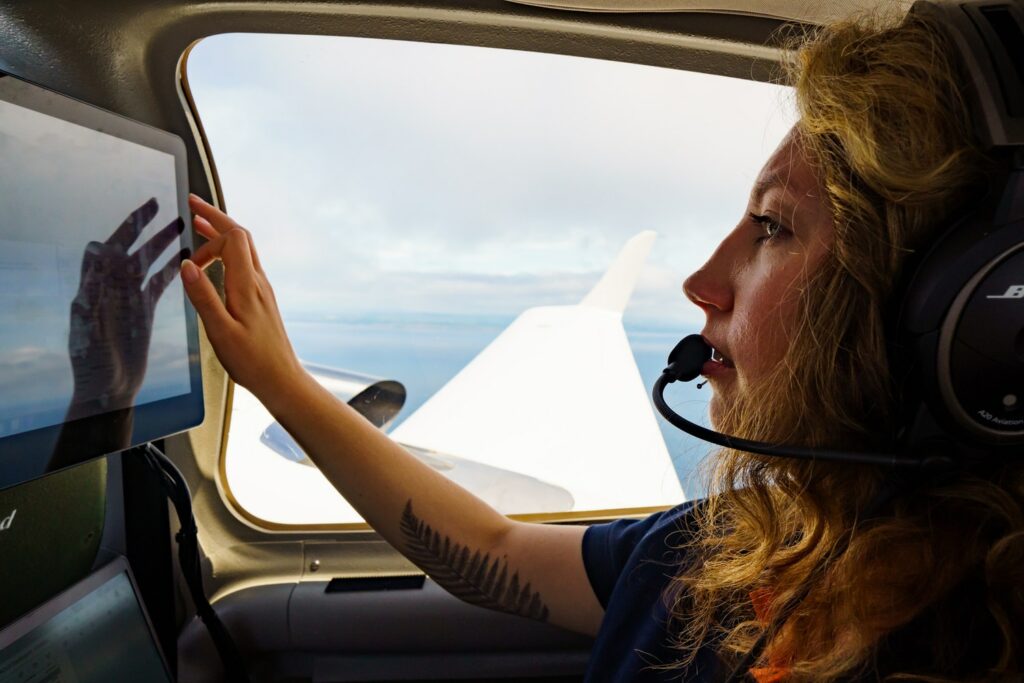
Surveys for Offshore Renewable Energy (ORE) projects are generally completed monthly over at least 24 months. For companies such as Green Rebel, who are working with multiple projects (i.e., carrying out multiple surveys per month), planning can be a logistical challenge, as surveys can only take place in suitable weather conditions. Suitable weather conditions are necessary to deliver data that are of sufficient quality for analysis (typically, sea state <WMO 4 and cloud base >2000ft). For example, if the sea state is too high, white caps can be seen in the imagery, making it difficult to identify and classify wildlife in the imagery. Aerial surveyors need to be able to assess changes in weather conditions to plan their activity, which can be especially difficult during the winter months when the weather is more unpredictable.
CHOOSING THE BEST AERIAL DIGITAL IMAGING SOLUTION
To meet the complex and specific requirements necessary for offshore wind development planning and consenting, it was necessary to engineer a bespoke sensor setup, as well as an appropriate server and processing solution to act as a strong backbone for rapid and reliable data processing.
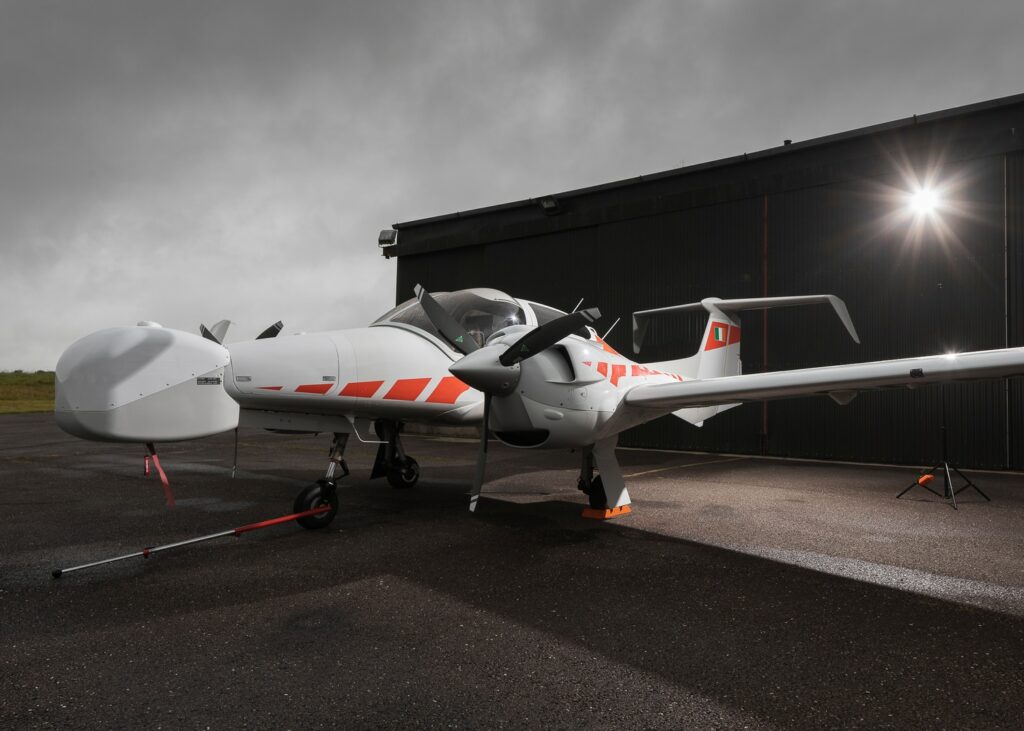
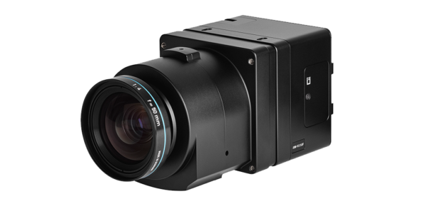
Green Rebel chose GALG | Global Assistant & Logistic Group to support engineering and technical solution developments, which was built around Phase One aerial digital imaging technology. The data acquisition system is comprised of two Phase One iXM RS150-F cameras, along with Phase One’s latest-generation iX controller MK5. All mission equipment was integrated into Green Rebel’s special mission, twin engine aircraft, a Diamond Air DA42 MPP, by aviation engineers at Diamond Aircraft Industries in Austria.
The two cameras increase the overall footprint area, allowing Green Rebel to map a wider corridor with double the coverage per flightline.
A high-precision GNSS- and Inertial Measurement Unit (IMU) is integrated inside the controller. This allows for direct georeferencing of the imagery without the need for ground control points (GCPs).
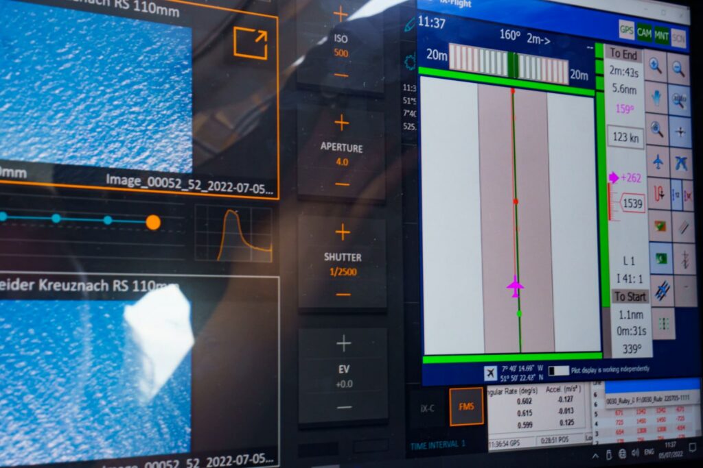
The Phase One iXM-RS 150F full frame cameras are housed in a bespoke pod that sits within a gyroscopically stabilized mount. The cameras deliver high resolution images (2cm GSD when flying at an altitude of 1800 ft), which are essential for accurate species identification. Each camera features an ultra-high resolution (14204 x 10652) backside-illuminated CMOS sensor. The rapid frame rate and high light sensitivity associated with the CMOS sensors facilitate high levels of productivity. For example, high quality imagery can be obtained even in low-light conditions, which is often the case when surveying in Ireland. The overall result is a fit-for-purpose data acquisition system.
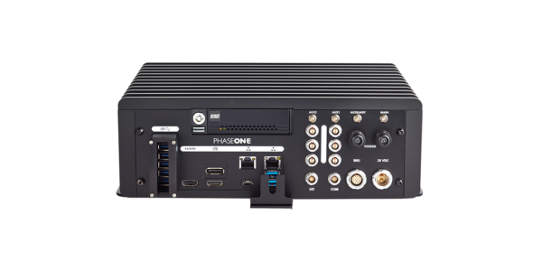
Each of Green Rebel’s survey campaigns results in tens of thousands of images. In order to turn the raw data into useful information, these images must undergo a number of processing steps. GALG designed a bespoke, high-performance database-based processing and data-interpretation solution that facilitates fast, accurate and efficient processing of the survey data to deliver species abundance and density information. The combination of modern sensor technologies with bespoke software engineering has resulted in the development of a highly
advanced and unique system. Green Rebel are currently in the process of exploring the application of AI technologies to automate the identification of wildlife in their imagery.
After 18 months of operations and more than 150 surveys, Green Rebel are happy to report that Phase One’s sensors and controller equipment are running smoothly and have proven extremely reliable to date.
"To date we have successfully performed more than one hundred and fifty digital aerial marine ecology surveys in UK and Irish waters. We get consistently high species ID rates due to the high-quality of our imagery. Green Rebel are proud to support the transition to cleaner, greener, more sustainable energy while protecting marine wildlife. Thanks to Phase One aerial technologies, we have the equipment and the support we need to achieve this."

Geospatial
Eight perspectives, one system

Geospatial
Finding tiny cracks with UAVs opens new opportunities

Geospatial
From capture to corridor intelligence: How Kavel 10 scaled 1 cm mapping with the Phase One + IGI CM-1

Geospatial
From sensors to solutions: How AISPECO orchestrates precision in reality surveying

Geospatial
Monitoring pipeline corridor using PAS 280 large format camera

Geospatial
Preventing Wild Bushfires By Mapping Planned Burns

Geospatial
Novice Aerial Photographer Becomes Advanced Mapping Provider

Geospatial
Inspecting Wind Turbine Blades While They Are Rotating

Geospatial
Precision at Altitude: Redefining Aerial Mapping with the PAS 880 Oblique Camera System

Geospatial
Perfecting telescope dish accuracy with UAV photogrammetry

Geospatial
Saving costs while lowering carbon footprint: Innovative aerial surveying service uses small airplanes enabled by compact cameras

Geospatial
Detecting forest tree diseases using a large-format camera on an ultralight aircraft

Geospatial
Mapping lava flows during volcanic eruptions in Iceland

Geospatial
The PAS Pana: a 48,800-pixel camera innovated with our customer Surdex

Geospatial
Rebuilding after Hawaii’s wildfire with engineering-grade surveying