3D city models - Mapping of an historic, medieval town in the Alsace
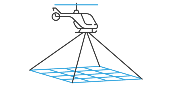
Using aerial oblique images combined with close range UAV (uncrewed aerial vehicles) based data
3D city models
Taking care of cultural heritage is an important task in cities all over Europe. As an enabling technology, the use of aerial images for the creation of 3D city-models (digital twins) is becoming increasingly popular and offers a range of benefits to city and urban planners. From urban quarters to entire construction projects to transport or climate protection measures: Digital twins show planning, maintenance, and future scenarios interactively and realistically in a 3D model. At the same time, the digital twin is linked to real parameters such as environment, time, and condition.
Customer Solutions
GGS has been dealing with OIS (Oblique Imaging System) for more than 8 years. Since then, the requirements have changed to achieve better resolutions for the reconstruction using more powerful sensor setups with faster capture rates.
GGS is specialized in designing and building OIS for the customer’s specific requirements. GGS focuses on finding the perfect combinations between cameras and lens, adjustable oblique angles and multispectral camera systems as integration to existing devices. Aerial missions are limited due to predefined minimal flight altitudes over cities, the capture rate of the camera, forward motion blurring and the costs for the flight mission and data processing. Hence, a GSD of 5 cm is still a quite common, extremely high resolution that combines delicate details of the buildings with an acceptable data volume and price range. The limits to achieve very high–resolution data with aerial missions is at around 2 cm GSD. However, the 2 cm GSD results in 3 times more flight time and 7 times more data to be processed compared with the 5 cm GSD. Thus, the request to acquire data with an ultra-high resolution better than 1 cm for building city model became increasingly important, particularly for important objects.
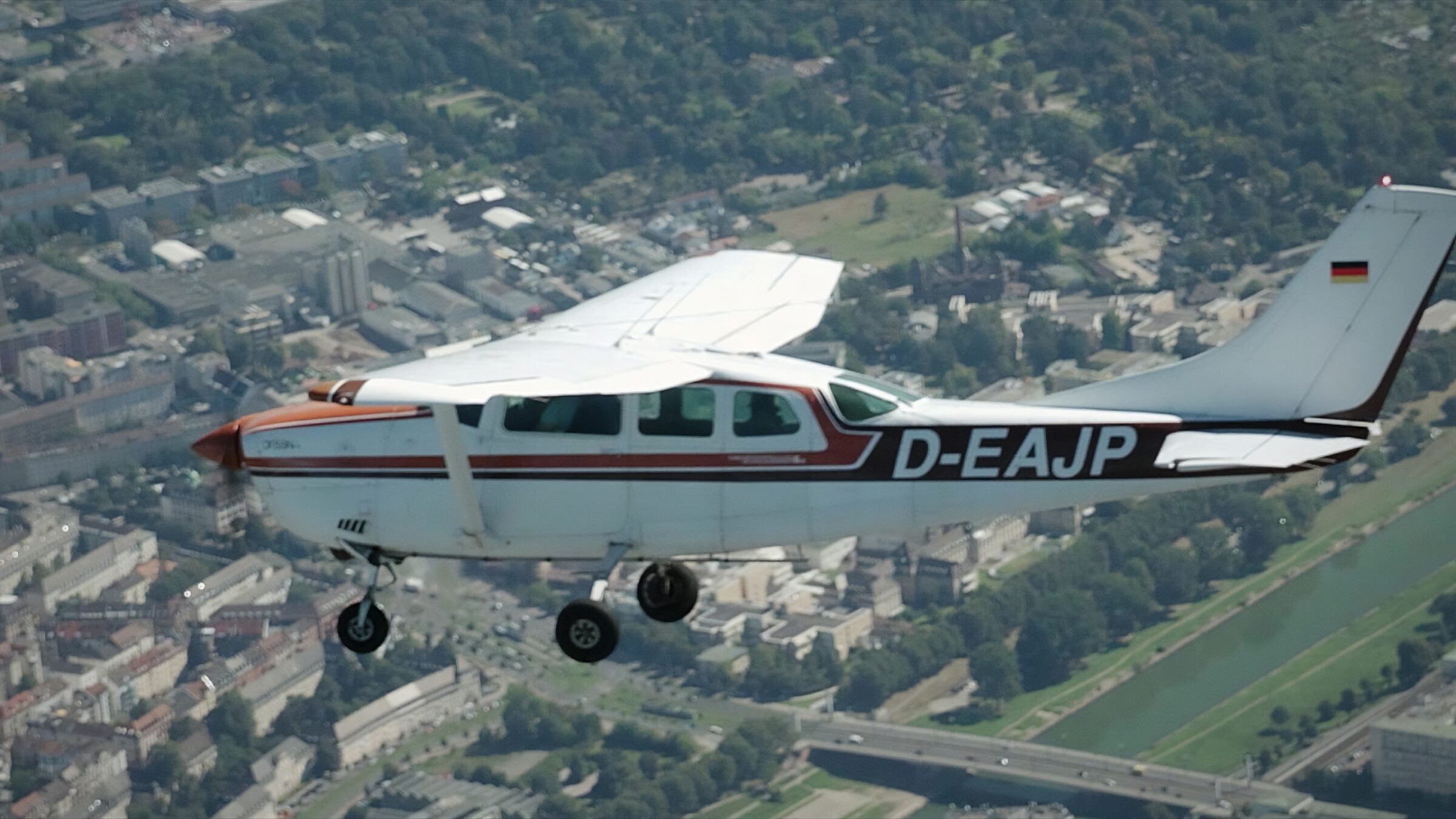
The study shows an example of the city of Wissembourg in France highlighting the possibilities in combined sensor usage. Phase One technology was used in an oblique imagery system and a single camera out of this installation on a UAV. The combined image processing still provides a challenge.
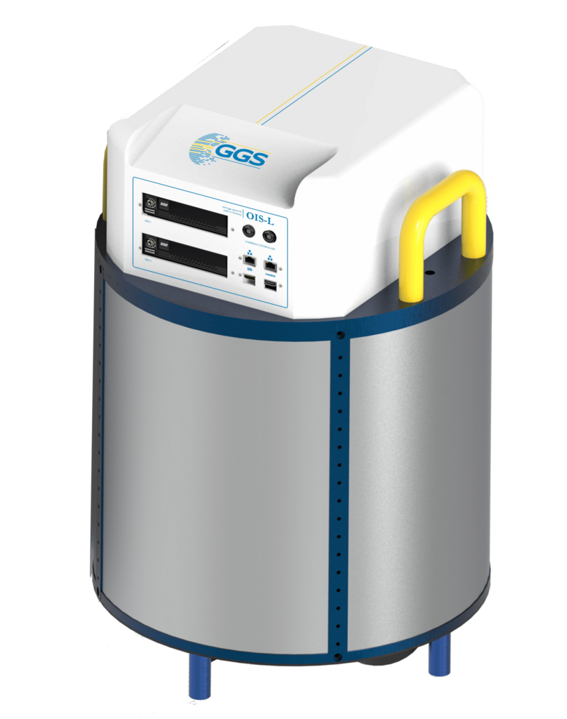
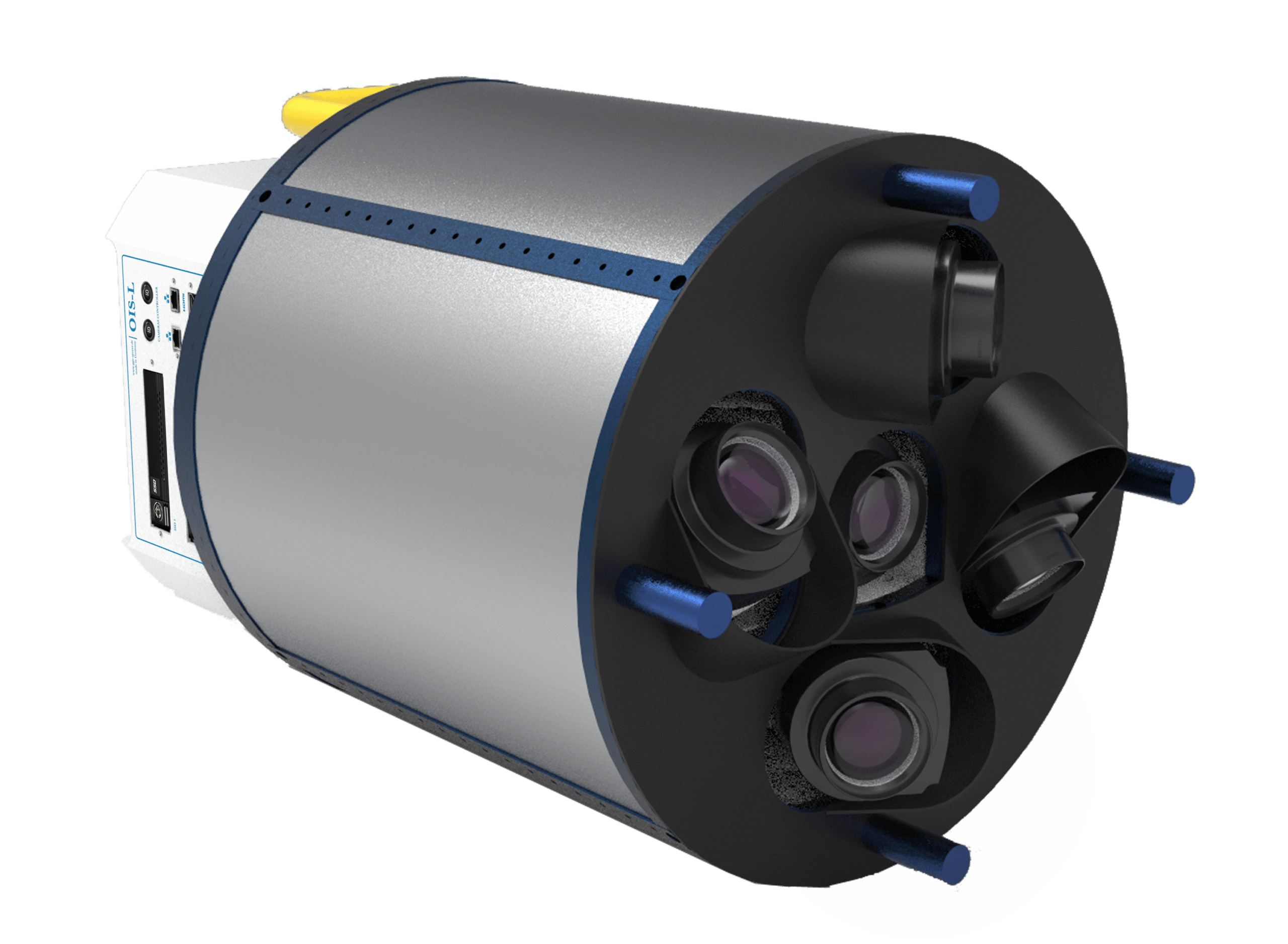
Figure 1: The OIS-L with 550 MPix


The project location
Wissembourg, situated in the Northeast of France, Region Grand Est, Département Alsace, is a historical city close to the border of Germany. Founded in the 7th century, Wissembourg has many important old buildings and is rich in cultural heritage objects. Wissembourg is a useful test site since it covers urban areas, cultural heritage objects, hilly terrain with vineyards and agriculture, mountains of the Biosphere Reservation Alsace/Palatine and rivers/cannels floating around and through the city. The Palais Stanislas was built in 1722 and thus is one of the major historical monuments in Wissembourg. It is under reconstruction and was one of the objects captured with a UAV mission. Besides that, the Façade of the “Maison du Sel” and the reconstructed city wall have been surveyed to generate incredibly detailed digital twins.
The reconstruction of historical buildings, especially if they are listed in the inventory of cultural objects in France, must be done with respect to the cultural heritage and must be documented after each reconstruction step. The UAV Mission is a new feature for such object documentation and is used increasingly for metric measurements. Data captured for the mentioned objects have a resolution better than 1 cm GSD that enables the extraction of details, that are sufficient to also be used for other conservation purposes. UAV data can be captured more frequently than aerial missions and support the documentation of an ongoing reconstruction.
The Project Details
The city of Wissembourg was surveyed by aircraft with 5 cm GSD and 80/60% overlaps. This resolution is far better than the existing national orthophotos. The 3D reconstruction takes respect to the historical city and the need for detailed planning and renovation of cultural heritage.
Data collection took place with the Camera OIS–L made by GGS. This sensor is equipped with one Phase One iXM-RS150 camera with 150 MP and 70 mm focal length for nadir view, mounted in landscape format, and four iXM-100, 100 MP cameras for oblique views each equipped with an 80 mm lens. The sideward looking cameras were mounted in portrait orientation with a tilt angle of 41 degrees while the forward and backward cameras were mounted as landscape with 45-degree tilt angle. This setup results in an oblique GSD of 4.7-7.8 cm. Such a setup with “wider-angled“ lenses has the benefit of many views of facades for the reconstruction and good representation of roof overhangs. But the lower flight altitude sometimes has restrictions of aerial control and a wider distribution of the GSD on oblique views.
The entire dataset was processed with the PhotoMeshTM from Skyline Software. The calibrated camera system with the precise GNSS-INS resulted in a very exact model with an accuracy of more than 3 cm. GCPs (ground control points) have been used to validate the overall result.
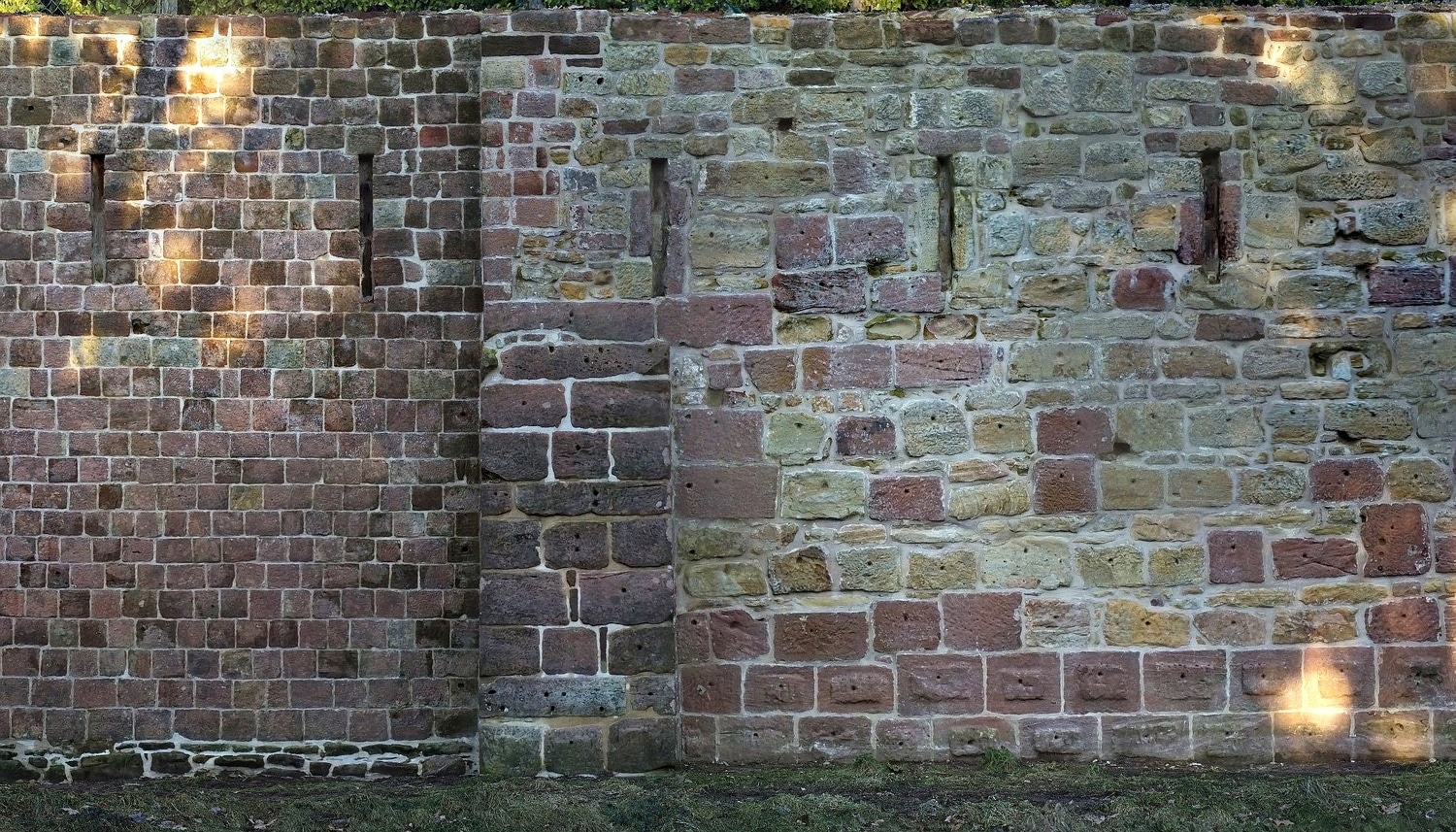
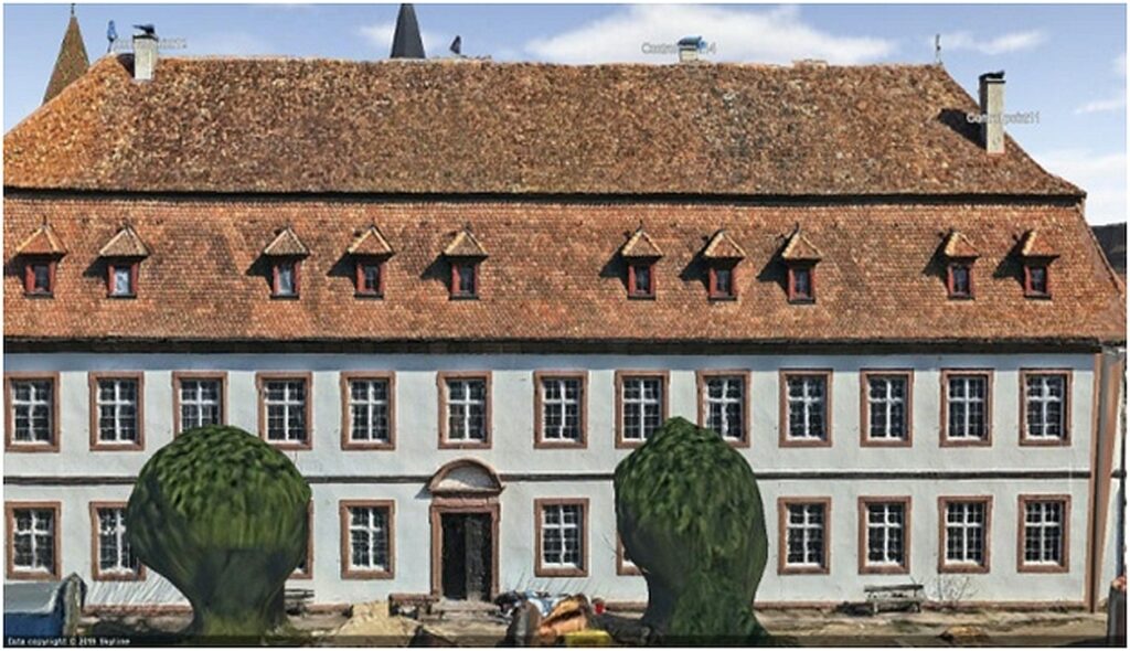
Figure 2: Part of the city wall with 3 mm GSD
Ultra high resolution survey
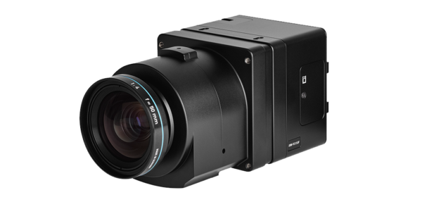
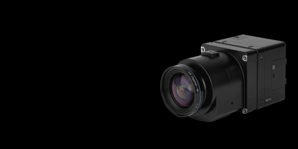
Wissembourg’s city architects requested ultra-high-resolution details for specific objects, including the Palais Stanislas to document the renovation process. For the UAV Mapping, the AeroSpector-S was chosen, equipped with an iXM100 with a 35 mm lens. The camera was dismantled from the OIS-L, for ease of use to access oblique ones was chosen. Due to dismantling and changing the lens, it was necessary to do a full recalibration.
The mission close to the facades was performed manually, while the more nadir images were captured with a planned mission. Two further objects were surveyed, one being a part of a new reconstructed city wall (remparts) and the roof of the “Maison du Sel” where a true Orthophoto for the department for cultural heritage was produced. The massively deformed roof of this building is an extremely specific site of interest that was to be preserved during renovation.
Figure 3: The OIS-L with 550 MPix
Results
The aerial data was processed with PhotoMeshTM from Skyline Software Systems as a full project with Tie Point Matching, AT, Dense Point Cloud and mesh generation, texturing, and export of the final model. The UAV Data was processed by Aerial Triangulation with full automated Tie Point Extraction and Bundle Block Adjustments using the input GPS as a factored observation. The calculated AT results function as an input to the full Aerial Triangulation together with the Aerial Images. To ensure high level co-registration between the UAV Images and Aerial Images, supplemental control points from the resulting 3D Mesh from the Aerial data are used. The final 3D model now contains both levels of resolution in one model and allows to analyze the detailed objects in the 3D city environment. This can be part of touristic guidance. This was the first time such a combination was performed with Skyline Software.
The aerial model left and the UAV model right of the southern facade of the Palais Stanislas.
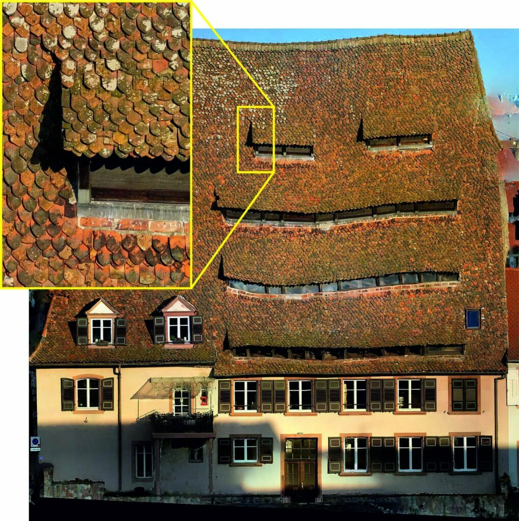
Figure 7: Example of a produced True Orthophoto captured by UAV of the “Maison du Sel” before the reconstruction of the roof with a resolution of a 5 mm GSD. This severe deformation of the roof is one of the famous sites and a special feature of the city of Wissembourg.

Geospatial
Eight perspectives, one system

Geospatial
Finding tiny cracks with UAVs opens new opportunities

Geospatial
From capture to corridor intelligence: How Kavel 10 scaled 1 cm mapping with the Phase One + IGI CM-1

Geospatial
From sensors to solutions: How AISPECO orchestrates precision in reality surveying

Geospatial
Monitoring pipeline corridor using PAS 280 large format camera

Geospatial
Preventing Wild Bushfires By Mapping Planned Burns

Geospatial
Novice Aerial Photographer Becomes Advanced Mapping Provider

Geospatial
Inspecting Wind Turbine Blades While They Are Rotating

Geospatial
Precision at Altitude: Redefining Aerial Mapping with the PAS 880 Oblique Camera System

Geospatial
Perfecting telescope dish accuracy with UAV photogrammetry

Geospatial
Saving costs while lowering carbon footprint: Innovative aerial surveying service uses small airplanes enabled by compact cameras

Geospatial
Detecting forest tree diseases using a large-format camera on an ultralight aircraft

Geospatial
Mapping lava flows during volcanic eruptions in Iceland

Geospatial
The PAS Pana: a 48,800-pixel camera innovated with our customer Surdex

Geospatial
Rebuilding after Hawaii’s wildfire with engineering-grade surveying
Press Release
Phase One introduces iX Process – a new standard for simplified, high-performance mapping workflows
Press Release
A new benchmark – sub-centimeter aerial mapping at aircraft speeds without compromises

Press Release
A new era in aerial imaging technology – made easy to adopt

Geospatial Blog
Part Two of: Taking Off – our pre-flight checklist for aerial mapping as the season takes off

Press Release
Carbonix, RIEGL, Phase One announce first fixed-wing VTOL integration of long-range dual sensor system

Geospatial Blog
Insights and future trends at Geo Week 2024

Press Release
Phase One Appoints HALG | Hindustan Assistant & Logistic Group as Official Technical Partner in India to Enhance Local Support and Engagement
Press Release
Phase One Introduces PAS Pana at InterGeo 2023: The Most Effective Wide Area Camera for Aerial Mapping

Press Release
Phase One announces New Calibration Lab and Geospatial Center of Excellence in Denver