Using Advanced Drone Solutions for Flare Stack Inspection
Getting the smallest details from a safe distance
SkyeBase, an inspection service provider from Belgium, has a wealth of experience helping asset owners and maintenance managers to deploy and perform 100% uptime inspections with drones and sensors to manage critical assets. SkyeBase is operating in line with VCA Petrochemical, ISO9001:2015, and EU drone legislation, showcasing its expertise in advanced drone solutions.
Faster, safer and more efficient flare stack inspections
The flare is a vital part of the safety system in an oil and gas production facility. Hence it is of utmost importance that flares are working faultlessly. To ensure optimal working conditions, flares are regularly assessed and inspected for defect analysis. These reports can then be archived for comparison with future inspections for an even more accurate survey and reliable monitoring of any potential issues.
UAV inspections offer unprecedented visual access to hard-to-reach areas during flare stack inspections whilst also dramatically reducing costs as the processing plant and flare system can remain fully operational, thereby helping to prevent major events, such as scheduled shutdowns or unusual flaring events.
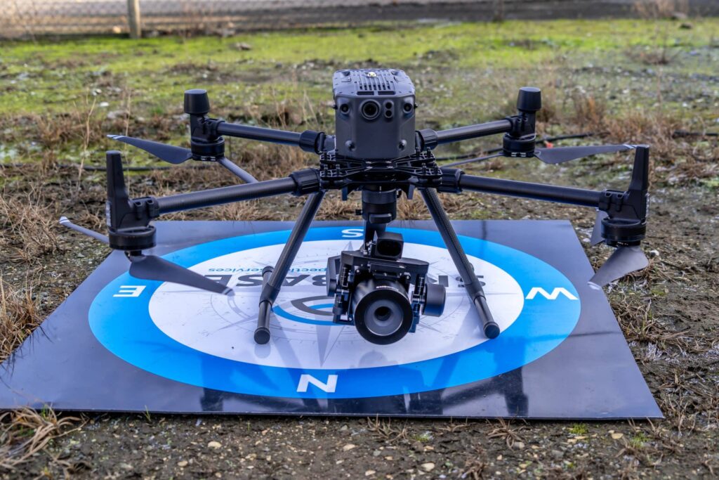
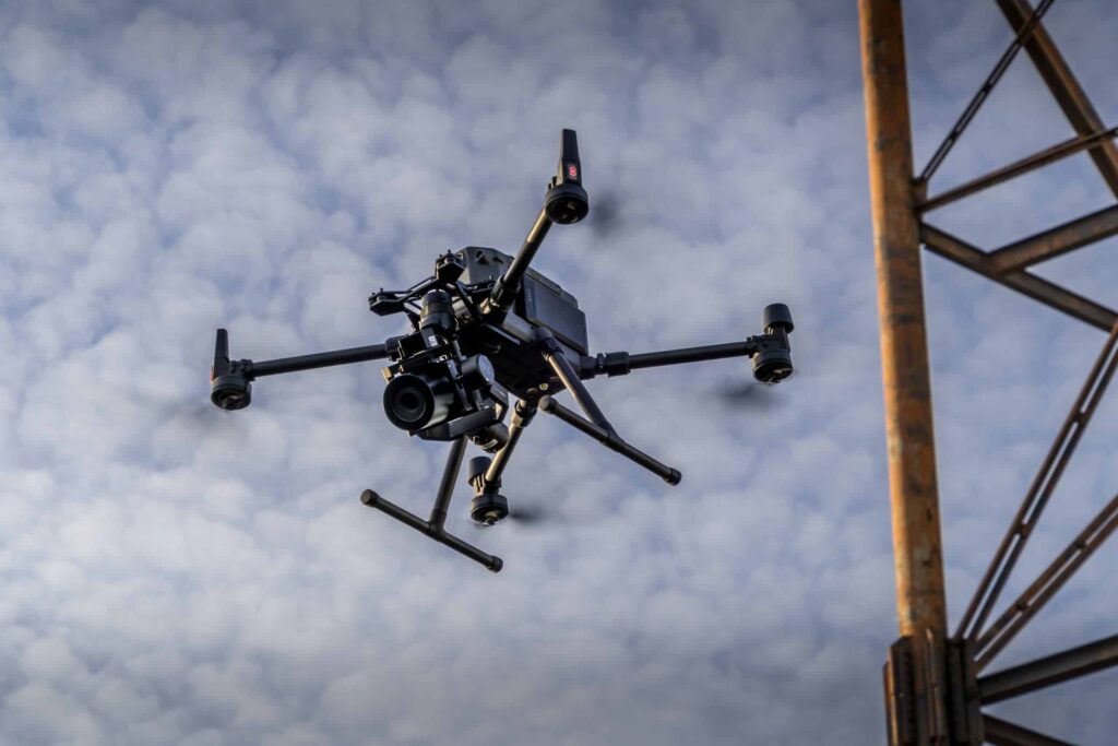
The flare stack inspections deployed by SkyeBase uses UAV technologies capable of capturing a full 360-degree perspective of the asset, while also allowing to focus on specific areas such as the flare tip, radiation shield, pilot ignition systems, pipework, gantries and handrails, while also giving a general overview of the flare stack condition, using advanced drone solutions.
In addition to significantly reducing inspection time and cost, UAV based inspection immensely reduces the risks as no inspection team personnel needs to be working at height in dangerous conditions.
Flare stack inspection: the project details
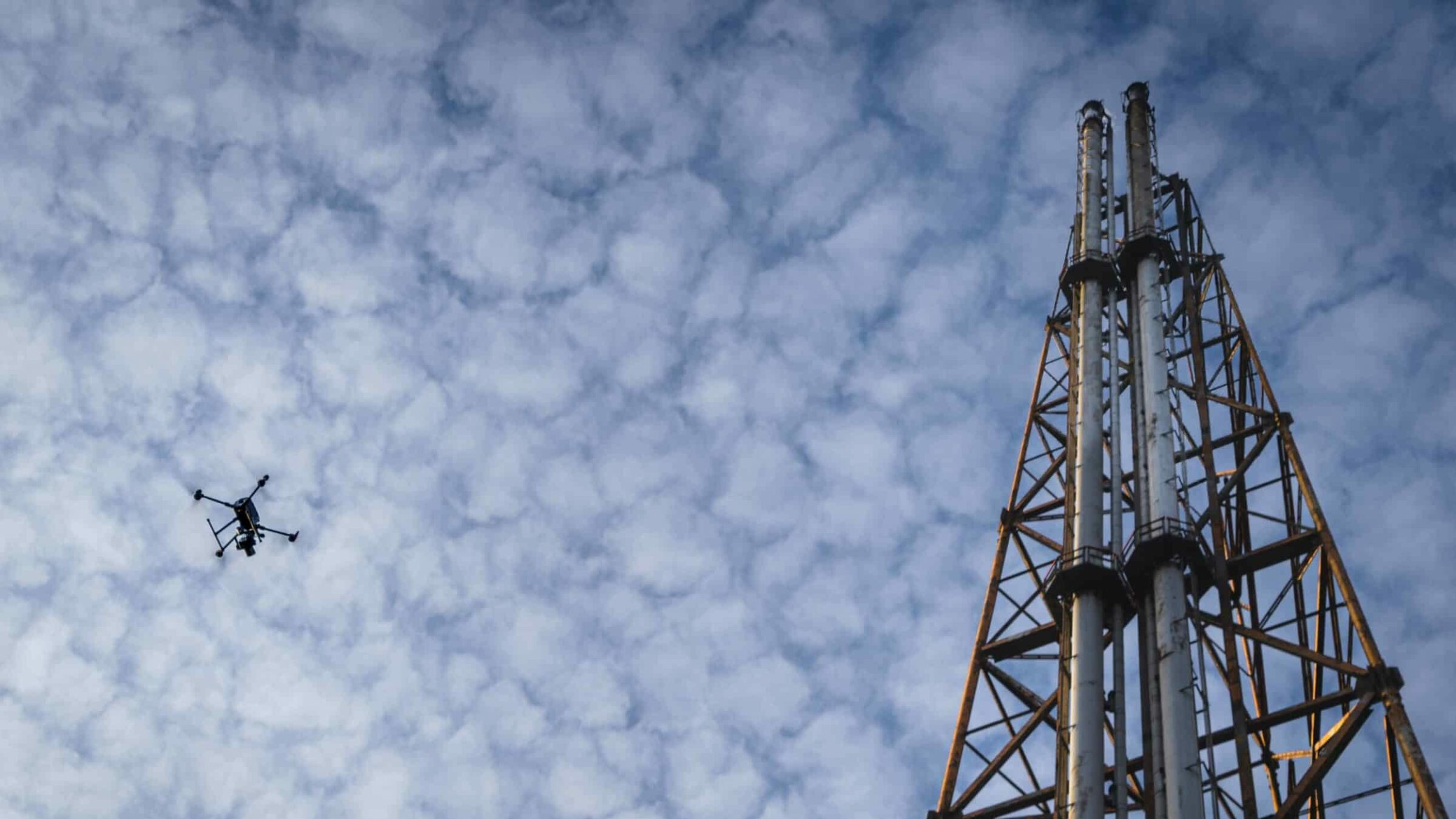
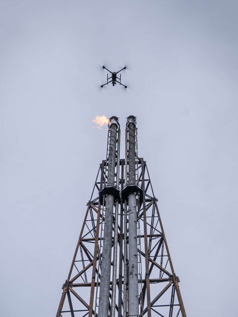
In December 2021, SkyeBase was tasked by a multinational oil and gas company to conduct a flare stack inspection for the structural evaluation, condition assessment and technical analysis of live flare stacks located in the port of Antwerp.
By taking overview photos from a distance, using advanced drone solutions they can be analyzed in the office afterwards. This greatly reduces downtime, site time and increase quality and efficiency. Due to the high quality of the images, a safer distance can be taken from certain critical assets. This increases safety and makes risk analysis for flights easier. Below is an example of a flare inspection in the port of Antwerp (December 2021).
It is also possible to inspect damages on millimeter level. Assets can be viewed more closely and in greater detail. This allows faster identification of areas of concern for routine maintenance and reduces the cost of downtime.
By taking the same picture at the same location and the same angle every time, assets can be monitored very efficiently, even in difficult external conditions. Hence re-accessed and continuously monitored regarding defect analysis. These reports can then be archived for comparison with future inspections for an even more accurate survey and reliable monitoring of any potential issues.
Mapping and 3D modeling
A high-resolution camera has more pixels and a larger sensor. This makes it possible to fly higher and take fewer pictures for the same accuracy. In this way, the flight time is reduced, and our site presence is shorter. When flying in a similar way the quality is significantly higher.
Below an overview of GSD at the same altitude. (Ground Sampling Distance, the lower the number, the higher the accuracy)
| Height | DJI Zenmuse P1
(43Mp, 35mm) |
PhaseOne P3
(100Mpx, 35mm) |
PhaseOne P3
(100Mpx, 80mm) |
| 40m | 0.50 cm/px | 0.43 cm/px | 0.19 cm/px |
| 80m | 1.00 cm/px | 0.86 cm/px | 0.37 cm/px |
| 100m | 1.26 cm/px | 1.08 cm/px | 0.47 cm/px |
High resolution images can also be used to create 3D models. With a shorter data capture time, more points can be created for the point cloud. The general benefits offered by 3D models include
- Localization of damage,
- Volume measurement,
- Generation of plans,
making assessments much easier.
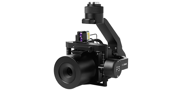
Advantages of Phase One’s P3 Payload Solution
The P3, with its 100MP camera, has the advantage of doing inspections and mappings on-site much faster and from a higher and safer distance. This significantly reduces potential downtime and risks associated with manual inspection. Due to the high resolution, images contain much more detail, and point clouds have a much higher accuracy.

Geospatial
Eight perspectives, one system

Geospatial
Finding tiny cracks with UAVs opens new opportunities

Geospatial
From capture to corridor intelligence: How Kavel 10 scaled 1 cm mapping with the Phase One + IGI CM-1

Geospatial
From sensors to solutions: How AISPECO orchestrates precision in reality surveying

Geospatial
Monitoring pipeline corridor using PAS 280 large format camera

Geospatial
Preventing Wild Bushfires By Mapping Planned Burns

Geospatial
Novice Aerial Photographer Becomes Advanced Mapping Provider

Geospatial
Inspecting Wind Turbine Blades While They Are Rotating

Geospatial
Precision at Altitude: Redefining Aerial Mapping with the PAS 880 Oblique Camera System

Geospatial
Perfecting telescope dish accuracy with UAV photogrammetry

Geospatial
Saving costs while lowering carbon footprint: Innovative aerial surveying service uses small airplanes enabled by compact cameras

Geospatial
Detecting forest tree diseases using a large-format camera on an ultralight aircraft

Geospatial
Mapping lava flows during volcanic eruptions in Iceland

Geospatial
The PAS Pana: a 48,800-pixel camera innovated with our customer Surdex

Geospatial
Rebuilding after Hawaii’s wildfire with engineering-grade surveying