CONSTRUCTION
See the World with a Bird’s-eye View: Interactive 360° High-Resolution Aerial Imaging
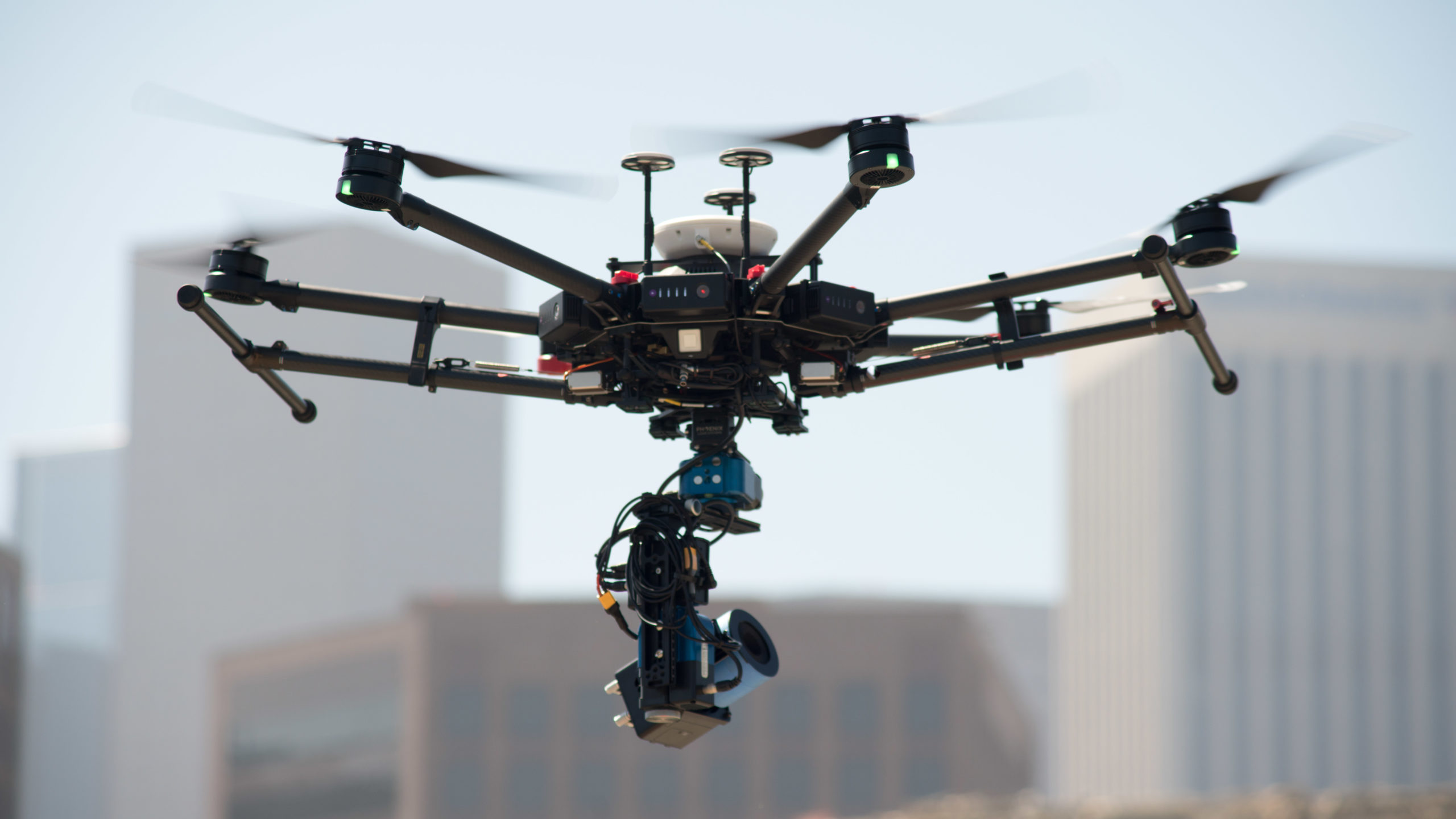
Phoenix LiDAR Systems partnered with German based Black Forest Motion, experts in camera motion control, to offer their customers next-level 360° aerial imaging technology solutions. iXM-100 cameras were purchased to fill a niche by providing motion controlled applications ranging from time-lapse and Giga-pixel photography to fully autonomous turntable photogrammetry scan setups.
360° Aerial Imaging – An All Round Improvement
Serious about LiDAR and innovation, California based Phoenix LiDAR Systems, was established in 2012, and soon launched their first commercial UAV LiDAR system. The company specializes in custom, survey-grade mapping & post-processing solutions designed to collect detailed, 3D topographic information for the engineering, construction, mining markets, and more. Lead by Grayson Omans, CEO, Phoenix LiDAR continues to drive innovation in the industry, integrating the latest hardware and building automation software for every stage of laser mapping.
In March 2019, Phoenix LiDAR Systems partnered with German based Black Forest Motion, experts in camera motion control, to offer their customers next-level technology solutions. Black Forest Motion fills a niche by providing motion controlled applications ranging from time-lapse and Giga-pixel photography to fully autonomous turntable photogrammetry scan setups.
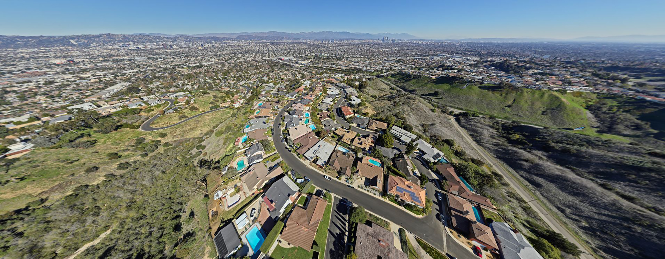
Until now drone solutions have made 360° aerial imaging accessible to many. However, low quality and lack of detail in images result in a limited practical usability. Customers now want to view interactive 360° high-resolution images captured from greater heights to provide wider coverage at faster speeds for processing and stitching. Post-production, images use cloud based storage, accessible from anywhere with an internet connection.
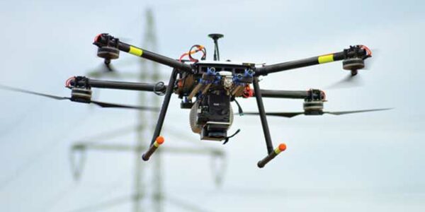
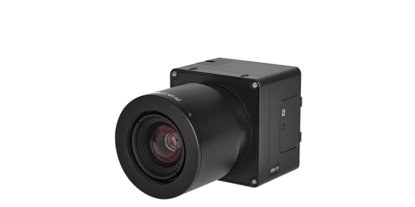
Phase One Industrial’s 100MP imaging technology completes the Phoenix Vision360 solution as it meets all our requirements, plus its compact size and weight allow for easy integration with our UAV based platforms.
Zoom in from Hundreds of Feet in the Air
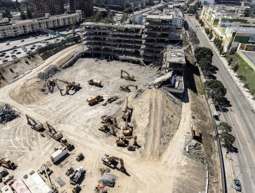
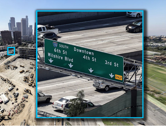
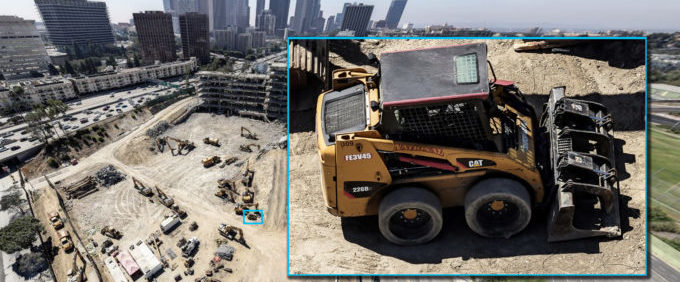
Phase One Industrial cameras offer backside-illuminated CMOS sensors with high sensitivity, fast capture rates, and ultra-high resolution. Medium-format provides a wide surface coverage and better image sharpness, allowing the end-user to zoom right into the stitched images in order to see the finest details such as road signs, safety hazards, and archeological digs from hundreds of feet in the air, all through 360° aerial imaging.
Patrick Ketterer, CEO of Black Forest Motion explains, “Imagine putting binoculars on the standard aerial image capture tools you’re currently using. Then imagine the numerous management and safety applications that become available to you”
Grayson Omans, CEO of Phoenix LiDAR continues, “We’ve had construction site managers request the ability to easily identify equipment asset ID numbers on the ground from safe distances, and Phoenix Vision360 allows them to do that from a drone 600 feet away.”
Business Gains with Giga-pixels
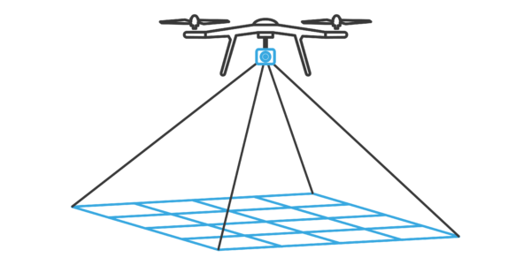
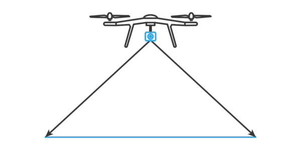
“360° Aerial images have never been sharper, the Phoenix Vision360 process is built around a technology stack comprising of two layers: the drone and imaging control technology. The highly optimized imaging control technology allows Phoenix Vision360 to capture data for some of the largest aerial images with a drone flight-time of less than 10 minutes. Image stitching processing and hosting is cloud-based, allowing users to view interactive 360° high-resolution aerial images (30 million megapixels – Giga-pixel technology) from any location whether close to the site or from an office in another city” says Omans.
360° high-resolution aerial imaging benefits businesses by improving:
- Budget management – through identifying unused resources
- Personnel management – increasing cost efficiency through real-time progress updates.
- Asset management – identify machinery and read serial numbers without disturbing the work-site.
- Job safety – able to clearly pinpoint occupational hazards.
Phoenix Vision360 Intergrated System Benefits
Phase One Industrial medium-format sensor technology
integrated with Phoenix LiDAR results in minimizing project time and costs, risk to people, and work-site disruptions.
Business growth is easily achieved with Vision360 as new aerial imagery applications and investment opportunities can be clearly identified including:
- Utility managers – infrastructure inspection and corridor mapping.
- Construction companies – remote site management and progress documentation.
- Real estate developers – identification of plots of land for development.
- Archeologists – identification of hidden artifacts, academic research, and virtual tours with the disturbance of foot traffic to the site.

Geospatial
Eight perspectives, one system

Geospatial
Finding tiny cracks with UAVs opens new opportunities

Geospatial
From capture to corridor intelligence: How Kavel 10 scaled 1 cm mapping with the Phase One + IGI CM-1

Geospatial
From sensors to solutions: How AISPECO orchestrates precision in reality surveying

Geospatial
Monitoring pipeline corridor using PAS 280 large format camera

Geospatial
Preventing Wild Bushfires By Mapping Planned Burns

Geospatial
Novice Aerial Photographer Becomes Advanced Mapping Provider

Geospatial
Inspecting Wind Turbine Blades While They Are Rotating

Geospatial
Precision at Altitude: Redefining Aerial Mapping with the PAS 880 Oblique Camera System

Geospatial
Perfecting telescope dish accuracy with UAV photogrammetry

Geospatial
Saving costs while lowering carbon footprint: Innovative aerial surveying service uses small airplanes enabled by compact cameras

Geospatial
Detecting forest tree diseases using a large-format camera on an ultralight aircraft

Geospatial
Mapping lava flows during volcanic eruptions in Iceland

Geospatial
The PAS Pana: a 48,800-pixel camera innovated with our customer Surdex

Geospatial
Rebuilding after Hawaii’s wildfire with engineering-grade surveying
Press Release
Phase One, Quantum Systems and Trimble unveil groundbreaking survey grade UAV solution with the launch of Phase One P5 camera
Geospatial
Phase One Selects Globe Flight as Sales Partner for Drone Solutions in Germany and Austria
Press Release
Phase One ernennt Globe Flight GmbH als Vertriebspartner für Drohnenlösungen in Deutschland und Österreich
Press Release
Remote Vision Named as Swiss Reseller of Phase One Drone Payloads