Urban Projects
Documenting Historic Buildings by creating true to scale image plans with Phase One 50MP camera, a UAV and metigo®
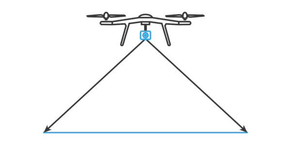
With Phase One Industrial’s lightest 50MP camera, surveillance of structures in populated areas is easier, faster and more affordable.
Digitizing for the Purpose of Conservation
Historic architecture is being digitized and modeled for the purpose of conservation, preservation, and protection of the structures and their cultural heritage. In the past, photogrammetrical documentations were possible only with analog cameras of 5’x7’ or 4’x5’ frame size and accomplished by using a lift that was positioned and driven around the object and carried the photographer around.
Today, with the development of smaller and lighter aerial platforms (UAVs and cameras), surveying complex structures in populated environments is becoming easier, faster, affordable, and more efficient, and the images are utilized for inspection, monitoring, 2D/3D image rectification, and dense point cloud creation.
CopterSystems GmbH is developing intelligent aerial platforms and manufacturing tailor-made UAV solutions for diverse applications.
Fokus GmbH Leipzig is an engineering company that provides special services in the fields of architecture photogrammetry and focuses on complex surveying supporting the documentation of monuments, as well as photogrammetrical evaluation of historic photographs for dimensional reconstruction of historic objects.
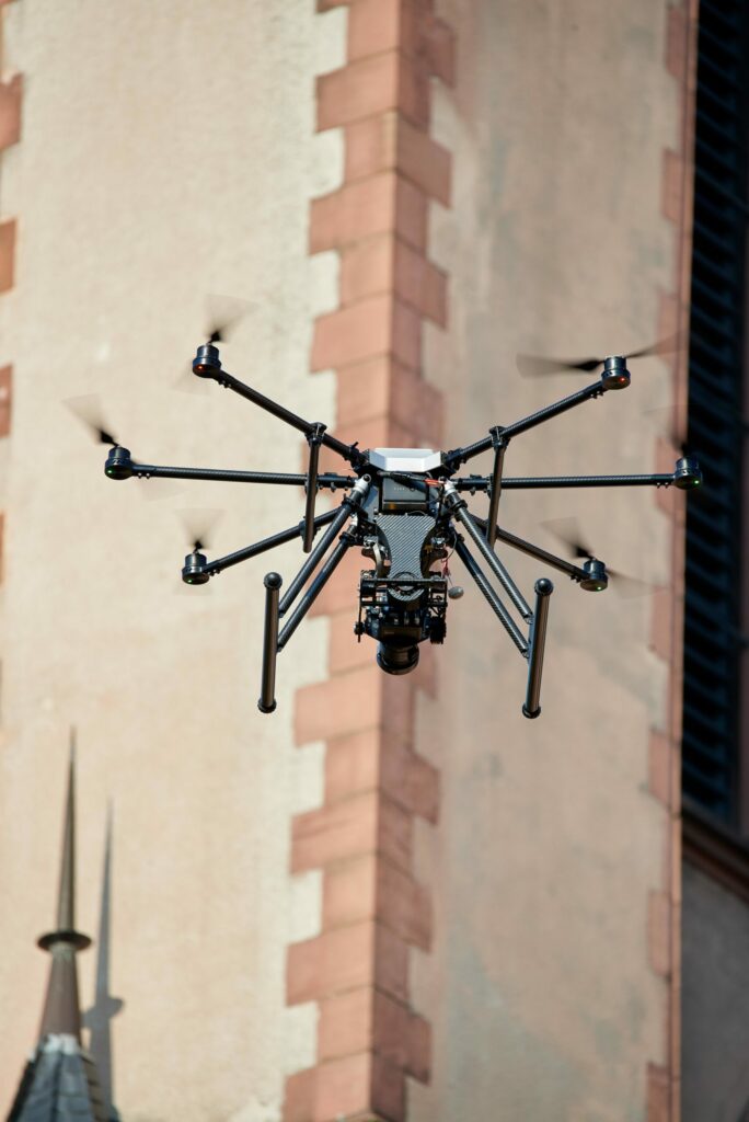
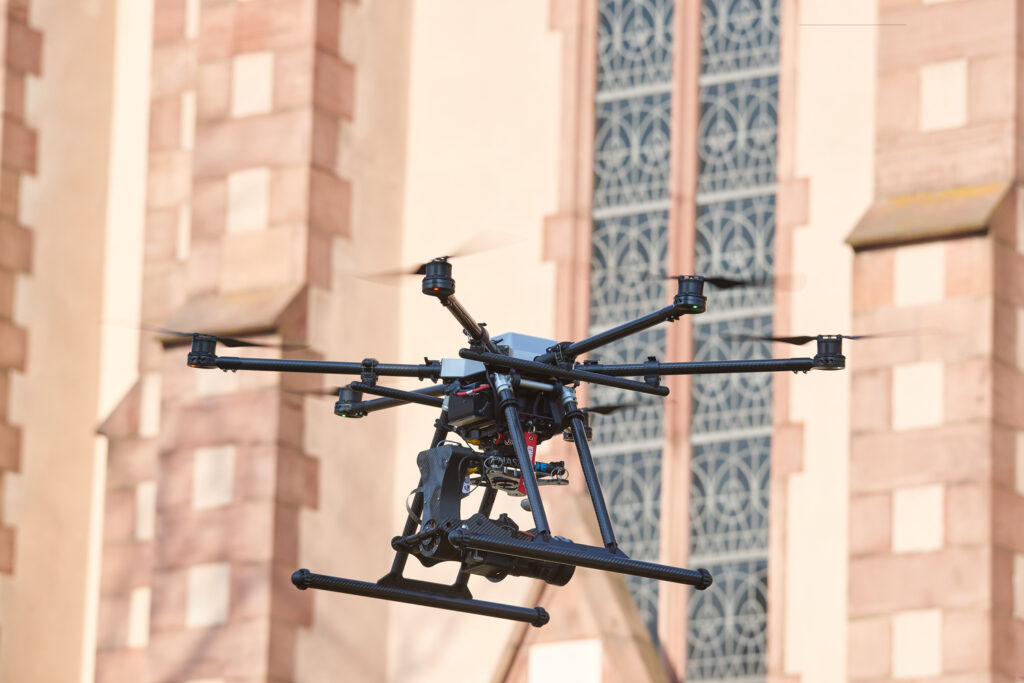
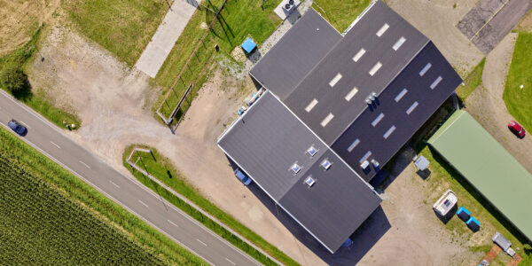
CopterSystems and Fokus GmbH Leipzig joined forces and executed a complex aerial survey for documenting the historic neo-Gothic church St. Mauritius in Frankfurt /Main. The church that was built in 1901 is located in a populated area and attracts many visitors. The challenge was not only documenting the structure but also allowing the traffic of people around it uninterrupted.
2D Image Rectification
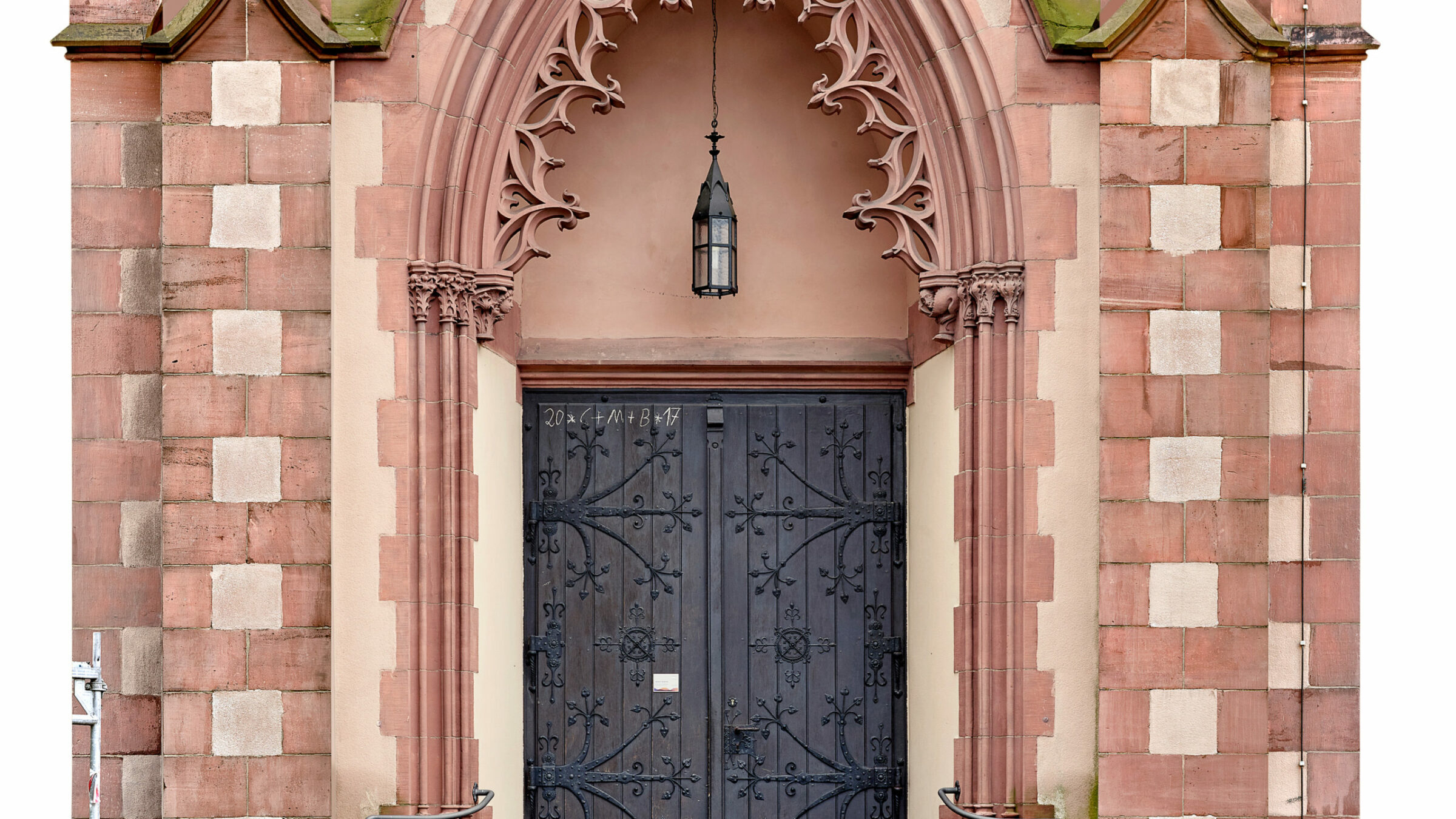
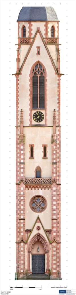
The four facades of the church tower – 42 meters high – were documented by 2D rectified images in the scale 1:20 and 300 dpi resolution. This corresponds to a pixel resolution of 1.7 mm at the object.
The decision to use 2D image rectification (instead of 3D ortho projection) was due to the higher image quality of depiction of damages at the natural stone. The image rectification and image mosaic were made with metigo® MAP. Colour correction and final processing were done with Adobe Photoshop.
The metigo® MAP software has been developed by Fokus GmbH Leipzig in close cooperation with conservators since 2000 and offers image rectification and mapping, as well as quantity survey and analysis. On the basis of the true-to-scale image plans, planers and conservators can document damages and estimate quantities that enable providing accurate cost and time estimations for conservation projects.
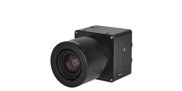
The 50MP camera was integrated into the CS-P.O.C easily, and its high dynamic range enabled the capture of images in the highest resolution. The camera delivered excellent results with high level of accuracy and details that enabled our customer to use the true-to-scale image plans for the damage mapping and for the controlling process of restoration.
Bypassing Obstacles
As with any project where buildings are occupied, the principal consideration is disruption to the daily routine and attempts to minimize it. In this specific project, the challenges were clear; the need to fly in the center of a big german city that is located close to the airport, and execute a surveying project close to a church – a local historical attraction with high density of visitors.
CopterSystems chose to integrate Phase One’s 50MP camera – the smallest and lightest digital medium format aerial camera, with CMOS sensor, quality capture from ISO 100 to 6400, 8280 pixels in cross track coverage, capture rate of 0.8 sec/frame, direct connectivity with FMS, GPS/IMU and Schneider-Kreuznach central shutter lenses up to 1/1600 sec.
Gisbert Sacher, Fokus GmbH Leipzig CEO said:
“The usage of the UAV was a great help for recording images of the church in high quality. The usage of a larger lift was not possible and image recording would have taken more time.”

Geospatial
Eight perspectives, one system

Geospatial
Finding tiny cracks with UAVs opens new opportunities

Geospatial
From capture to corridor intelligence: How Kavel 10 scaled 1 cm mapping with the Phase One + IGI CM-1

Geospatial
From sensors to solutions: How AISPECO orchestrates precision in reality surveying

Geospatial
Monitoring pipeline corridor using PAS 280 large format camera

Geospatial
Preventing Wild Bushfires By Mapping Planned Burns

Geospatial
Novice Aerial Photographer Becomes Advanced Mapping Provider

Geospatial
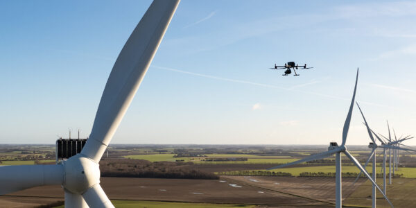
Inspecting Wind Turbine Blades While They Are Rotating

Geospatial
Precision at Altitude: Redefining Aerial Mapping with the PAS 880 Oblique Camera System

Geospatial
Perfecting telescope dish accuracy with UAV photogrammetry

Geospatial
Saving costs while lowering carbon footprint: Innovative aerial surveying service uses small airplanes enabled by compact cameras

Geospatial
Detecting forest tree diseases using a large-format camera on an ultralight aircraft

Geospatial
Mapping lava flows during volcanic eruptions in Iceland

Geospatial
The PAS Pana: a 48,800-pixel camera innovated with our customer Surdex

Geospatial
Rebuilding after Hawaii’s wildfire with engineering-grade surveying
Press Release
Phase One strengthens distribution network with DroneStars for Enhanced UAV Inspection in the Benelux region
Geospatial Blog
Unlocking Efficiency: The Holistic Approach to Drone-Based Utility Inspections
Press Release
Phase One expands distributor reach with Measur for strong UAV inspection growth in the Canadian market
Geospatial Blog
Technology Turning the Tide Against Ocean Plastic Pollution
Geospatial Blog
Setting the New Standard: Evaluating Survey-Grade Accuracy with the Phase One P5
Press Release
Phase One Partners with gNext to Revolutionize Asset Inspections based on Intelligent Image Quality (IIQ)
Geospatial Blog
Part One of: Taking Off – a checklist for the start of the inspection flying season

Geospatial Blog
Insights and future trends at Geo Week 2024
Press Release
Cyberhawk selects Phase One in their pursuit of revolutionizing drone-based industrial inspection by delivering more value in less time.

Press Release
SPH Engineering and Phase One Team Up to Enhance Visual Inspections with ImageInspector Solution

Press Release
Phase One certifies Xer Technologies’ hybrid electric X8 BVLOS capable UAS for next-generation high-resolution inspections

Press Release
Phase One and Boston Announce Partnership for strong Drone Imaging collaboration in the Nordics