Finding tiny cracks with UAVs opens new opportunities
When a commercial inspection company in Japan gained the ability to detect small failures from greater distances, they improved safety and productivity – and broadened the applications and clients they could support.
The Challenge
Kyuden Droneservice had been using a standard 4K camera for their inspections. With their surveying customers expecting a 1 cm GSD, they had to fly their mission at 37m AGL, not matching the safe altitude.
Moreover, the Japanese Building Standards Act stipulates that cracks larger than 0.2 mm in structures must be repaired. This means clients having their building inspected often request the company to look for any cracks larger than 0.2mm, requiring even closer flying.
Therefore, safety concerns meant they had to fly higher, preventing the company from getting close enough to achieve the necessary GSD. Consequently, they were only able to perform rough inspections.
The Phase One UAV solution
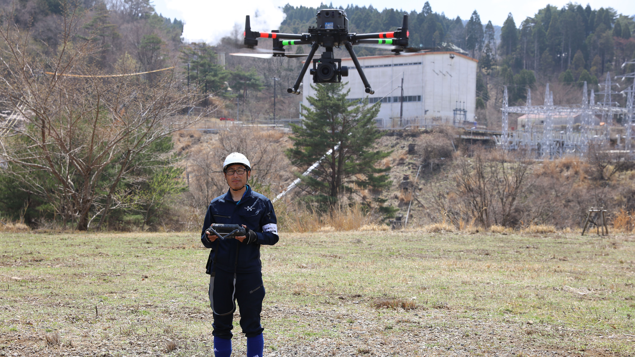
To improve their UAV inspection quality, Kyuden Droneservice invested in Phase One P3 iXM-100 and iXM-GS120.
At first, they started using a DJI Matrice 600 UAV with a Ronin gimbal. Then, switching to a DJI Matrice 300 RTK with a P3 gimbal, they found a solution that was easier to use, and began using it more frequently as a result.
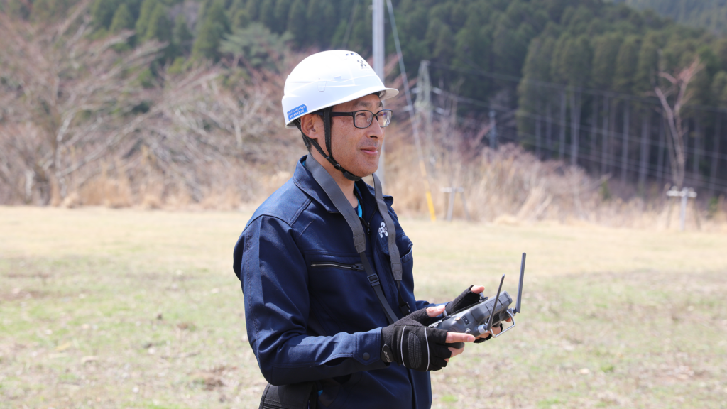
As Mr. Koga of Kyuden Droneservice says, “The distributor and manufacturer kindly taught me, and now I’m able to use it well. Since then, I’ve become an intense user, using it at least once a month in many locations.”
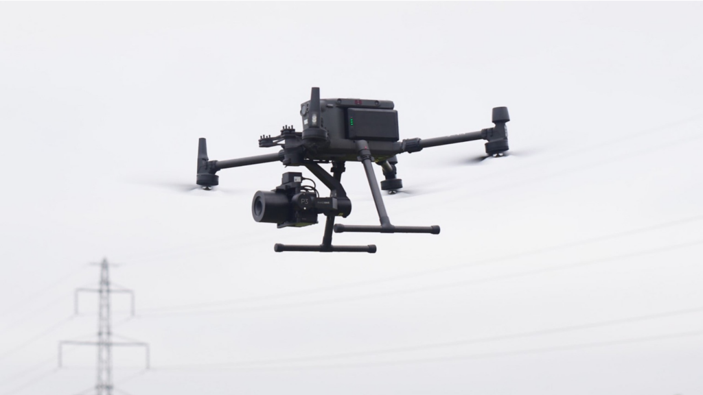
The iXM-100 is a 100-megapixel high-resolution camera that is suitable for shooting in adverse environments such as drone photography. It uses a back-illuminated medium-format sensor, which provides large pixel size, excellent high sensitivity characteristics, and a wide dynamic range.
The iXM-GS120 is the world’s first 120-megapixel global shutter camera. With a maximum shutter speed of 1/16000 and high-speed continuous shooting, it is specially designed to address new imaging fields such as security, defense, and the inspection and testing of moving objects.
The Phase One P3 is compatible with the DJI M400/M350/M300 RTK UAV, allowing easy connection and integration.
Vastly improved GSD at much safer distances
While conventional cameras require low-altitude photography to maintain accuracy, Phase One’s high-resolution cameras can efficiently capture wider areas from higher altitudes. This has enabled improvements in both inspection and surveying applications.
With the iXM-100, Kyuden Droneservice can achieve a GSD of 0.46 cm even at an altitude of 100m, which gives a large margin for flight path deviation and thus enhances safety.
The company flies their drones with automatic navigation software that they have developed in-house.
During inspections, UAV pilots can see cracks clearly, and during surveying, they can take wide shots and take photos from a distance using GNSS – and still be able to capture the necessary details.
Looking for cracks larger than 0.2mm can now be achieved even from 18 meters away. This means they are now able to fly safely while achieving the necessary GSD – and it has also made it easier for AI to detect them.
Significant efficiency improvements save time
In addition to the improved GSD, using the iXM-100 for photogrammetry significantly reduces flight time and the number of shots taken, because they can capture more detailed images. This enhances the productivity of infrastructure inspections.
The solution also ensures they capture useful data. As Mr. Koga says:
“I like the large sensor size, which allows you to take bright, accurate shots no matter where you shoot. There’s no lens distortion even when looking at the edges of the image, which is great for surveying.”
Another advantage is that the iXM-100 is highly compatible with DJI drones, making it very easy to use.
In some cases, the time required for work has been reduced by about one-third.
As Mr. Koga says, “As I’ve used the Phase One cameras, I’ve come to understand their value. I think they’re good for anyone who is serious about surveying and inspection.”
As I've used the Phase One cameras, I've come to understand their value. I think they're good for anyone who is serious about surveying and inspection.
Enabling the company to take on more tasks
Because Kyuden Droneservice are now able to capture high-resolution images and perform more detailed inspections, the solution has broadened the scope of their operations. Their survey data can also be converted into orthoimages to obtain accurate topographical data.
Mr. Koga conducts inspections of road tunnel construction in Osaka. He does this about twice a month to investigate whether the road above the tunnel is sinking. For this, he processes 1,500 120-megapixel 3D images each time. He compares the results with previous models to determine how much the ground has sunk.
He has also inspected a 150-meter chimney, which took just over half a day. For this, he was able to take images from a distance of 18 meters, with a resolution of approximately 0.8 mm.
“Until now, I wasn’t sure how to safely inspect a 150-meter-tall chimney due to altitude restrictions imposed by aviation law,” says Mr. Koga. “However, being able to capture a wide area from a distance eliminates that concern.”
Having Phase One cameras is sometimes actually required by the clients.
“There are an increasing number of cases where Phase One’s high-resolution, high-dynamic-range cameras are specified for inspection work, so I think their recognition within the industry is also increasing,” he adds.
Post-processing with AI
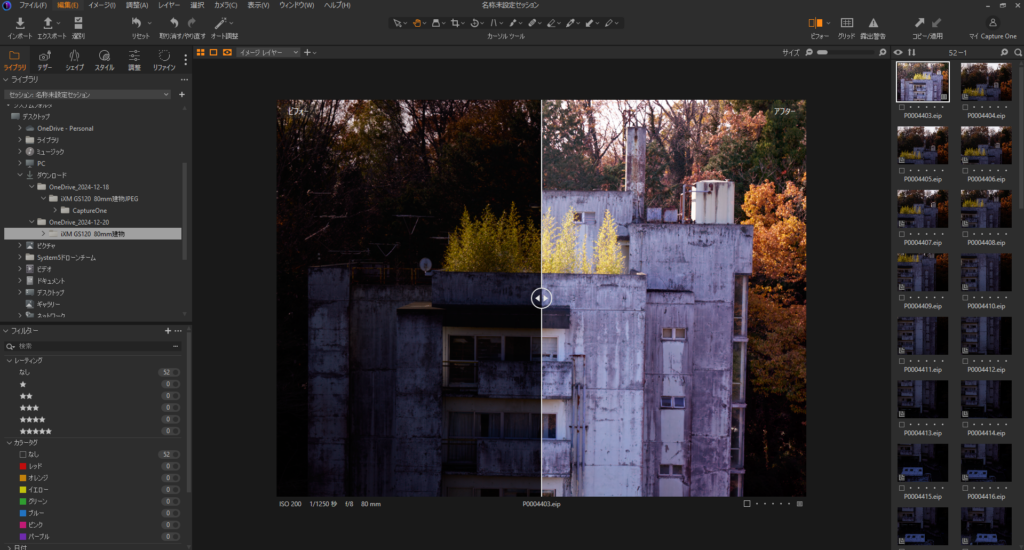
Mr. Koga analyzes the images on a workstation using iX Capture, where he uses both the auto-correction function and fine-tunes the brightness manually.
Thanks to the high dynamic range of the large format sensor, it is possible to correct and adjust the brightness to a natural level, allowing the image to be recovered in post-processing, regardless of how you shoot.
During post-processing, crack detection is performed using AI, further improving the accuracy and efficiency of the work.
Image brightness finetuning, with the original image before correction at left, and the brightened image to the right of the slider.

A bright future together
Working with Phase One has proven valuable for Mr. Koga. and Kyuden Droneservice.
“Considering the increased work efficiency and safety, I think Phase One cameras are well worth it,” says Mr. Koga.
He also appreciates his support agreement, “I don’t have to worry about expensive repair costs, so I feel at ease,” he says.
In the future, the company wants to be able to perform inspections completely autonomously, so they can inspect offshore wind turbines using Phase One’s iXM-GS120 camera autonomously from land, rather than by boat.
More about the customer
Kyuden Droneservice provides surveying and inspection work throughout Japan and is headquartered in Fukuoka. It has approximately 50 employees and owns around 150 drones.
https://www.kyuden-drone.co.jp/
This case study is based on an interview with System 5, who are one of Phase One’s distributors in Japan. https://dji-info.system5.jp/blogs/enterprise/phaseone-interview-kyuden

Geospatial
Eight perspectives, one system

Geospatial
From capture to corridor intelligence: How Kavel 10 scaled 1 cm mapping with the Phase One + IGI CM-1

Geospatial
From sensors to solutions: How AISPECO orchestrates precision in reality surveying

Geospatial
Monitoring pipeline corridor using PAS 280 large format camera

Geospatial
Preventing Wild Bushfires By Mapping Planned Burns

Geospatial
Novice Aerial Photographer Becomes Advanced Mapping Provider

Geospatial
Inspecting Wind Turbine Blades While They Are Rotating

Geospatial
Precision at Altitude: Redefining Aerial Mapping with the PAS 880 Oblique Camera System

Geospatial
Perfecting telescope dish accuracy with UAV photogrammetry

Geospatial
Saving costs while lowering carbon footprint: Innovative aerial surveying service uses small airplanes enabled by compact cameras

Geospatial
Detecting forest tree diseases using a large-format camera on an ultralight aircraft

Geospatial
Mapping lava flows during volcanic eruptions in Iceland

Geospatial
The PAS Pana: a 48,800-pixel camera innovated with our customer Surdex

Geospatial
Rebuilding after Hawaii’s wildfire with engineering-grade surveying

Geospatial
Revolutionizing Slovenian urban planning: Phase One’s PAS 880i redefines reality mapping