DSM and DTM
A Multi-level Approach to Aerial GSD Photogrammetry
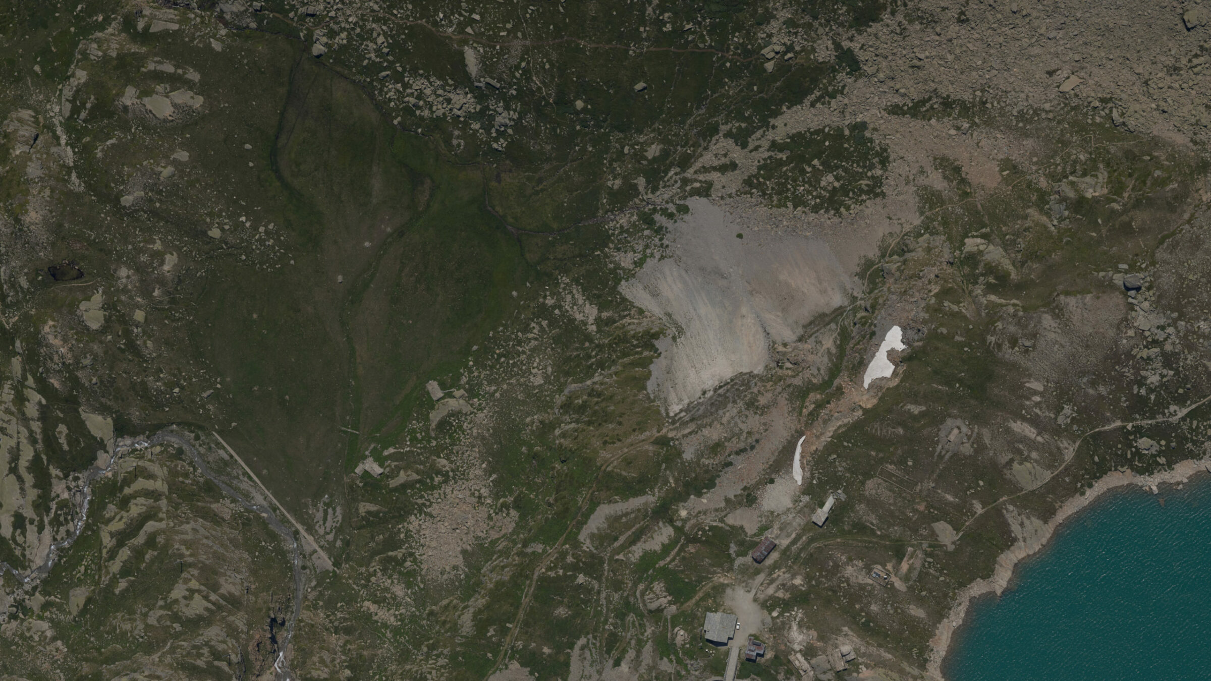
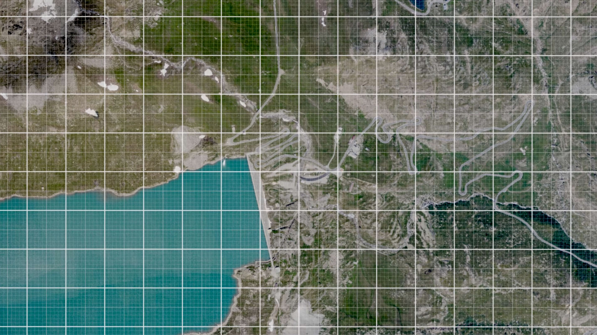
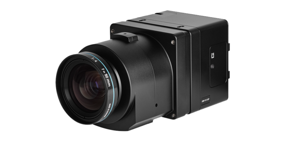
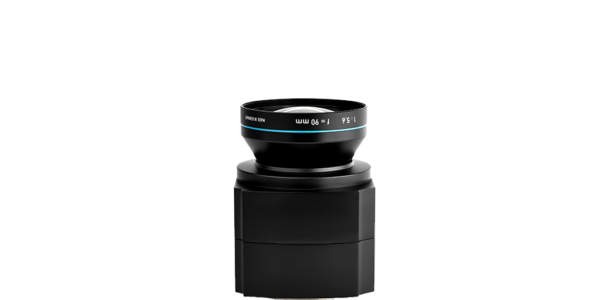
DigiSky offers aerial photogrammetry and monitoring services and recently completed a multilevel remote sensing mission for IREN ENERGIA S.p.A. to map the Serrù reservoir and hydroelectric production plant. The 1500 hectares area sits at altitudes of between 2000m and 2500m. A Phase One Industrial iXM-RS150F digital camera (90mm optics) installed into a SmartBay© avionic system captures data used to produce Digital Elevation Models (DEM) and orthophotos with a resolution of higher than 5 cm/pixel.
Imagery and Data Terrain Models (DTM)
DigiSky was recruited by IREN S.p.A. to map the Serrù reservoir, in the Orco valley, where the company operates a hydroelectric production plant.
Remote sensing was used to monitor the hydrogeological context of the basin and to plan some ancillary works to the artificial barrier. Ideal conditions to use advanced instruments for aerial photogrammetry. A DTM of access paths to the reservoir was built to assist technicians find a route when the area is covered in snow in the winter.
The area of interest covers over 800 hectares at altitudes between 2000m and 2500m within the Gran Paradiso National Park and has therefore requested a special permit for the execution of flights.
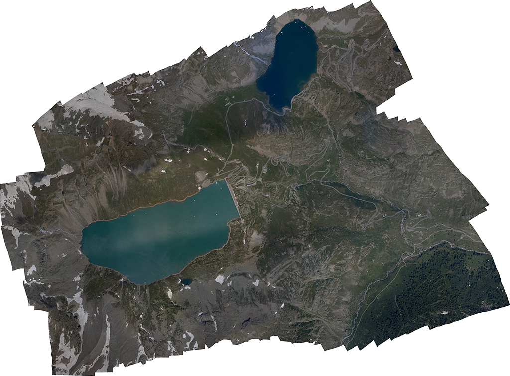
Image: Aircraft equipped with a SmartBay systems integrated with very high resolution digital cameras is able to obtain a Ground Sample Distance (GSD) of just a few centimeters per pixel. Stereoscopic data obtained is used to develop an accurate dimensional terrain model (DTM).
The Phase One iXM-RS 150MP camera's wide swath allowed us to fly at higher altitudes, faster speeds, and acquire larger aerial images. With the sensor integrated into our P92 SmartBay system, we can now fly missions in two-thirds of the time.
Watch the SmartBay in Action
Watch Phase One iXM-RS150F integrated into a SmartBay System – Skymetry Highway – 2019 © DigiSky
Bridge Inspection
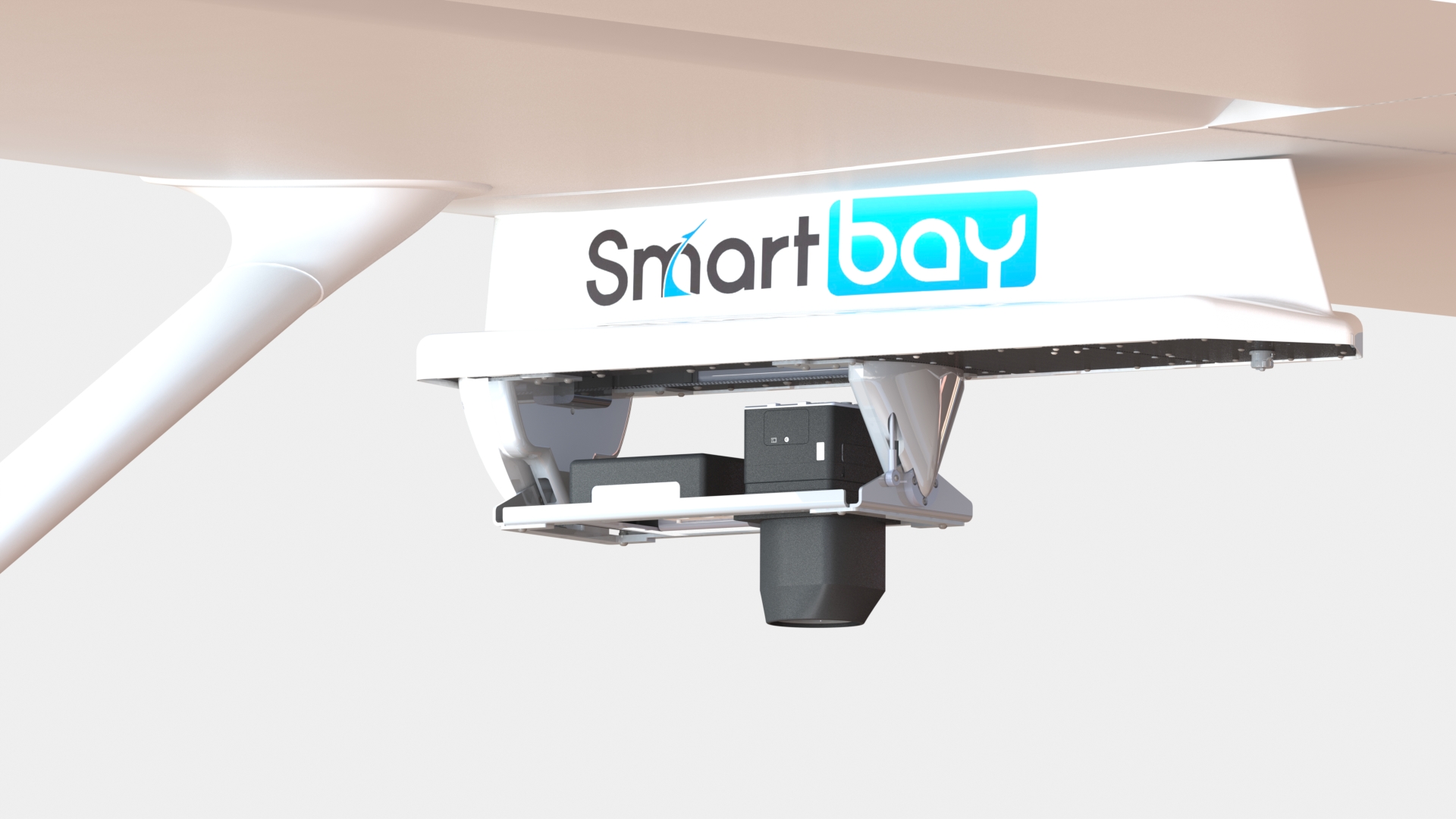
Digisky SmartBay System
The system includes:
- Phase One iXM-RS150 Aerial Camera (RGB)
- NADIR naturally stabilized
- Multi-spectral camera (advanced multi-spectral texture)
- SmartBay Avionic System
Light and Smart
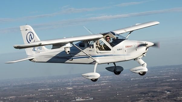
The Tecnam P92 JS SmartBay is a high wing, two seats, single engine, tricycle landing gear airplane.
It is equipped with a medium-format iXM-RS150F digital camera (90mm optics) integrated into a SmartBay avionic system. Pilots can fly at a safe height of 1000 ft above ground level (AGL) and still capture high-quality images with the Phase One Industrial high-resolution sensor. Images stored on the camera’s XQD memory card enabled the elaboration of an orthophoto and a DTM with a resolution higher than 5cm / pixel.
Fly Three Times Higher and in Two-thirds of the Time
DigiSky experienced a significant saving in mission time and costs as their plane fitted with Phase One Industrial’s iXM-RS150F allowed them to fly at a higher altitudes and at greater speed.
An Area of 1500 hectors captured with a GSD <5cm.
- SmartBay with iXM-RS150F
- Altitude 1000ft AGL
- Mission Time 60 minutes
- SmartBay with Sony 42MP Camera
- Altitude 350ft AGL
- Mission Time 90 minutes

Geospatial
From capture to corridor intelligence: How Kavel 10 scaled 1 cm mapping with the Phase One + IGI CM-1

Geospatial
From sensors to solutions: How AISPECO orchestrates precision in reality surveying

Geospatial
Monitoring pipeline corridor using PAS 280 large format camera

Geospatial
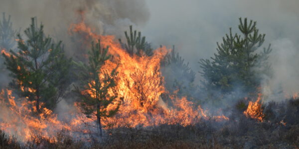
Preventing Wild Bushfires By Mapping Planned Burns

Geospatial
Novice Aerial Photographer Becomes Advanced Mapping Provider

Geospatial
Inspecting Wind Turbine Blades While They Are Rotating

Geospatial
Precision at Altitude: Redefining Aerial Mapping with the PAS 880 Oblique Camera System

Geospatial
Perfecting telescope dish accuracy with UAV photogrammetry

Geospatial
Saving costs while lowering carbon footprint: Innovative aerial surveying service uses small airplanes enabled by compact cameras

Geospatial
Detecting forest tree diseases using a large-format camera on an ultralight aircraft

Geospatial
Mapping lava flows during volcanic eruptions in Iceland

Geospatial
The PAS Pana: a 48,800-pixel camera innovated with our customer Surdex

Geospatial
Rebuilding after Hawaii’s wildfire with engineering-grade surveying

Geospatial
Revolutionizing Slovenian urban planning: Phase One’s PAS 880i redefines reality mapping
Geospatial
Imaging solutions combined with AI and 5G – A new approach and promising to assess forest health and detect and monitor wildfires

Press Release
A new benchmark – sub-centimeter aerial mapping at aircraft speeds without compromises

Press Release
A new era in aerial imaging technology – made easy to adopt

Geospatial Blog
Part Two of: Taking Off – our pre-flight checklist for aerial mapping as the season takes off

Press Release
Carbonix, RIEGL, Phase One announce first fixed-wing VTOL integration of long-range dual sensor system

Geospatial Blog
Insights and future trends at Geo Week 2024

Press Release
Phase One Appoints HALG | Hindustan Assistant & Logistic Group as Official Technical Partner in India to Enhance Local Support and Engagement
Press Release
Phase One Introduces PAS Pana at InterGeo 2023: The Most Effective Wide Area Camera for Aerial Mapping

Press Release
Phase One announces New Calibration Lab and Geospatial Center of Excellence in Denver