3D Modeling
Phase One Aerial System & Photogrammetric Software Increased Profitability by 25%
In order to diversify its revenue Uralgeoinform, decided to develop the aerial survey capabilities in a large territory of the Russian Federation. After an economic evaluation with leased equipment yielded positive results, the company acquired the Phase One 190MP Aerial System
Aerial Solutions Provide a Diversified Revenue Stream.
Uralgeoinform is active on the Russian market and specializes in digital mapping and updating, cartography, aerial survey, GIS development and remote sensing, digital cartography, and map creation and updating.
In order to diversify its revenue, the company decided to develop its aerial survey capabilities. Aerial surveys were carried out on leased aerial photography equipment. Financial feasibility studies were conducted on the leased solutions which yielded favorable results. The company decided to purchase its own aerial survey equipment.
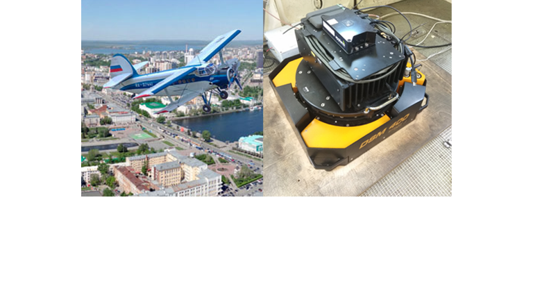
The system was delivered by Phase One’s Russian partner – NPK Photonica and installed on an AN-2 aircraft. Testing and training were carried out jointly by specialists from the three companies.
After purchasing their own equipment Uralgeoinform saw an increase of 25% in profitability compared with the work performed with rented equipment.
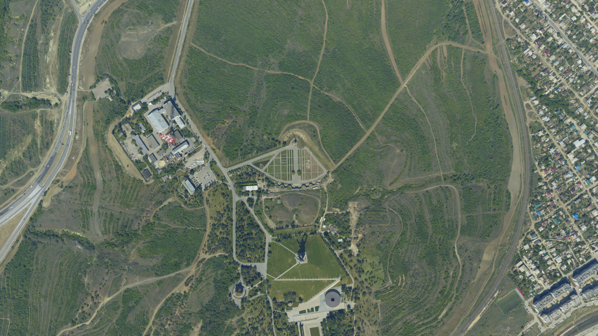
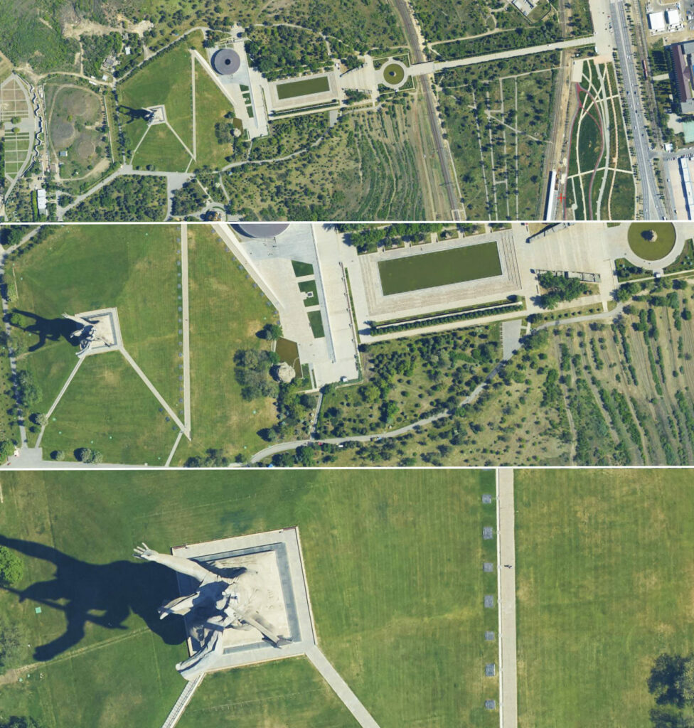
Image: Examples of aerial photographs of different scales obtained using Phase One190MP camera. Uralgeoinform 2018 ©.
The acquisition of our own aerial survey solution led to an increase of orders for aerial survey works by 2.3 times compared with 2017. We also saw an increase in related orders, in particular, the creation of digital orthophotos by 1.5 times.
Fly More Hours in a Day
During the summers of 2018 and 2019, the following aerial surveys were performed:
• 3350 sq. km for orthophoto production and navigation maps for cities in the scale of 1:2,000. The resolution on the ground is 10 cm at a flight height of 2000 m and the image forward/side overlap is 80/40%.
• 12,500 sq. km for orthophoto production of settlements in the scale of 1:2,000 and 1:10,000. The resolution on the ground is 15 cm at a flight height of 3000 m and the image forward/side overlap is 60/30%.
• In 2019, 48,000 sq.km were flown for data acquisition projects
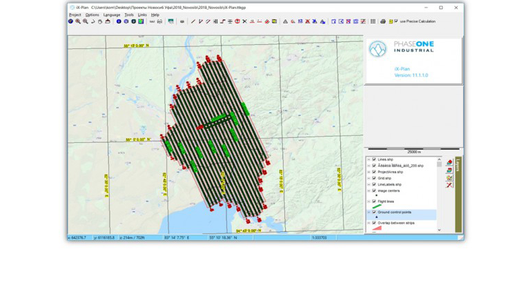
Image: Flight planning was carried out with iX Plan
Quality Assurance (QA) of Images Made Easy
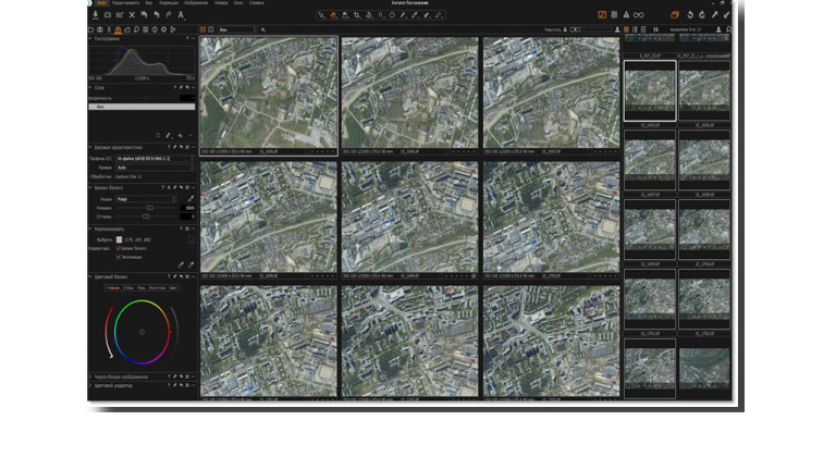
Capture One software and Photomod software was used to conduct quality assurance and to determine if all images had sufficient and uniform sharpness and were free of defects, such as streaks; smears; and stains. Analysis of histograms and tone curves in Capture One along with visual inspection was used to determine if objects in the images were well defined such as:
• linear objects – marking on roads, etc., a coastline of water bodies, surface pipelines, etc.
• local objects – pylons and poles of power lines and shadows from them, hatches of wells in built-up areas, details of roofs of buildings, marking of pedestrian crossings on highways, etc.
Image: Capture One is used for basic color grading of images: a typical histogram and tonal curves for RGB images. Uralgeoinform 2019 ©
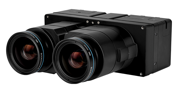
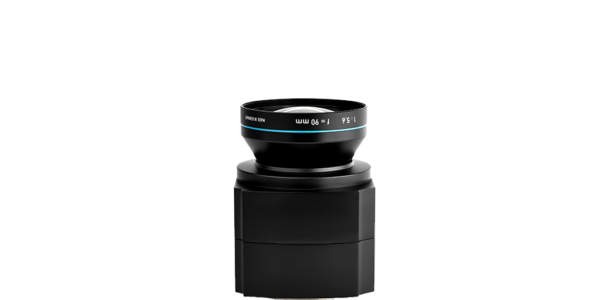
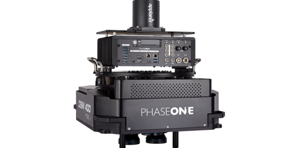
Phase One 190MP Aerial Solution
The Phase One 190MP aerial solution comprises:
-
- iXU-RS1900 camera
- iX Controller with removable SSD tray for secure data transfer
- SOMAG DSM400 gyro stabilizer
- Applanix GNSS/IMU system
- iX Capture Software
Uralgeoinform also purchased:
Image: Phase One 190MP Aerial Solution – Compact and Light enough to fit into the Uralgeoinform AN-2 Aircraft – Uralgeoinform 2018 ©
Results, Return on Investment, and Future Plans
Additional photogrammetric products obtained by using the PhaseOne 190MP solution, in combination with the appropriate photogrammetric software, are true-orthophoto and 3D city models. As an experiment, a dense DSM was created, and a three-dimensional model of a small part of the city with a resolution of 3 cm was build. On the basis of the dense DSM, counter lines were calculated. The quality check showed that the automatically constructed counter lines approximate the relief forms with high details. Using a dense three-dimensional terrain model, it is possible to solve various engineering problems, such as:
• Aerodiagnostics of electric grid facilities. For example, the definition of the sag of the wires between the supports of power lines for the timely prevention of emergency outages of power lines.
• Determination of the geometric spatial characteristics of the road network, its condition, for the organization of repair work and design.
• Monitoring of mining activities, determination of sizes, volumes and dimensions of various nature, etc.
With the Phase One 190MP Aerial Solution the return on investment in 2-3 years instead of 5 regulatory year.
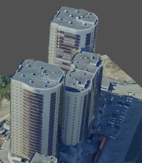
Image: 3D model of residential building from true orthophoto. – Uralgeoinform 2019 ©

Geospatial
From capture to corridor intelligence: How Kavel 10 scaled 1 cm mapping with the Phase One + IGI CM-1

Geospatial
From sensors to solutions: How AISPECO orchestrates precision in reality surveying

Geospatial
Monitoring pipeline corridor using PAS 280 large format camera

Geospatial
Preventing Wild Bushfires By Mapping Planned Burns

Geospatial
Novice Aerial Photographer Becomes Advanced Mapping Provider

Geospatial
Inspecting Wind Turbine Blades While They Are Rotating

Geospatial
Precision at Altitude: Redefining Aerial Mapping with the PAS 880 Oblique Camera System

Geospatial
Perfecting telescope dish accuracy with UAV photogrammetry

Geospatial
Saving costs while lowering carbon footprint: Innovative aerial surveying service uses small airplanes enabled by compact cameras

Geospatial
Detecting forest tree diseases using a large-format camera on an ultralight aircraft

Geospatial
Mapping lava flows during volcanic eruptions in Iceland

Geospatial
The PAS Pana: a 48,800-pixel camera innovated with our customer Surdex

Geospatial
Rebuilding after Hawaii’s wildfire with engineering-grade surveying

Geospatial
Revolutionizing Slovenian urban planning: Phase One’s PAS 880i redefines reality mapping
Geospatial
Imaging solutions combined with AI and 5G – A new approach and promising to assess forest health and detect and monitor wildfires
Press Release
A new benchmark – sub-centimeter aerial mapping at aircraft speeds without compromises

Press Release
A new era in aerial imaging technology – made easy to adopt

Geospatial Blog
Part Two of: Taking Off – our pre-flight checklist for aerial mapping as the season takes off

Press Release
Carbonix, RIEGL, Phase One announce first fixed-wing VTOL integration of long-range dual sensor system

Geospatial Blog
Insights and future trends at Geo Week 2024

Press Release
Phase One Appoints HALG | Hindustan Assistant & Logistic Group as Official Technical Partner in India to Enhance Local Support and Engagement
Press Release
Phase One Introduces PAS Pana at InterGeo 2023: The Most Effective Wide Area Camera for Aerial Mapping

Press Release
Phase One announces New Calibration Lab and Geospatial Center of Excellence in Denver